2009-05-09 50 -119
| Sat 9 May 2009 in 50,-119: 50.6692014, -119.0335969 geohashing.info google osm bing/os kml crox |
Logging road exploration. Deer skeleton, giant bumblebee, mosquitoes. Write up later.
Contents
Location
Up a hill, near a switchback on a forest service road near Mara Lake.
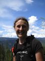
Participants
Planning
This geohash was situated on the side of a hill near the unincorporated area of Mara. Juventas and Rhonda looked at backroads maps and determined that the Hunter-Blurton Forest Service Road would take us almost all the way to the geohash. That would give us a short scramble to the geohash itself and plenty of time to drive back down and go on to the next graticule. We would leave Robyn's car in Mara and travel all together in Juventas' car.
So the plan was: drive to Mara, find road, park Robyn's car, drive almost to geohash, walk 50 metres through bush, tag geohash, reverse.
Expedition
We packed up and left the campground where we'd stayed after the previous night's geohash and drove in convoy to Mara. It was just over 50 km, and in the same valley, so nothing compared to the previous day's travel, and we soon passed Grindrod, the last place before Mara, and started looking.
Searching for the right logging road
Just inside Mara, Juventas pulled off the highway into a road signed as Zettergreen. He explained that he wasn't certain where the access point was, but it should be close around here, and as a Forest Service Road we knew it should not be gated or otherwise inaccessible. We expected it to be in pretty good repair as well. Robyn could most likely park at the side by the beginning of the road. Rhonda figured out that the access was between the two places that "Riverside Road" met the highway, and that we'd already passed one, so if we saw Riverside Road again, we'd gone too far. We pulled back onto the highway and watched carefully for something that could have been the beginning of an FSR. We saw Riverside Road again.
We turned the convoy around and headed back the other way, driving really slowly with four way flashers on, determined not to miss this hidden access road. There were little roads into the trees and grand entrances to ranches, but they all had house numbers or "Private Road" signs on them. After passing Zettergreen Road we reached an access road that on the way up we had seen only as a private drive, but from this direction could be seen to fork right after leaving the highway. This must be our road. It was immediately steep and narrow, and not suitable for Robyn to drive or park on, so we all returned to the Mara gas station we had passed (what, two or three times now?) to park Robyn's car and transfer gear.
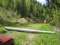
The entire party, Rhonda and Juventas in the front, Robyn and T-Rex in the back, headed back to the access road, off the highway, up the steep gravel road, and then stopped. Someone had placed a length of culvert pipe right across the road. That's another way of saying "Private Property - No Trespassing." It was still the wrong road.
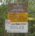
We went back to Zettergreen Road to investigate if there might be FSR access through there somehow. The pulloff signed as Zettergreen went in two possible directions. One was very clearly a private road, and one looked like a private road leading to a house, but wasn't actually signed as such so we drove along it, passed the house and found a real road. In fact, after a few corners, we found the Hunter-Blurton FSR. Victory!
The problem with the Forest Service Roads isn't that they aren't well posted and maintained, it's that the Crown Lands (i.e. land attributed to the Queen/government, hence public land) are also crisscrossed with roads leading to private homes on the edge of Crown Land, roads to cattle grazing areas, logging roads, skidder tracks, places where someone turned off the road to go off-roading, and things that look like roads, right down to deer trails, which don't look like roads at all, just very narrow trails with lots of poop pellets on them. An FSR has a sign at the beginning, and may have a sign indicating which road is which if it crosses another FSR, but other kinds of road crossing an FSR are not signed. So it's easy to follow the road marked by the sign, but later not be on that road, even though you didn't knowingly turn off it.
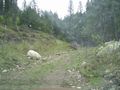
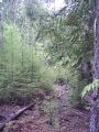
We started up the Hunter-Blurton road, choosing the most FSR-like road at each junction. We were pretty sure of our choices, as the others seemed to go to private homes. It was a good surface, but still bumpy, and as it climbed a steep hill there were lots of switchbacks. Robyn held on tightly to T-Rex, so he would not be frightened. The switchbacks, and Robyn, calmed down after a while and Robyn started calling out GPS distances. We drew within 1.77 km of the geohash, but then started pulling away again. By the time we were 2.5 km from the geohash, this was determined to be the wrong road. We turned around and went back to the point of closest approach. The bush was pretty thick, and 1.77 km is an appallingly long stupidity distance, especially as we had two creeks to cross, so we continued back to a likely turnoff. At first it appeared to be going to a house under construction, or some kind of gravel-crushing operation, but we wound around past those things and discovered another road. We went up. It was in good enough shape that we could believe it was an FSR, but then it got worse and at a fork Juventas declared that it was no longer suitable to continue. We were, at this point, about 1.4 kilometres from the geohash, so we decided to leave the car, marking its location with the GPS, and continue walking up the road.
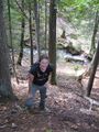
Hiking up
Success
Walking down
GPS Tracklog
Photos
We tried some wrong roads
Then found the right road
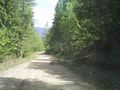
It was nice and wide
We stopped on a narrower road
Which Robyn didn't like much
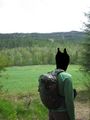
An unexpected meadow
Across a stream and up a bank
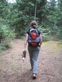
Along another road
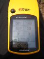
At the coordinates
At the top of the hill
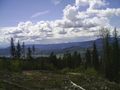
View from the top
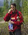
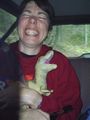
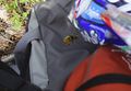
Snack time
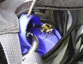
A visitor
Same visitor
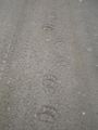
A bear took this road too.
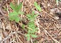
Interesting plants
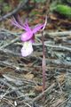
Purple flower
Google maps' friendly bright green
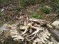
A skeleton


