Difference between revisions of "2009-08-13 52 13"
imported>Davidc |
imported>Relet (→Expedition) |
||
| Line 26: | Line 26: | ||
== Expedition == | == Expedition == | ||
| − | + | === live from the expedition === | |
*davidc found the cache with the first grab. -- [[User:relet|relet]] 17:24, 13 August 2009 (UTC) | *davidc found the cache with the first grab. -- [[User:relet|relet]] 17:24, 13 August 2009 (UTC) | ||
*picture selection seems to fail. have to check if it's user fail or script fail. -- [[User:relet|relet]] 18:18, 13 August 2009 (UTC) | *picture selection seems to fail. have to check if it's user fail or script fail. -- [[User:relet|relet]] 18:18, 13 August 2009 (UTC) | ||
| + | |||
| + | === relet === | ||
| + | |||
== Tracklog == | == Tracklog == | ||
davidc's approximate route: [http://maps.google.co.uk/maps?f=d&source=s_d&saddr=Rosenthaler+Platz&daddr=Chausseestra%C3%9Fe+to:Pankstra%C3%9Fe+to:Emmentaler+Str.+to:Unknown+road+to:Unknown+road+to:Kienhorststra%C3%9Fe+43,+Reinickendorf+13403+Berlin,+Germany+to:Lienemannstra%C3%9Fe+to:General-Barby-Stra%C3%9Fe+to:Kienhorststra%C3%9Fe+to:Ollenhauerstra%C3%9Fe+to:Charles-Corcelle-Ring+to:Unknown+road+to:Am+Nordhafen+to:Gartenstra%C3%9Fe+to:52.530556,13.391261+to:Rosenthaler+Platz&hl=en&geocode=FSSLIQMdC3zMAA%3BFSiIIQMdlDzMAA%3BFSHWIQMdMhzMAA%3BFbcmIgMdndfLAA%3BFS4mIgMdIpTLAA%3BFYgvIgMd5onLAA%3BFXQ1IgMdimXLAA%3BFQg-IgMdEUzLAA%3BFSUxIgMdsTnLAA%3BFdM2IgMdFEjLAA%3BFRQuIgMd2GjLAA%3BFTj-IQMd-1XLAA%3BFQDbIQMd5DvLAA%3BFeeoIQMdu-3LAA%3BFZurIQMdmTDMAA%3B%3BFSSLIQMdC3zMAA&mra=dpe&mrcr=1&mrsp=15&sz=15&via=1,2,3,4,5,7,8,9,10,11,12,13,14,15&dirflg=w&sll=52.530765,13.393364&sspn=0.016761,0.034633&ie=UTF8&z=15 google maps] (24km) | davidc's approximate route: [http://maps.google.co.uk/maps?f=d&source=s_d&saddr=Rosenthaler+Platz&daddr=Chausseestra%C3%9Fe+to:Pankstra%C3%9Fe+to:Emmentaler+Str.+to:Unknown+road+to:Unknown+road+to:Kienhorststra%C3%9Fe+43,+Reinickendorf+13403+Berlin,+Germany+to:Lienemannstra%C3%9Fe+to:General-Barby-Stra%C3%9Fe+to:Kienhorststra%C3%9Fe+to:Ollenhauerstra%C3%9Fe+to:Charles-Corcelle-Ring+to:Unknown+road+to:Am+Nordhafen+to:Gartenstra%C3%9Fe+to:52.530556,13.391261+to:Rosenthaler+Platz&hl=en&geocode=FSSLIQMdC3zMAA%3BFSiIIQMdlDzMAA%3BFSHWIQMdMhzMAA%3BFbcmIgMdndfLAA%3BFS4mIgMdIpTLAA%3BFYgvIgMd5onLAA%3BFXQ1IgMdimXLAA%3BFQg-IgMdEUzLAA%3BFSUxIgMdsTnLAA%3BFdM2IgMdFEjLAA%3BFRQuIgMd2GjLAA%3BFTj-IQMd-1XLAA%3BFQDbIQMd5DvLAA%3BFeeoIQMdu-3LAA%3BFZurIQMdmTDMAA%3B%3BFSSLIQMdC3zMAA&mra=dpe&mrcr=1&mrsp=15&sz=15&via=1,2,3,4,5,7,8,9,10,11,12,13,14,15&dirflg=w&sll=52.530765,13.393364&sspn=0.016761,0.034633&ie=UTF8&z=15 google maps] (24km) | ||
Revision as of 21:01, 13 August 2009
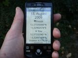
| Thu 13 Aug 2009 in 52,13: 52.5733500, 13.3290257 geohashing.info google osm bing/os kml crox |
Location
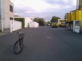
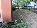
Behind a Bohle building in an industrial site on Kienhorststraße.
Right next by is the Museum Staatliche Münze. Opens Mo - Fr 10.00 - 16.00 Uhr.
Participants
Plans
If we are to visit the museum (free entry), I would suggest to meet in the morning, 9-10am. It will be difficult for me to get there before 4pm otherwise.
If not, 7pm sounds like a plan. :)-- relet 13:38, 12 August 2009 (UTC)
I approve 7pm. Museum would be nice, too. But I don't have time before 1pm.
Do you go by bike, too? Where do you want to meet? --pari 15:11, 12 August 2009 (UTC)
I would. Probably starting at Goslarer Platz directly, via Westhafen. -- relet 16:58, 12 August 2009 (UTC)
- ETA Goslarer Platz: 18:40! -- relet 13:15, 13 August 2009 (UTC)
Probable hash collision! http://coord.info/GCY864 --Davidc
I am going to walk! (5.9km from my home) ETA 19:15, hope to see you! lyxi-büxi (not-logged-in lyx)
Expedition
live from the expedition
- davidc found the cache with the first grab. -- relet 17:24, 13 August 2009 (UTC)
- picture selection seems to fail. have to check if it's user fail or script fail. -- relet 18:18, 13 August 2009 (UTC)
relet
Tracklog
davidc's approximate route: google maps (24km)


