Difference between revisions of "2009-08-30 51 12"
imported>Thepiguy (Pi's images;) |
imported>FippeBot m (Location) |
||
| (3 intermediate revisions by 3 users not shown) | |||
| Line 32: | Line 32: | ||
| − | + | After another eventfull drive, the band of Geohashers arrived near their next destination. | |
| + | With only 120 metres to go, the GPS gave the direction to turn off of the main road and into the forrest. However, this time, they were pleasently surprized to find a small (but very steep) driveway perfectly placed for parking. | ||
| + | |||
| + | Emergency break firmly engaged, the 3 Geohashers set off into the trees towards the coordinates. The ended up emerging from the forest on site of a now non-existant railroad track. | ||
| + | |||
| + | Pictures were taken, Nibs were shared, highs were fived, and with the smell of burning clutch hanging in the air, they set off once again. | ||
| − | |||
<gallery> | <gallery> | ||
| − | Image:2009-08-30_51_12_hashers.JPG|That's 3 | + | Image:2009-08-30_51_12_parking.jpg|Some minutes of rest for the car |
| − | Image:2009-08- | + | Image:2009-08-30_51_12_trail.jpg|Old railroad track |
| + | Image:2009-08-30_51_12_gps.JPG|GPS | ||
| + | Image:2009-08-30_51_12_hashers.JPG|That's 3 2s, not a 6. | ||
| + | Image:2009-08-30 51 12 butterfly.jpg|Butterflies! | ||
</gallery> | </gallery> | ||
| Line 46: | Line 53: | ||
[[Category:Coordinates reached]] | [[Category:Coordinates reached]] | ||
[[Category:Danatar]] | [[Category:Danatar]] | ||
| + | {{location|DE|TH|ABG}} | ||
Latest revision as of 05:30, 8 August 2019
| Sun 30 Aug 2009 in Leipzig: 51.0775160, 12.3233754 geohashing.info google osm bing/os kml crox |
Location
Today's location is on a former railway trail near Lucka.
Country: Germany; state: Thüringen (Thuringia, EU:DE:TH); district: Altenburger Land
Expedition
srs0, Danatar, thepiguy
This expedition is part 2 of a monsterhash done on the way home from the big 2009-08-29 52 13 meetup, and was on day 3 of a 3-day consecutive geohash:
- Day 1:
- Day 2:
- Day 3:
After another eventfull drive, the band of Geohashers arrived near their next destination.
With only 120 metres to go, the GPS gave the direction to turn off of the main road and into the forrest. However, this time, they were pleasently surprized to find a small (but very steep) driveway perfectly placed for parking.
Emergency break firmly engaged, the 3 Geohashers set off into the trees towards the coordinates. The ended up emerging from the forest on site of a now non-existant railroad track.
Pictures were taken, Nibs were shared, highs were fived, and with the smell of burning clutch hanging in the air, they set off once again.
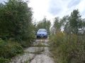
Some minutes of rest for the car
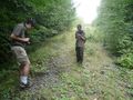
Old railroad track
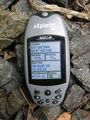
GPS
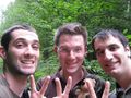
That's 3 2s, not a 6.

Butterflies!


