2010-08-02 49 8
| Mon 2 Aug 2010 in 49,8: 49.3913773, 8.5960983 geohashing.info google osm bing/os kml crox |
Location
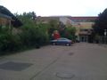
In the schoolyard of the Friedrichschule, an elementary school in Plankstadt
Participants
Plans
Next to a school in Plankstadt, insanely close to the 2010-07-28 coordinates. While I back then couldn't go due to time constraints, I will probably try to walk to the hashpoint on Monday. Unfortunately, no Juggernaut, since 6.2 km (straight line) and a deviation of about 500 m => 5:62 > 1:20, although I will be able to travel most of the way in a perfectly straight line. Aerial image of the hashpoint --ilpadre 09:54, 31 July 2010 (UTC)
- Might try it as well. I'd try to go sometime in the late afternoon (maybe 17:00) Koepfel talk 19:17, 31 July 2010 (UTC)
Expedition Report
Ilpadre
Tracklog: http://www.everytrail.com/view_trip.php?trip_id=734463
I didn't want to miss a hashpoint in walking distance, now that I finally have time to go on expeditions again. Expedition went just as planned, even the walking didn't hurt as much as I had expected after more than a month without training. Just the occasional rain was a bit annoying.
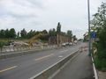
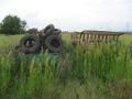
Until about a month ago, there was a bridge.
Revisited the 2009-01-21 49 8 hashpoint.
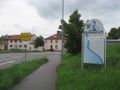
Walked to Plankstadt in a straight line.
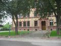
Found the school.
Found the schoolyard.
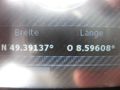
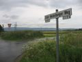
Found the coordinates.
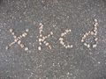
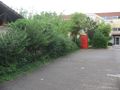
Left a marker for koepfel.

Obligatory.
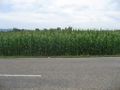
Walked a different way back, mostly through fields.


Koepfel
Took a train from Karlsruhe to Schwetzingen, walked to the hashpoint by 17:00, found Ilpadre's marker, a couple of small stones spelling "xkcd".
Left at 17:15, walked to Eppelheim, revisited 2009-05-21 49 8, walked to Pfaffengrund and took the tram to Heidelberg.
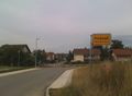
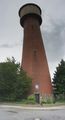
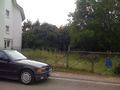
Entering Plankstadt
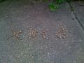
found Ilpadre's marker
Revisiting 2009-05-21 49 8


