Difference between revisions of "2011-03-04 43 -79"
imported>HiroProtagonist m (Created page with "{{subst:Expedition |lat = 43 |lon = -79 |date = 2011-03-04 }}") |
m (More specific location) |
||
| (8 intermediate revisions by 4 users not shown) | |||
| Line 1: | Line 1: | ||
| − | |||
<!-- If you did not specify these parameters in the template, please substitute appropriate values for IMAGE, LAT, LON, and DATE (YYYY-MM-DD format) | <!-- If you did not specify these parameters in the template, please substitute appropriate values for IMAGE, LAT, LON, and DATE (YYYY-MM-DD format) | ||
| Line 16: | Line 15: | ||
<!-- edit as necessary --> | <!-- edit as necessary --> | ||
| − | |||
== Location == | == Location == | ||
| − | + | In Warden Woods (East Toronto) very close to a subway station. | |
== Participants == | == Participants == | ||
| − | < | + | * [[User:HiroProtagonist|HiroProtagonist]] with <s>probable some drag-alongs if she is persuasive</s> no drag-alongs because she was not persuasive |
| + | * [[User:Splitdipless|Splitdipless]] went eventually. | ||
== Plans == | == Plans == | ||
| − | + | Hooray, the first clearly accessible geohash in a reasonable distance on a day that I have time to go since I've been in Toronto. Definitely want to go this afternoon. Anybody want to join? :) I 'm really flexible with the time... --[[User:HiroProtagonist|HiroProtagonist]] 11:39, 4 March 2011 (EST) | |
| + | :Haven't found anybody who wants to join me :( So I'll head off now before it gets dark :) --[[User:HiroProtagonist|HiroProtagonist]] 14:12, 4 March 2011 (EST) | ||
| + | |||
| + | Sorry Hiro, but I can't make it right now. I have to study for a course I'm taking tonight and tomorrow. I am getting out of the course at about 9pm, so I might attempt this hash late at night, in the woods, in Scarborough. Best of luck during the daylight hours. [[User:Splitdipless|Splitdipless]] 16:59, 4 March 2011 (EST) | ||
| + | |||
| + | Awww, a couple months too early. I'll be joining the Toronto graticule for May to August (and possibly longer). I hope you had a good hash, and hopefully we get some more good locations during the summer! -[[User:Srs0|Srs0]] 18:26, 4 March 2011 (EST) | ||
== Expedition == | == Expedition == | ||
| − | <!-- how | + | === [[User:HiroProtagonist|HiroProtagonist]] === |
| + | During lunch, I tried to recruit some of my house mates for geohashing, but was unsuccessful which may have partly been due to the following part in the conversation: | ||
| + | : Lisa: So and where exactly is the geohash for today? | ||
| + | : Me: In Warden. | ||
| + | : Lisa: Oh... Well, try not to get shot! | ||
| + | After these encouraging words of advice, I spent some hours "preparing" for the geohashing expedition which basicly meant watching Big Bang Theory (=> preparing myself to be nerdy enough for geohashing) and trying to find people who might come with me (=> preparing myself to be brave enough for geohashing). I also tried to research some possible achievements: [[Juggernaut achievement|Juggernaut]] first seemed like a possibility and the direct subway route would have only deviated 10% from the straight line, but I couldn't see any possibility to get it below 5%. I first thought the [[Picnic achievement]] would be something to go for, but then realized that I would just be by myself and it was cold and wet... And so on. | ||
| + | |||
| + | |||
| + | <gallery perrow="5"> | ||
| + | Image:2011-03-04 43 -79 excited.jpg | Excited to go geohashing again | ||
| + | Image:2011-03-04 43 -79 copyshop.jpg | USB Stick + copy card = Geohash marker :) | ||
| + | Image:2011-03-04 43 -79 subway tokens.jpg | Cute subway tokens | ||
| + | Image:2011-03-04 43 -79 subway plan.jpg | Ride the Rocket! | ||
| + | Image:2011-03-04 43 -79 scarborough.jpg | Scarborough isn't quite as ghetto as it was described to me. | ||
| + | </gallery> | ||
| + | At half past two I finally left the house and... Wait? What's that? RAIN?!? I haven't seen rain in Toronto in the last three months! Snow and sunshine, sure, lots of that, but: rain? So I guess it's not gonna be Frozen Geohash either... I didn't go to the subway straight away but first to a copy shop to print a marker. After that I walked to Queen's Park and "rode the rocket" (yep, that's the subways motto) and as always got really excited about how cute the tokens look. They just take me back in time to those cute little play stores we had at kindergarten where we had toy money that looked very similar :D I took the University line up to St.George and changed into the Bloor line, and thus used all the two subway lines that really are in Toronto. Great public transport, ey? Well, guess why I haven't been to that many hashes in Toronto! | ||
| + | |||
| + | |||
| + | <gallery perrow="5"> | ||
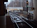
| + | Image:2011-03-04 43 -79 car park.jpg | From Warden subway station, through the car park and onwards | ||
| + | Image:2011-03-04 43 -79 be what you want to be.jpg | I want to be a geohasher! | ||
| + | Image:2011-03-04 43 -79 identifying the street.jpg | Check: Found the street needed for orientation! | ||
| + | Image:2011-03-04 43 -79 fence.jpg | A fence is blocking the way :( | ||
| + | Image:2011-03-04 43 -79 subway tracks.jpg | Got around the fence :) | ||
| + | </gallery> | ||
| + | Since I still don't have a GPS, my plan was to find the unnamed but peculiarly curved street, cause if I walked through the forest in a straight line from there, the point where I hit the hiking trail would be reasonably close to the hash. That street was easy enough to find, but then it came to probably the most dangerous task of this expedition: Crossing the street without getting killed! Success! After that the plan was to walk in a reasonably straight line into the forest, but - Behold! A fence... I could got around it rather easily though and get myself back on the magical straight line leading to the geohash. | ||
| − | == | + | |
| − | < | + | <gallery perrow="5"> |
| + | Image:2011-03-04 43 -79 down the hill.jpg | Through the forest down the hill | ||
| + | Image:2011-03-04 43 -79 tracks.jpg | Who knows which wild animals might have made these tracks? | ||
| + | Image:2011-03-04 43 -79 streamlet.jpg | I did not fall into the water! Yay =) | ||
| + | Image:2011-03-04 43 -79 streetlight.jpg | Helpful but probably not magical street light | ||
| + | Image:2011-03-04 43 -79 reaching the path.jpg | And there is the security of the path! | ||
| + | </gallery> | ||
| + | Now comes the walk through the woods! There was somewhat more of slope than I had expected and so sometimes I was more sliding down more than anything else... I found some tracks in the snow, but I can't really say much more than that it was some kind of hoofed animal. Any guesses what would be most probable in a inner city park in Toronto? I had to leap across a few really small streamlets but it was just about 100 metres through the forest. I was just hoping that none of the snow covered areas were ice that would give away under my feet... In order to keep true to the magical straight line leading to the geohash I used a probable not magical street lamp for orientation than shone through the trees. Before long I came to the path and thus to the geohash! :) | ||
| + | |||
| + | |||
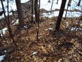
| + | [[Image:2011-03-04 43 -79 the geohash.jpg|600px|center]] | ||
| + | |||
| + | The site of the geohash is not too exciting (just a couple of feet beyond the path) and I put up the [http://activegeohasher.com/geohashes/4hqz.pdf marker from activegeohasher] on the hashtree. Then begins my quest to design a snowy xkcd marker... | ||
| + | <gallery perrow="5"> | ||
| + | Image:2011-03-04 43 -79 marker no1.jpg | 1: Not really visible at all :( | ||
| + | Image:2011-03-04 43 -79 marker no2.jpg | 2: Too small, and far off from the path so nobody would see it | ||
| + | Image:2011-03-04 43 -79 marker no3.jpg | 3: Like 2 but bigger and closer to the path, but now it looks like XKCO -.- | ||
| + | Image:2011-03-04 43 -79 marker no4.jpg | 4: Finally the right idea: I proudly present "Snow on Mud" :D | ||
| + | </gallery> | ||
| + | |||
| + | Now I tried to get myself and the marker into one picture. Not easy. | ||
| + | <gallery perrow="5"> | ||
| + | Image:2011-03-04 43 -79 themarkerandme 1.jpg | | ||
| + | Image:2011-03-04 43 -79 themarkerandme 2.jpg | | ||
| + | Image:2011-03-04 43 -79 themarkerandme 3.jpg | | ||
| + | Image:2011-03-04 43 -79 themarkerandme 4.jpg | | ||
| + | Image:2011-03-04 43 -79 themarkerandme 5.jpg | Okay, that one will do! | ||
| + | </gallery> | ||
| + | |||
| + | |||
| + | And what else did I do at the hash except breaking my back while taking pictures? | ||
| + | <gallery perrow="5"> | ||
| + | Image:2011-03-04 43 -79 marker in plastic.jpg | Put the paper marker into a plastic bag, so that it will withstand the rain | ||
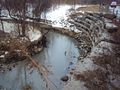
| + | Image:2011-03-04 43 -79 river.jpg | Be happy that I don't have to cross that river | ||
| + | Image:2011-03-04 43 -79 confused hikers.jpg | Confuse some hikers | ||
| + | Image:2011-03-04 43 -79 tracks2.jpg | Find some more tracks | ||
| + | Image:2011-03-04 43 -79 success.jpg | Celebrate my success... | ||
| + | </gallery> | ||
| + | |||
| + | |||
| + | By now I'm really cold and so I head home taking the easier way along the path... | ||
| + | <gallery perrow="5"> | ||
| + | Image:2011-03-04 43 -79 marker from afar.jpg | My marker is visible from far away! | ||
| + | Image:2011-03-04 43 -79 not helpful.jpg | How am I supposed to help a drowning person with this? Throw the sign at them?! | ||
| + | Image:2011-03-04 43 -79 alien.jpg | Then an alien said hello to me... | ||
| + | Image:2011-03-04 43 -79 warden woods.jpg | Good Bye Warden Woods and Taylor Massey Creek | ||
| + | Image:2011-03-04 43 -79 going home.jpg | And back home again... | ||
| + | </gallery> | ||
| + | |||
| + | === [[User:Splitdipless|Splitdipless]] === | ||
| + | |||
| + | SLt Splitdipless, reporting for geohashing, SIR! | ||
| + | |||
| + | So, after getting out of my relatively short class tonight in Oshawa, I decided on going right to the geohash, still in my uniform. Parking at Warden subway station's south parking lot, I walked up to the nearby intersection and crossed at the lights. Immediately, I could see the entrance, and I could then see the construction equipment and fences. I heeded the warnings of the signs and progressed slowly. | ||
| + | |||
| + | The trail was more of a wide dirt road that had been ripped up by construction equipment rolling through the area. The rain that had been falling since earlier had made the trail a soupy mess at this point to. At a break in the trail, I had to backtrack and go around because of the large pond that had cropped up over the trail. Eventually, I got to the point. I looked around for signs that the Internet had been there before, but sadly, I could find any. (Note to self: next time, bring a flashlight.) I then took the requisite snaps before trudging back from whence I came. | ||
| + | |||
| + | In the dark, I discovered some graffiti that I thought was interesting, and took a picture of it. Turns out HiroProtagonist thought of taking a snap of it earlier during the daylight. | ||
| + | |||
| + | Getting back into the light of civilization, I check my uniform over. A little mud on the boots, but nothing that won't polish out. Also, first hash completed in 2011 (I can't believe I didn't get any in Jan/Feb). Yay. | ||
== Photos == | == Photos == | ||
| − | + | === [[User:HiroProtagonist|HiroProtagonist]] === | |
| − | + | I didn't take any pictures. ;) | |
| − | + | ||
| + | === [[User:Splitdipless|Splitdipless]] === | ||
| + | ...but I did. | ||
<gallery perrow="5"> | <gallery perrow="5"> | ||
| − | </gallery> | + | Image:2011-03-04 43 -79 0.7 A.jpg | Use EXTREME caution. EXTREME! |
| + | Image:2011-03-04 43 -79 0.7 B.jpg | The alien. | ||
| + | Image:2011-03-04 43 -79 0.7 C.jpg | The glow of Scarborough just outside the woods. | ||
| + | Image:2011-03-04 43 -79 0.7 D.jpg | SLt Splitdipless, reporting for Geohashing, SIR! | ||
| + | Image:2011-03-04 43 -79 0.7 E.jpg | I needed to watch my step around the geohashing point. | ||
| + | Image:2011-03-04 43 -79 0.7 F.jpg | Right on target.</gallery> | ||
== Achievements == | == Achievements == | ||
{{#vardefine:ribbonwidth|800px}} | {{#vardefine:ribbonwidth|800px}} | ||
| − | + | {{Globetrotter | |
| + | | name = [[User:HiroProtagonist|Hiro Protagonist]] | ||
| + | | northamerica = true | ||
| + | | eurasia = true | ||
| + | | continents = 2 | ||
| + | | image = 2011-03-04 43 -79 success.jpg | ||
| + | }} | ||
| − | |||
| − | |||
| − | |||
| − | |||
| − | |||
| − | |||
| − | |||
| − | |||
| − | |||
[[Category:Expeditions]] | [[Category:Expeditions]] | ||
| − | |||
[[Category:Expeditions with photos]] | [[Category:Expeditions with photos]] | ||
| − | [[Category:Expeditions with videos]] | + | <!-- [[Category:Expeditions with videos]] I have one, but haven't uploaded it yet --> |
[[Category:Expedition without GPS]] | [[Category:Expedition without GPS]] | ||
| − | |||
| − | |||
| − | |||
[[Category:Coordinates reached]] | [[Category:Coordinates reached]] | ||
| − | + | {{location|CA|ON|TO}} | |
| − | |||
| − | |||
| − | |||
| − | |||
| − | |||
| − | |||
| − | |||
| − | |||
| − | |||
Latest revision as of 23:39, 9 August 2020
| Fri 4 Mar 2011 in 43,-79: 43.7075160, -79.2809640 geohashing.info google osm bing/os kml crox |
Contents
Location
In Warden Woods (East Toronto) very close to a subway station.
Participants
- HiroProtagonist with
probable some drag-alongs if she is persuasiveno drag-alongs because she was not persuasive - Splitdipless went eventually.
Plans
Hooray, the first clearly accessible geohash in a reasonable distance on a day that I have time to go since I've been in Toronto. Definitely want to go this afternoon. Anybody want to join? :) I 'm really flexible with the time... --HiroProtagonist 11:39, 4 March 2011 (EST)
- Haven't found anybody who wants to join me :( So I'll head off now before it gets dark :) --HiroProtagonist 14:12, 4 March 2011 (EST)
Sorry Hiro, but I can't make it right now. I have to study for a course I'm taking tonight and tomorrow. I am getting out of the course at about 9pm, so I might attempt this hash late at night, in the woods, in Scarborough. Best of luck during the daylight hours. Splitdipless 16:59, 4 March 2011 (EST)
Awww, a couple months too early. I'll be joining the Toronto graticule for May to August (and possibly longer). I hope you had a good hash, and hopefully we get some more good locations during the summer! -Srs0 18:26, 4 March 2011 (EST)
Expedition
HiroProtagonist
During lunch, I tried to recruit some of my house mates for geohashing, but was unsuccessful which may have partly been due to the following part in the conversation:
- Lisa: So and where exactly is the geohash for today?
- Me: In Warden.
- Lisa: Oh... Well, try not to get shot!
After these encouraging words of advice, I spent some hours "preparing" for the geohashing expedition which basicly meant watching Big Bang Theory (=> preparing myself to be nerdy enough for geohashing) and trying to find people who might come with me (=> preparing myself to be brave enough for geohashing). I also tried to research some possible achievements: Juggernaut first seemed like a possibility and the direct subway route would have only deviated 10% from the straight line, but I couldn't see any possibility to get it below 5%. I first thought the Picnic achievement would be something to go for, but then realized that I would just be by myself and it was cold and wet... And so on.

Excited to go geohashing again
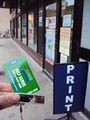
USB Stick + copy card = Geohash marker :)
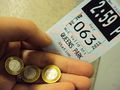
Cute subway tokens
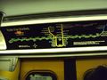
Ride the Rocket!
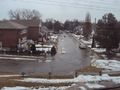
Scarborough isn't quite as ghetto as it was described to me.


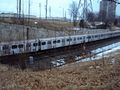
At half past two I finally left the house and... Wait? What's that? RAIN?!? I haven't seen rain in Toronto in the last three months! Snow and sunshine, sure, lots of that, but: rain? So I guess it's not gonna be Frozen Geohash either... I didn't go to the subway straight away but first to a copy shop to print a marker. After that I walked to Queen's Park and "rode the rocket" (yep, that's the subways motto) and as always got really excited about how cute the tokens look. They just take me back in time to those cute little play stores we had at kindergarten where we had toy money that looked very similar :D I took the University line up to St.George and changed into the Bloor line, and thus used all the two subway lines that really are in Toronto. Great public transport, ey? Well, guess why I haven't been to that many hashes in Toronto!
From Warden subway station, through the car park and onwards

I want to be a geohasher!
Check: Found the street needed for orientation!
A fence is blocking the way :(
Got around the fence :)


Since I still don't have a GPS, my plan was to find the unnamed but peculiarly curved street, cause if I walked through the forest in a straight line from there, the point where I hit the hiking trail would be reasonably close to the hash. That street was easy enough to find, but then it came to probably the most dangerous task of this expedition: Crossing the street without getting killed! Success! After that the plan was to walk in a reasonably straight line into the forest, but - Behold! A fence... I could got around it rather easily though and get myself back on the magical straight line leading to the geohash.
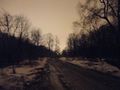
Through the forest down the hill
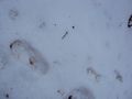
Who knows which wild animals might have made these tracks?
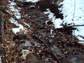
I did not fall into the water! Yay =)
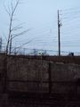
Helpful but probably not magical street light
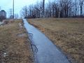
And there is the security of the path!


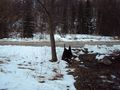
Now comes the walk through the woods! There was somewhat more of slope than I had expected and so sometimes I was more sliding down more than anything else... I found some tracks in the snow, but I can't really say much more than that it was some kind of hoofed animal. Any guesses what would be most probable in a inner city park in Toronto? I had to leap across a few really small streamlets but it was just about 100 metres through the forest. I was just hoping that none of the snow covered areas were ice that would give away under my feet... In order to keep true to the magical straight line leading to the geohash I used a probable not magical street lamp for orientation than shone through the trees. Before long I came to the path and thus to the geohash! :)

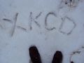
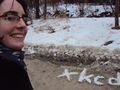
The site of the geohash is not too exciting (just a couple of feet beyond the path) and I put up the marker from activegeohasher on the hashtree. Then begins my quest to design a snowy xkcd marker...
1: Not really visible at all :(
2: Too small, and far off from the path so nobody would see it
3: Like 2 but bigger and closer to the path, but now it looks like XKCO -.-
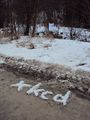
4: Finally the right idea: I proudly present "Snow on Mud" :D


Now I tried to get myself and the marker into one picture. Not easy.
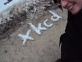
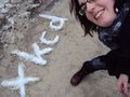
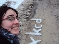

Okay, that one will do!


And what else did I do at the hash except breaking my back while taking pictures?
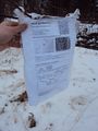
Put the paper marker into a plastic bag, so that it will withstand the rain
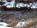
Be happy that I don't have to cross that river
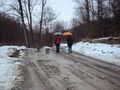
Confuse some hikers
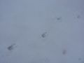
Find some more tracks

Celebrate my success...


By now I'm really cold and so I head home taking the easier way along the path...
My marker is visible from far away!
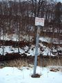
How am I supposed to help a drowning person with this? Throw the sign at them?!
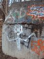
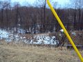
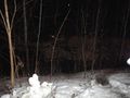
Then an alien said hello to me...
Good Bye Warden Woods and Taylor Massey Creek
And back home again...


Splitdipless
SLt Splitdipless, reporting for geohashing, SIR!
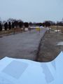
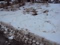
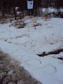
So, after getting out of my relatively short class tonight in Oshawa, I decided on going right to the geohash, still in my uniform. Parking at Warden subway station's south parking lot, I walked up to the nearby intersection and crossed at the lights. Immediately, I could see the entrance, and I could then see the construction equipment and fences. I heeded the warnings of the signs and progressed slowly.
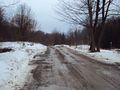
The trail was more of a wide dirt road that had been ripped up by construction equipment rolling through the area. The rain that had been falling since earlier had made the trail a soupy mess at this point to. At a break in the trail, I had to backtrack and go around because of the large pond that had cropped up over the trail. Eventually, I got to the point. I looked around for signs that the Internet had been there before, but sadly, I could find any. (Note to self: next time, bring a flashlight.) I then took the requisite snaps before trudging back from whence I came.
In the dark, I discovered some graffiti that I thought was interesting, and took a picture of it. Turns out HiroProtagonist thought of taking a snap of it earlier during the daylight.
Getting back into the light of civilization, I check my uniform over. A little mud on the boots, but nothing that won't polish out. Also, first hash completed in 2011 (I can't believe I didn't get any in Jan/Feb). Yay.
Photos
HiroProtagonist
I didn't take any pictures. ;)
Splitdipless
...but I did.
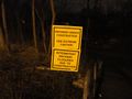
Use EXTREME caution. EXTREME!
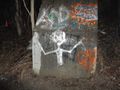
The alien.
The glow of Scarborough just outside the woods.
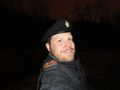
SLt Splitdipless, reporting for Geohashing, SIR!
I needed to watch my step around the geohashing point.
Right on target.


Achievements
Hiro Protagonist earned the Globetrotter achievement
|