Difference between revisions of "User:DODO"
imported>DODO (→Graticule 49,81) |
imported>DODO (→Expeditions) |
||
| Line 20: | Line 20: | ||
!Expedition!![[Image:Landgeohash.png|33px|land]]<sup>1</sup>!![[Image:Walk.PNG|31px|walk]]<sup>2</sup>!![[Image:Bikegeohash.png|31px|bike]]<sup>2</sup>!![[Image:Lightcycle.png|31px|tron]]<sup>1</sup>!![[Image:Meetup.PNG|31px|meetup]]<sup>3</sup>!![[Image:Handshake-littlefinger.png|31px|handshake]]<sup>4</sup>!![[Image:Consecutivegeohash.jpg|31px|consecutive]]<sup>5</sup>!![[Image:RaptorGeohashing.png|31px|raptor]]!![[Image:Minesweeper_geohash_3.png|31px|Minesweeper]]<sup>6</sup>!![[Image:T2htemp2.JPG |31px|Tale of 2 hashes]]<sup>7</sup>!![[Image:Centurion0.png |31px|Nullaturion]]<sup>1</sup>!![[Image:Regionalhashingsimple.png |31px|Regional hashing]]<sup>8</sup>!![[Image:ReverseRegional.png |31px|Reverse Regional]]<sup>8</sup>!![[Image:Picnic.png |31px|Picnic]]<sup>1</sup>!![[Image:Border.PNG |31px|Border]]<sup>1</sup>!!anual<sup>9</sup>!![[Image:Notrespassing.gif|31px|notrespassing]]<sup>1</sup>!![[Image:MNB_Ribbon.jpg|31px|MNB]]<sup>1</sup>!![[Image:Ducklings.png|31px|MNB]]<sup>1</sup>!!Description | !Expedition!![[Image:Landgeohash.png|33px|land]]<sup>1</sup>!![[Image:Walk.PNG|31px|walk]]<sup>2</sup>!![[Image:Bikegeohash.png|31px|bike]]<sup>2</sup>!![[Image:Lightcycle.png|31px|tron]]<sup>1</sup>!![[Image:Meetup.PNG|31px|meetup]]<sup>3</sup>!![[Image:Handshake-littlefinger.png|31px|handshake]]<sup>4</sup>!![[Image:Consecutivegeohash.jpg|31px|consecutive]]<sup>5</sup>!![[Image:RaptorGeohashing.png|31px|raptor]]!![[Image:Minesweeper_geohash_3.png|31px|Minesweeper]]<sup>6</sup>!![[Image:T2htemp2.JPG |31px|Tale of 2 hashes]]<sup>7</sup>!![[Image:Centurion0.png |31px|Nullaturion]]<sup>1</sup>!![[Image:Regionalhashingsimple.png |31px|Regional hashing]]<sup>8</sup>!![[Image:ReverseRegional.png |31px|Reverse Regional]]<sup>8</sup>!![[Image:Picnic.png |31px|Picnic]]<sup>1</sup>!![[Image:Border.PNG |31px|Border]]<sup>1</sup>!!anual<sup>9</sup>!![[Image:Notrespassing.gif|31px|notrespassing]]<sup>1</sup>!![[Image:MNB_Ribbon.jpg|31px|MNB]]<sup>1</sup>!![[Image:Ducklings.png|31px|MNB]]<sup>1</sup>!!Description | ||
|- | |- | ||
| − | |align="center"|38/ | + | |align="center"|38/46<!--all--> |
|align="center"|38<!--land--> | |align="center"|38<!--land--> | ||
|align="center"|1<!--walk--> | |align="center"|1<!--walk--> | ||
| Line 37: | Line 37: | ||
|align="center"|2<!--Border--> | |align="center"|2<!--Border--> | ||
|align="center"|1<!--others--> | |align="center"|1<!--others--> | ||
| − | |align="center"| | + | |align="center"|6<!--Notrespassing--> |
|align="center"|1<!--MNB--> | |align="center"|1<!--MNB--> | ||
|align="center"|1<!--Chicken out--> | |align="center"|1<!--Chicken out--> | ||
|<span style="color:red;">not</span> reached | |<span style="color:red;">not</span> reached | ||
| + | |-- | ||
| + | |align="center"|[[2014-11-19 49 8]] | ||
| + | | | ||
| + | | | ||
| + | | | ||
| + | | | ||
| + | | | ||
| + | | | ||
| + | | | ||
| + | | | ||
| + | | | ||
| + | | | ||
| + | | | ||
| + | | | ||
| + | | | ||
| + | | | ||
| + | | | ||
| + | | | ||
| + | |align="center"|6 | ||
| + | | | ||
| + | | | ||
| + | |<span style="color:red;">A scrapyard in the harbour of Mannheim-Rheinau. | ||
|-- | |-- | ||
|align="center"|[[2014-11-02 48 8]] | |align="center"|[[2014-11-02 48 8]] | ||
Revision as of 08:09, 19 November 2014
Contents
Me
Hello out there in the internet, I'm DODO from Speyer. I'm into geohashing since 2014-01-21.
To reach geohashes the following tools declared their consent to carry me:
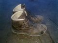
shoes
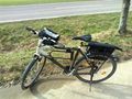
bike
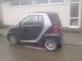
small car (up to 20 KM deviation)
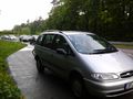
big car (up to 10 KM deviation)


Since I don't want to waste more than a liter of fuel for a hash, the deviation-range for the cars is limited (OK, there will be an exception for a global hash just 25 KM away (or an easy accessible hash in the small part of Rheinland-Pfalz in 48_8-graticule), and if I want to drive out for a walk anyway, the actual hashpoint could influence the place, where it takes part, but that doesn't count as deviation, does it?).
Expeditions
| Expedition | anual9 | MNB1 | Description | |||||||||||||||||
|---|---|---|---|---|---|---|---|---|---|---|---|---|---|---|---|---|---|---|---|---|
| 38/46 | 38 | 1 | 13 | 2 | 3 | 7 | 7 | 2 | 3 | 0/1 | 6 | 0/0/0/3 | 1/1/0/0 | 3 | 2 | 1 | 6 | 1 | 1 | not reached |
| 2014-11-19 49 8 | 6 | A scrapyard in the harbour of Mannheim-Rheinau. | ||||||||||||||||||
| 2014-11-02 48 8 | 38 | 80 | 2 | A vineyard above Keltern. | ||||||||||||||||
| 2014-11-01 49 8 | 37 | On a field near Grenzhof | ||||||||||||||||||
| 2014-10-28 49 8 | 36 | 2 | On the road from Schwetzingen to Leimen | |||||||||||||||||
| 2014-10-27 49 8 | 35 | On a field next to a farm south of Dudenhofen | ||||||||||||||||||
| 2014-10-16 49 8 | 34 | 2 | 7 | 2/4/0/0 | 2 | In the forest near Schleithal (Alsace) | ||||||||||||||
| 2014-10-05 49 8 | 1 | On a field close to Riedstadt-Leeheim | ||||||||||||||||||
| 2014-09-28 49 12 | 33 | 1 | In the forest near Karlstein | |||||||||||||||||
| 2014-09-19 48 11 | 32 | On a field near Altmannstein | ||||||||||||||||||
| 2014-09-17 49 8 | 31 | 2 | In the forest on a hill near Eberbach | |||||||||||||||||
| 2014-09-16 49 8 | 30 | A forestial hash-path near Reilingen and the St. Leoner lake. | ||||||||||||||||||
| 2014-09-13 49 8 | 29 | 61 | 6 | A cornfield near Minfeld | ||||||||||||||||
| 2014-09-05 49 8 | 5 | Between two private parking-lots in Hockenheim | ||||||||||||||||||
| 2014-08-03 48 8 | 28 | 2 | 2 | In the lowland forest of Karlsruhe | ||||||||||||||||
| 2014-08-02 49 8 | 27 | 95 | 5 | A recreational meadow in Trebur. | ||||||||||||||||
| 2014-07-27 49 8 | 26 | 62 | On a lawn in Karlsruhe-Knielingen | |||||||||||||||||
| 2014-07-11 49 8 | 4 | Inside a cycling track in Ludwigshafen-Friesenheim. | ||||||||||||||||||
| 2014-07-04 49 8 | 25 | In the forest between Hockenheim and Sandhausen | ||||||||||||||||||
| 2014-06-15 48 7 | 24 | 2 | 3 | 3 | 1 | In the forêt de Haguenau | ||||||||||||||
| 2014-06-14 49 8 | 23 | 70 | 4 | Next to the former nuclear reprocessing plant Karlsruhe | ||||||||||||||||
| 2014-06-12 49 8 | 22 | On a wheat field near the Johanneshof. | ||||||||||||||||||
| 2014-05-31 49 8 | 21 | 89 | 3 | On a wheat field near Bodenheim. | ||||||||||||||||
| 2014-05-28 49 8 | 20 | 4,6 | On a field near the station of Heiligenstein. | |||||||||||||||||
| 2014-05-26 49 8 | 19 | On a salad-field near Mechtersheim. | ||||||||||||||||||
| 2014-05-21 49 8 | 18 | In a forest near Neckargemünd. | ||||||||||||||||||
| 2014-05-02 49 8 | 17 | 2 | In a forest near Kronau. | |||||||||||||||||
| 2014-04-30 49 8 | 3 | A fenced copse near Limburgerhof | ||||||||||||||||||
| 2014-04-23 49 8 | 16 | 74 | 4 | 2 | In a steep forest next to Mörlenbach-Weiler | |||||||||||||||
| 2014-04-22 50 8 | 15 | 91 | 3 | A meadow near Merzhausen | ||||||||||||||||
| 2014-04-21 50 8 | 14 | 100 | 2 | 2 | 1 | A clearing near Weidelbach | ||||||||||||||
| 2014-04-20 49 8 | 13 | 36 | On the dike near Biebesheim | |||||||||||||||||
| 2014-04-18 49 8 | 12 | 38 | 2 | A grainfield near Freimersheim | ||||||||||||||||
| 2014-04-16 49 8 | 2 | An industrial area in the south of Speyer. | ||||||||||||||||||
| 2014-04-12 48 8 | 11 | 2 | 2 | In a forrest between Rastatt and Ettlingen | ||||||||||||||||
| 2014-03-31 49 8 | 10 | 2 | A rapeseed field near Rülzheim | |||||||||||||||||
| 2014-03-29 48 8 | 9 | 1 | On a way-crossing in Waldprechtsweier | |||||||||||||||||
| 2014-03-25 49 8 | 8 | On a rapeseed field near Venningen | ||||||||||||||||||
| 2014-03-19 48 8 | 7 | 1 | Neuburg | On a footpath near the french border | ||||||||||||||||
| 2014-03-16 49 8 | 6 | 2 | 1 | Next to Hornbach in Bornheim | ||||||||||||||||
| 2014-03-15 49 8 | 5 | 26 | In the forrest near the inlet to the Otterstädter Altrhein | |||||||||||||||||
| 2014-02-27 49 8 | 4 | 2 | 6 | On an asparagus field near Grenzhof | ||||||||||||||||
| 2014-02-23 49 8 | 3 | 66 | 1 | 6 | 5 | On the parking area of a shopping center in Mannheim | ||||||||||||||
| 2014-02-21 49 8 | 1 | In a blackberry fallow in the center of Sandhausen | ||||||||||||||||||
| 2014-02-08 49 8 | 2 | On a field near Otterstadt | ||||||||||||||||||
| 2014-02-07 49 8 | 1 | In a residential house in Mannheim-Neckarau | ||||||||||||||||||
| 2014-02-03 49 8 | 1 | In the forest west of Bammental |
Legend
1 consecutive number / count
2 distance [KM] / count
3 number of participants (including me) / number of "real meetups"
4 number of first met geohashers / total number of met hashers
5 number of consecutive hashes / number of rows
6 level /max level
7 challenge (not earned in red) / #earned/#issued
8 number of graticules/units / count Level 0/1/2/3
9 some achievements that appear only once a year. Total number of them.
Further Achievements
handshakes
DODO earned the Little Finger Handshake achievement
|
- GeorgDerReisende (2014-02-23 49 8)
- Thomcat (2014-02-23 49 8)
- Mampfred, LadyBB and EmmJay (2014-02-23 49 8)
- Danatar (2014-02-27 49 8)
- DLichti (2014-10-16_49_8)
A tale of two hashes

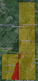
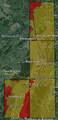
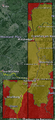
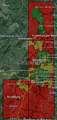
Regional geohashing achievement
This table shows my progress in all possible regional geohashing achievements and all reverse regional achievements. If the intersection between an administrative structure and a graticule is smaller than 2 km2 (0,025% of the graticule area), I take the liberty to ignore this part, unless there is anyone who reaches a hash inside of the intersection (The hash 2009-09-17_49_8 was indeed in the ca. 0.7 km2 intersection of the 49,8-graticule with Wiesbaden, but no one reached it). Graticules that have no intersection with the given administrative structure are outlined by black cells. It only shows the first hash I reached in the given administrative structure, but the number of reached hashes in this structure and graticule is added in parentheses. The following levels are used:
Level 0: Countries
Level 1: D: States, F: Regions
Level 2: D: Regierungsbezirke, F: Departements
Level 3: D: Kreise, F: arrondissements
| Level | Administrative Structure | 48,7 | 48,8 | 49,8 | 50,8 | #graticules | #reached | achievement |
|---|---|---|---|---|---|---|---|---|
| 0 | Germany | 2014-03-19 (5) | 2014-02-03 (27) | 2014-04-21 (2) | 70 | 5 | ||
| 0 | France | 2014-06-15 (1) | 2014-10-16 (1) | 98 | 2 | |||
| 1 | Baden-Württemberg | 2014-03-29 (4) | 2014-02-03 (14) | 10 | 2 | |||
| 1/2 | Rheinland-Pfalz | 2014-03-19 (1) | 2014-02-08 (11) | 7 | 2 | |||
| 1 | Hessen | 2014-04-20 (2) | 2014-04-21 (2) | 10 | 2 | |||
| 1 | Alsace | 2014-06-15 (1) | 2014-10-16 (1) | 7 | 2 | |||
| 2 | Regierungsbezirk Karlsruhe | 2014-03-29 (4) | 2014-02-03 (14) | 4 | 2 | |||
| 2 | Regierungsbezirk Darmstadt | 2014-04-20 (2) | 2014-04-22 (1) | 6 | 2 | |||
| 2 | Regierungsbezirk Gießen | 2014-04-21 (1) | 3 | 1 | ||||
| 2 | Bas Rhin | 2014-06-15 (1) | 2014-10-16 (1) | 5 | 2 | |||
| 3 | Rhein-Neckar-Kreis | 2014-02-03 (8) | 2 | 1 | ||||
| 3 | Rhein-Pfalz-Kreis | 2014-02-08 (5) | 1 | 1 | boring | |||
| 3 | Stadt Mannheim | 2014-02-31 (1) | 1 | 1 | boring | |||
| 3 | LK südl. Weinstraße | 2014-03-16 (3) | 2+11 | 1 | ||||
| 3 | Kreis Germersheim | 2014-03-19 (1) | 2014-02-31 (2) | 2 | 2 | |||
| 3 | Landkreis Karlsruhe | 2014-03-29 (2) | 2014-05-02 (2) | 2 | 2 | |||
| 3 | Landkreis Groß-Gerau | 2014-04-20 (2) | 2 | 1 | ||||
| 3 | Lahn-Dill-Kreis | 2014-04-21 (1) | 1 | 1 | boring | |||
| 3 | Hochtaunuskreis | 2014-04-22 (1) | 1 | 1 | boring | |||
| 3 | Bergstraße | 2014-04-23 (1) | 1 | 1 | boring | |||
| 3 | LK Mainz-Bingen | 2014-05-31 (1) | 4 | 1 | ||||
| 3 | Haguenau | 2014-06-15 (1) | 3 | 1 | ||||
| 3 | Stadt Karlsruhe | 2014-08-03 (1) | 2014-07-27 (1) | 2 | 2 | |||
| 3 | Wissembourg | 2014-10-16 (1) | 4 | 1 | ||||
| 3 | Stadt Heidelberg | 2014-11-01 (1) | 1 | 1 | boring | |||
| 3 | Enzkreis | 2014-11-02 (1) | 2 | 1 | ||||
| 0 | #admin. structures | 2 | 2 | 2 | 1 | |||
| # reached | 1 | 1 | 2 | 1 | ||||
| achievements | boring | |||||||
| 1 | #admin. structures | 3 | 3 | 4 | 4 | |||
| # reached | 1 | 2 | 4 | 1 | ||||
| achievements | ||||||||
| 2 | #admin. structures | 7 | 6 | 5 | 6 | |||
| # reached | 1 | 2 | 4 | 2 | ||||
| achievements | ||||||||
| 3 | #admin. structures | 21 | 22+11 | 30+42,3,4,5 | 23+26,7 | |||
| # reached | 1 | 4 | 12 | 2 | ||||
| achievements |
1: The LK südl. Weinstraße has a very small (< 0,2 km2) part in the 48,8-graticule between 48.998,8.061 and 49.000,8.071.
2: The Main-Taunus-Kreis has two small parts (< 1 km2 together) in the 49,8-graticule between 49.999,8.334 and 50.000,8.353 and between 49.996,8.384 and 50.000,8.416.
3: The Rheingau-Taunus-Kreis has a small ( < 1,5 km2) part in the 49,8-graticule between 49.988,8.000 and 50.000,8.029.
4: The town Wiesbaden has a small (< 1,5 km2) part in the 49,8-graticule between 49.993,8.282 and 50.000,8.311.
5: The LK Kaiserslautern has two very small parts (< 0,2 km2 together) in the 49,8-graticule between 49.433,8.000 and 49.433,8.003 and between 49.437,8.000 and 49.439,8.003.
6: The Schwalm-Eder-Kreis has a small (< 1,5 km2) part in the 50,8-graticule between50.927,8.974 and 50.937,9.000.
7: The LK Darmstadt-Dieburg has a very small (< 0,1 km2) part in the 50,8-graticule between50.000,8.944 and 50.002,8.948.
Overview
Near graticules1
Level 0
Level 1
Level 2
Level 3


1 as of 2014-11-03