Difference between revisions of "User:Dawidi"
From Geohashing
imported>Dawidi (+ 2009-01-11 48 12) |
imported>Dawidi (+ 2009-01-12 48 12) |
||
| Line 19: | Line 19: | ||
{| | {| | ||
|- | |- | ||
| + | | [[Image:2009-01-12 48 12 dawidi far.jpg|120px|frameless]] || [[2009-01-12 48 12]] in the same field as [[2008-12-18 48 12]] but 400m to the east. Cycled there before work, around 8:30. No sticky mud this time :-P | ||
| [[Image:2009-01-11 48 12 text-low.jpg|120px|frameless]] || [[2009-01-11 48 12]] in a snowy field, with [[User:Tomcat|Tomcat]] and Hans. Wrote stuff into the snow and flew my paraplane to photograph the work from above. | | [[Image:2009-01-11 48 12 text-low.jpg|120px|frameless]] || [[2009-01-11 48 12]] in a snowy field, with [[User:Tomcat|Tomcat]] and Hans. Wrote stuff into the snow and flew my paraplane to photograph the work from above. | ||
| − | |||
|- | |- | ||
| [[Image:2008-12-30 49 12 cassiopeia.jpg|120px|frameless]] ||[[2008-12-30 49 12]] on a wooded hill above Unterlichtenwald, about 15km east of Regensburg. Reached the coordinates together with [[User:Tomcat|Tomcat]] at 20:00. | | [[Image:2008-12-30 49 12 cassiopeia.jpg|120px|frameless]] ||[[2008-12-30 49 12]] on a wooded hill above Unterlichtenwald, about 15km east of Regensburg. Reached the coordinates together with [[User:Tomcat|Tomcat]] at 20:00. | ||
Revision as of 14:00, 12 January 2009
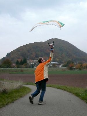
I work as a database programmer in the "IT-Speicher" in Regensburg, Germany, and toy around with unconventional r/c aircraft, aerial photography and some other odd digital photography techniques in my free time.
I do have a website but for the moment it is horribly outdated.
I'm into Openstreetmap and Geocaching also; these combine well with Geohashing expeditions.
I'll try to visit hashpoints on any day (or during the night, if necessary) if I find the time, and the coordinates happen to be reachable from Regensburg by bicycle, including the corners of the neighbor graticules:
I can be found idling around in #geohashing most of the time.
Been there...
(newest first)
 |
2009-01-12 48 12 in the same field as 2008-12-18 48 12 but 400m to the east. Cycled there before work, around 8:30. No sticky mud this time :-P |  |
2009-01-11 48 12 in a snowy field, with Tomcat and Hans. Wrote stuff into the snow and flew my paraplane to photograph the work from above. |
 |
2008-12-30 49 12 on a wooded hill above Unterlichtenwald, about 15km east of Regensburg. Reached the coordinates together with Tomcat at 20:00. |  |
2008-12-24 49 12 inside a Fristo beverage depot in Regensburg, near the Donaueinkaufszentrum. Arrived at 9:00 and explained geohashing to the interested shop leasee. |
 |
2008-12-18 48 12 In a field south of Neutraubling. Made a total mess of myself and my bike to get there (after work). |  |
2008-11-01 48 12 In a field north of Bad Abbach, about 10km from Regensburg. Went there by bike with Tomcat and Hans around 16:00, and also flew my "X-3D-BL" quadrocopter over the field. |
 |
2008-10-18 49 12 On a hill above Bach an der Donau, 15km east of Regensburg. I met Tomcat and a drag-along there at 9:00 in the morning. |  |
2008-10-14 49 12 In Sulzbach an der Donau, under an apple tree, 10km east of Regensburg, with Tomcat and my R/C paraplane. |
 |
2008-10-11 49 12 Near Hirschling, in a forest above the Regen valley, 25km north of Regensburg. |  |
2008-09-29 49 11 Very close to Eilsbrunn, in a field west of Regensburg, with Tomcat. |
 |
2008-08-09 49 12 Near Hainsacker, in a forest north of Regensburg, with Tomcat |  |
2008-06-15 49 11 Near Siebeneichen, in a field east of Amberg (my first, and for now the longest expedition) |
...done that:
dawidi earned the Frozen Geohash Achievement
by reaching the (49, 12) geohash on 2008-12-30 while the temperature was -9.1°C.
dawidi earned the cubicle geohash almost honorable mention
|
dawidi earned the Déjà Vu Geohash Achievement
|
dawidi, among several other expeditions (full list), earned the Bicycle geohash achievement
|
dawidi earned the Drag-along achievement
|

