2014-07-10 global
|
Globalhash on Thu 10 Jul 2014: |
|
Thu Jul 10 2014 Globalhash: |
Location
South of Tzoonie Lake, between Serov and Vrubel Peaks.
Participants
- Rex Wolf
- OtherJack
- Steve from Sea to Sky Air
Plans
OtherJack
Well, it all started on Talk:Seattle, Washington, when not long after I posted:
The globalhash is in the Vancouver graticule! See here or Eupeodes. However it seems to be in an extremely remote, roadless (and possibly trackless) area in the mountains well NW of the city. Even Wikipedia describes the globalhash's nearby lake and river as "remote"... oh well... -- OtherJack (talk) 14:12, 9 July 2014 (EDT)
I received an alert of a reply from a friendly stranger, clicked, and most unexpectedly read:
Don't give up! See my note on the Vancouver page. There is a local private airplane company very close by which lets you fly the plane once it's in the air! It may be nearly inaccessible by foot, but think of the first aerial globalhash! -Srs0 (talk) 16:21, 9 July 2014 (EDT)
I was rather skeptical, but curiosity piqued, I went and found Talk:Vancouver, British Columbia, where I read...
Globalhash in the Vancouver graticule! Not near a road, but you crazy guys don't need one anyway. Danatar (talk) 12:13, 9 July 2014 (EDT)
Seconded wholeheartedly! Go for it, you crazy Vancouverites! I wish I wasn't 9 times zones away! -Srs0 (talk) 16:16, 9 July 2014 (EDT)
Hint: note that Sea to Sky Air (http://www.seatoskyair.ca/) is based in Squamish (very close by) and does private flights, where you get to fly the plane, for reasonable prices. First aerial globalhash? I absolutely would if I was in the area... -Srs0 (talk) 16:19, 9 July 2014 (EDT)
...which at first sounded like crazy talk:
Thanks for referring me here Srs0 -- I took a look but I don't think this would make that much sense for me alone; I don't have a car so it would be difficult for me to get to Squamish, and then the next day (the 11th) I'm flying out of Seattle to go to Chicago for the weekend. So it would be pretty hectic. I may call that company up and at least see if they're available tomorrow though, so folks in general know if there's a chance. I can imagine them being booked a long way in advance... -- OtherJack (talk) 17:42, 9 July 2014 (EDT) from Seattle
But then over the next half hour or so at work the idea grew and grew on me, and when I finally called them it was with some anticipation. And, again to my surprise,
OK, I checked with them -- they are actually quite free and it would only be about $100-$150 per person, but there would have to be *two* people - it could not just be me. So any locals up for it? I suppose I'd also need some way of actually getting to up Squamish without my own car, so that would be good anyway. Car rental may work in a pinch too. -- OtherJack (talk) 18:21, 9 July 2014 (EDT)
When, alas, no locals appeared, I thought I'd try my fellow Seattleite Thomcat since I knew he, like me, greatly regretted failing to notice 2013-09-24 global until it was too late. However, he declined, so I started thinking about who else I knew who I could bug. Suddenly I remembered that Rex Wolf, who I'd met at 2014-01-25 47 -122, lived in or near Vancouver. I sent him an email, but when I didn't get a reply after a few hours I figured he was too busy, and I started to forget about the whole idea.
But then, while biking home from eating/drinking with friends later that evening, my phone told me I had an email... and it was from Rex! When I got home, there followed a furious planning session via geohashing IRC channel. I could definitely get from Seattle to Vancouver via bus or train but the question was what to do next. At first we considered heading up to Squamish in the evening after Rex finished work, but we weren't sure if Sea to Sky Air would even be open that late... and then I realized the last bus back to Seattle left at only 8pm, so it would be too rushed in any case.
So we decided to see if Rex could get time off work. He would find this out at 8:30am and immediately text me. The next conveyance to Vancouver after that was a 10am Bolt bus, which I later determined had a 9:30am deadline for buying tickets. The one other uncertainty, though, was whether Sea to Sky Air could actually fly us at the right time: with a 2pm bus arrival we probably wouldn't get to the airstrip until 3:30pm, so our requirements were going to be rather specific. So I reluctantly put off buying the bus ticket. I called them and left a voice message, hoping I'd get a reply in time the next morning. (Though I figured with no reply I'd still get a ticket, since they'd sounded so free in general on the phone earlier.)
In any case, I had to assume it was happening, so I posted:
UPDATE: Rex and I are going to try and do this in the afternoon if he can get off work! Which he thinks there's a decent chance of. Stay tuned. -- OtherJack (talk) 00:39, 10 July 2014 (EDT)
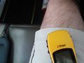
got all the gear (list pictured below) together, wrote out the coordinates in all three formats plus some vague directions to the place just in case Rex's phone internet stopped working (also pictured below), set an alarm for early, and with difficulty fell asleep.
While nervously waiting for Rex's message the next morning I got the bolt bus form all filled out, so would just be able to hit Buy and leave in the shortest amount of time if need be. And then:
Second update: Rex can skip work, so we are going to try it! I am still not 100% sure the company can do it at the time we'd get there (late afternoon), but it sure seemed like it yesterday - I hope to raise them on the phone soon and actually speak to them again... -- OtherJack (talk) 11:38, 10 July 2014 (EDT)
This was (almost) really awesome!! I tried Sea to Sky again, but no one in yet. Filled out the bolt bus form again on my phone (plan B), which was rather annoying since said phone is really old and can't run their new app. Soon the last safe Seattle Metro bus to catch the bolt bus was coming, so I had to grab my stuff and get on. Around 9:10 (somewhere in Fremont) I tried them again... and they were good for it! Huzzah! I texted Rex immediately. No celebrating yet though, I still had to successfully buy the bolt bus ticket on a moving Metro bus in the next 15 minutes or so... and the form had timed out and reset, so I had to do the whole thing again.
And then, a few minutes into that process, my phone rang -- uh oh. Had they realized they actually couldn't take us? I picked up, but instantly relaxed when the fellow told me he just wanted those GPS coordinates I mentioned, so they could plan the flight! These guys were really cool! I asked him whether he wanted decimals, degrees-minutes, or degrees-minutes-seconds, he said anything was fine, so decimals it was. (Later we would all realize that their software required DMS, but we were both innocent of this at the time.) I dictated the digits over the phone, trying to sound businesslike and unperturbed, like this was all completely normal and not crazy. I still think the guy sitting next to me on the bus must have been extremely curious about what was going on through all of this.
Of course, I *still* had to finish buying the stupid Bolt bus ticket, but luckily I was able to learn from my first attempt, and I did it in plenty of time, somewhere on 3rd Ave downtown. I finally relaxed for the first time since the previous evening. This really was going to happen. I got on the Bolt bus without incident and at the border I remembered to use Geohash Droid and post:
We are going for it! 3:30 ish custom sightseeing flight ... they seem to like the idea of geohashing, too. -- OtherJack (talk) 14:59, 10 July 2014 (EDT) -- OtherJack (talk) 14:59, 10 July 2014 (EDT)
Expedition
Rex
I left work around 1:20PM, given that Jack had texted me and said they were running a little early. Getting to Pacific Central Station was no problem, as I've done that drive many times. Upon arrival, I parked and waited quietly for Jack's bus to arrive. Given the placement of his bus's gate, I wasn't sure if he would walk inside, or follow the walkway out to the front of the building, so I kept walking back and forth between those locations to make sure I wasn't missing him. Chatted to a friendly Greyhound guy who was out front having a smoke. He said he'd let me in, but I'd have to go through security. I didn't mind having to wait out front.
As it happened, I was in the right place at the right time, as I'd gone into the station and then stood just inside the security screening area (where there was nobody on duty) as Jack's bus arrived. We spotted each other and quickly proceeded into the station, and then out to my car.
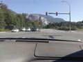
Downtown Vancouver wasn't bad, but as we hit Stanley Park, traffic slowed to a crawl. The fire truck and ambulance that passed us made me guess that there was an accident ahead. The local traffic news confirmed that, but at least the traffic wasn't blocking our side of the road. So it took some time for us to make it back out to the highway. But once we did, we made excellent time along Highway 1 and then up the Sea-to-Sky Highway.
(I mentioned to Jack that, before the highway was improved for the 2010 Winter Olympics, the local story about that highway said that the name was given because after your car fell off the side, you'd go to the sea, and then to the sky. Hopefully with a new pair of wings and a halo to match.)
Google's driving directions seemed a little odd, a couple times. We'd be driving along the highway northbound, and Google would suddenly announce that in so-many meters, we'd be merging on to the same highway...southbound. We'd drive on the "southbound" highway for another couple kilometers before Google announced that we were now merging on to the "northbound" highway. Jack suspected my GPS was screwing up, but I noticed that, in at least one place, the announced name of the highway changed. I wondered if that had anything to do with the screwy directions.
We actually arrived two minutes before we were due at Sea-to-Sky Air. We went inside and started figuring out where we were really wanting to go. Jack had provided the coordinates over the phone, but they explained that it took them a while to figure out what he'd meant. At which point they kindly explained to us that "there's no such thing as 'negative degrees.'" At which point we realized that they needed coordinates in the degrees, minutes, and seconds format. (They also measure distance in nautical miles and height in thousands of feet.) I helpfully tried to provide degrees, minutes, and decimal minutes, before Jack pointed out that the decimal minutes were not equivalent to actual seconds.
I did find the correct DMS on my display, after another minute, but it was moot by then--Jack had everything sorted out and written down. So Steve (our pilot) and we went to the planning computer and worked on figuring out where the coordinates actually were. Steve estimated it would be about a 40-minute round-trip, and outlined the course he was expecting us to take. He also outlined a shortcut that we could take, if we got enough altitude to do it. He marked it down on a plasticized flight map, and we headed outside.
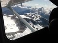
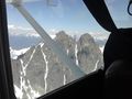
Steve took us to a Cessna 172 to start the safety briefing. (I forget the tail number, but it was Charlie blank Whiskey Kilo Charlie--probably the plane in this photograph.) In our case, the safety briefing was limited to seatbelt, fire extinguisher, first aid kit, survival kit, barf bags, and a warning about opening the windows during flight to take better pictures. Dropping one's phone because the slipstream ripped it out of your hand would be highly annoying.
Jack had the whole back seat to himself, and I sat up front with Steve. Headsets all round, and then it was out to the runway. There was a fairly heavy crosswind, so our takeoff was somewhat wobbly--it's always fascinating and a little eery to get a foot off the ground, and suddenly have your nose pointed at an angle to your direction of flight, with the wings wanting to flip over in the wind. But Steve's got skillz, yo!
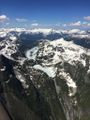
Those skills were on display, as we turned around and headed up through the valleys, gaining altitude as we went. Steve apparently teaches courses on mountain flying, and he noted the strong updrafts we were getting off the mountains today were helping us gain altitude much more rapidly than we otherwise could. He showed off the Rumbling Glacier to us on our way in, and that was quite the sight. More than that, I was fascinated by the little lakes that I could spot cupped in the big mountain ranges and foothills in the area. Far above the valley below, but there they were.
We did gain altitude quickly enough to take our direct shortcut route, and Steve was looking for a pair of lakes near the hashpoint. He thought he'd found them, but I really wasn't confident. My GPS said we still had another 8 kilometers or so to go. Jack was going back and forth with Steve over the intercom, working on directions, but I eventually just held up my phone so Steve could get a better idea of where we were.
(Before leaving on the expedition, I downloaded the full terrain maps for the area into my GPS app--I didn't want to be trying to download maps while in flight over a cellular connection. So I had the hashpoint set as the destination, terrain maps available, and was not only recording our track, but watching it update live every three seconds or so.)
Steve took one look at my phone and went "Hey, that's really cool!" And promptly adjusted our flight heading. As we went a little further, he realized that the pair of lakes we were looking for were ahead, around another peak. I caught sight of them too--the smaller one was iced over with snow, and the large one had only a tiny sliver of water in the middle, with ice and snow covering the rest of it. Jack couldn't identify the lakes at first until he too realized that they were iced over.
We curved around the hashpoint in a gentle arc, and I kept monitoring our progress. We weren't really close to the hash, but it was probably as good as we were going to get. Again, Steve wasn't entirely sure where we needed to be, since he didn't have a GPS in the plane. So I handed him mine. He looked at it, saw our track, and brought us around. Then the bank steepened, and for a moment I thought something must be wrong--we hadn't banked at that angle the entire flight. But I realized Steve was just bringing us around in a tighter curve to head for the hashpoint. And he was almost dead-on! A slight correction later, and we were headed right down the bearing like our nose was on a wire!
I tried to capture our coordinates at the right moment, but they updated a split second before I got my screen capture. Jack happily announced that his GPS recorded us being only 32 feet away from the hashpoint. In an airplane, I'd call that good enough--it's well within the 10m margin of error I often suffer on the ground. We were around 7500-8000 feet altitude at the time. I saved our track and put the GPS away. Right afterwards, Steve had to check his map and altimeter to make sure we weren't violating Vancouver airspace, but we were fine.
On the way back, Steve showed us some more landmarks, like the Witch's Tooth, Mount Garibaldi, Mount Tantalus, its twin peak Dijon, and Lake Lovelywater. He also pointed out some hunting cabins and lodges on the mountains and lake shores along the way. I kept taking pictures like nobody's business.
Losing altitude to come back in was harder than gaining altitude had been, and we had to circle a bit. Steve tried to bring us down nice and gentle for our ears. I was having trouble with my left ear, but oddly enough, the gentler and slower Steve brought us down, the more annoyed my ears became. Speeding up our rate of descent cleared everything up. I guess I'm just weird.
We landed, took a picture of all of us with the plane, and went in to clear up the bill. Then, with Steve's recommendation, we stopped by a food truck on the way back. The Locavore had some damn fine food! Jack had half a rotisserie chicken with roasted potatoes, and I had a pork Banh Mi in a pita, with bacon, with roasted potatoes. Oh man, that was TASTY!
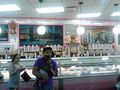
After that, it was just back down to Vancouver. Traffic across the Lion's Gate was terrible, as usual. With some extra time, I also took Jack to La Casa Gelato. He had a passion fruit sorbetto, while I enjoyed some garlic ice cream, maple bacon ice cream, and apple cheddar ice cream. Perfect capper on the afternoon, I'd say!
OtherJack
Rex's excellent writeup speaks for itself! I only want to add a few details that Rex and other Vancouverites likely take for granted, but I as a visitor to BC was struck by. In chronological order:
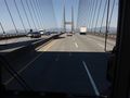
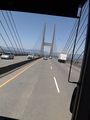
1) The brutalist Route 91 bridge over the Fraser on the bus ride up (apparently called the Alex Fraser Bridge) was super cool. Also apparently was the longest cable-stayed bridge in the world back when it was built. Pictures below.
2) In the suburbs of Vancouver, platoons of concrete skyscrapers climb up steep, densely forested mountainsides. It looks like the future.
3) The Lions Gate Bridge (the one with the accident) might be even cooler than 1). Very long, narrow, arcing, high, old, teal-painted suspension bridge leading directly towards 2).
4) The Sea to Sky Highway. Swooping to and fro between a fjord (!) and yet more steep, densely forested mountainsides for an hour plus. I was very glad not to be on the old version described by Rex above.
5) When I asked Steve how many people set foot down there per year (when we were still only about halfway out to the hashpoint), he said, "oh about 5 or 10."
6) La Casa Gelato is no ordinary gelato shop. They have 219 flavors out at a time (600+ total), including more sorbet flavors available than most places have total ice cream flavors. The walls are covered with cheesy renderings of famous places around the world, and "Welcome! Thank you!" translated into probably 100+ languages. You have to go there to truly understand how bizarrely excellent it is.
Going to sleep again but I'll put some extra photos up soon, I promise.
Tracklog
Photos
Rex
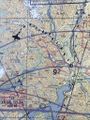
The plasticized pilot's map.
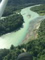
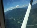
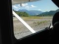
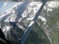
The river as we take off.
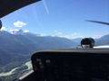
A view of Squamish.
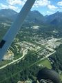
More of Squamish.
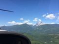
Mount Garabaldi.
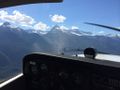
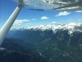
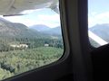
The mountains further up the valley.
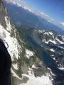
The Rumbling Glacier is behind these guys.
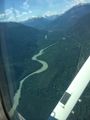
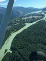
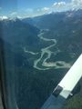
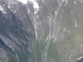
Further down the valley.
A small valley leading up towards the Rumbling Glacier.
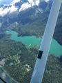
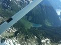
A small mountain lake, cupped in the high ridge.
A slight detour towards the Rumbling Glacier.
Getting closer to the Glacier.
One valley near, one valley far.
Even closer to the Glacier!
Another valley view.
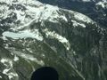
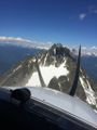
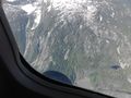
Crossing over into mountainous terrain.
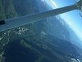
Leaving the valley on our wing.
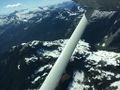
It's all mountains ahead.
We thought the hashpont was here at first.
There's the two frozen lakes!
Coming further around to our right.
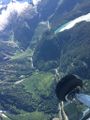
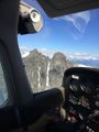
The hashpoint is down there somewhere...
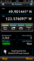
Coordinates!
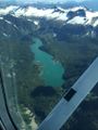
This lake had some logging roads along it, and what looked like a dock...
Better view of the dock area.
The far end of that lake takes a sudden tumble...
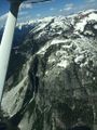
Approaching Mount Tantalus on the far right.
Logging roads around the foot of Tantalus.
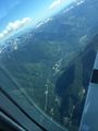
A view further down the valley.
Tantalus also has the Witch's Tooth, a small projection in between the two peaks.
A more contrasting view of the Witch's Tooth.
These mountain lakes are really quite pretty.
So are the mountains.
And we got fairly close to them!
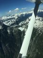
Coming around the side of Mount Tantalus.
Lake Lovelywater.
And Squamish just behind it.
Bye bye, mountains!
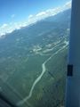
Coming back down into the Squamish area.
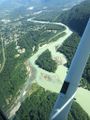
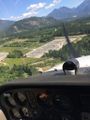
River and town.
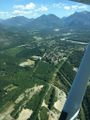
More town.
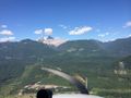
And over it all, Mount Garabaldi.
On final approach to the landing strip, a switching station!
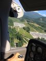
And its partner.
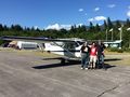
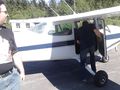
Two hashers, a pilot, and a plane.


OtherJack
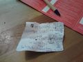
the piece of paper I took in my pocket
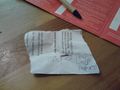
other side of the piece of paper

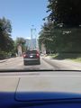
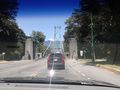
First sight of the 91 Fraser bridge
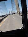
On the bridge
Futurey Vancouver suburbs
Lions Gate Bridge, with lions
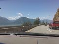
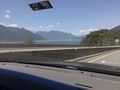
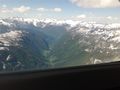
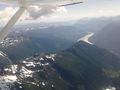
Fjord (Howe Sound)
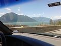
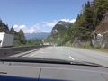
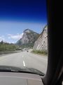
Cool mountains
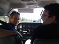
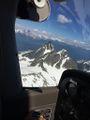
Steve and Rex up front
Rest of Sea to Sky Air's fleet
We're off!
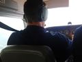
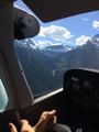
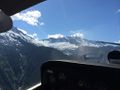
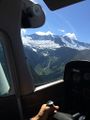
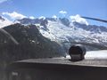
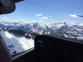
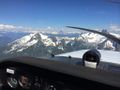
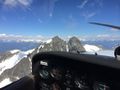
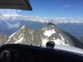
Piloting
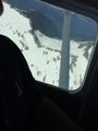
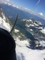
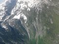
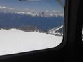
Lots of snow
The point is somewhere down here. Tzoonie Lake at upper left
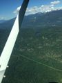
zooming back out again
Failed attempt at gps shot
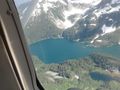
Closer to Lake Lovely Water
And we're back
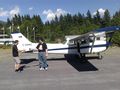
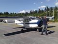
Steve and Cessna 172
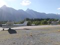
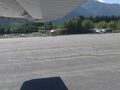
Squamish airport
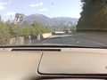
On the drive back

Inside La Casa Gelato
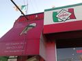
Outside La Casa Gelato
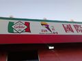
"This is it!"
Happy Rex


Achievements
Rex, OtherJack, and Steve the pilot earned the Air geohash achievement
|
Rex, OtherJack, and Steve the pilot earned the Globalhash achievement
|
Rex and OtherJack earned the Drag-along achievement
|
OtherJack earned the Border geohash achievement
|
Thank you!
- to Sea to Sky Air and Steve, for taking our business and getting us there, and just for being really cool in general...
- and to Srs0 for coming up with the whole idea and then somehow finding my post!