Difference between revisions of "2010-03-28 global"
imported>Robyn (About US $500 for the helicopter.) |
imported>FippeBot m (Location) |
||
| (60 intermediate revisions by 8 users not shown) | |||
| Line 1: | Line 1: | ||
| + | <blockquote> | ||
| + | To celebrate the size and diversity of the Earth for Earth Day, we decided to visit a random location on the globe. The point happened to be 800 km away on a mountain in Idaho, so we drove to Idaho, chartered a helicopter to get close, then hiked to the spot. What did you do for Earth day? Oh, you turned out the lights for a while. That's nice too. | ||
| + | </blockquote> | ||
| + | |||
| + | {{meetup global|date=2010-03-28}} | ||
==Location== | ==Location== | ||
| − | + | In Idaho, only 800 km away from Vancouver across one international border. That's about ten hours drive, plus we need to ford a river and climb 700' in elevation up a steep mountainside. We didn't check the global hash until [[User:Danatar|Danatar]] alerted us, so planning was hasty. | |
| + | |||
| + | Until I figure out how to put a map inline, we'll make do with this link: http://maps.google.com/maps?q=47.273779,-116.521377 | ||
| + | |||
| + | ==Participants== | ||
| + | *[[User:Robyn|Robyn]] | ||
| + | *[[User:Wade|Wade]] | ||
| + | *Jim Van Sky | ||
==Planning== | ==Planning== | ||
| − | + | Planning personnel initially included [[User:Robyn|Robyn]], [[User:Wade|Wade]] and [[User:Rhonda|Rhonda]]. Knowing it was possible that the roads in the area were blocked by snow, as was discovered by intrepid geohasher David Souther [[2009-03-04_global|last year about this time]], we started research. The geohash is on top of a plateau near the town of St. Maries. Highway three gets to within hiking distance of the point, with a river to ford, and there are some logging roads that get very close (and up the hill), but as mentioned, they may have been blocked by snow this time of year. In the Google satellite view, the area is a cutblock, so it's probably all young trees and dense underbrush by now. We've spent hours in the past going a few hundred metres in terrain like that. Vancouver geohashers may be stupidly obsessed in pursuit of their goals, but they do learn from experience. | |
| + | |||
| + | It's not that members of the Vancouver graticule hesitate to traverse [[2009-12-30 49 -123|brambles]], [[2009-05-08 49 -120|steep hills]], [[2009-04-08 49 -123|large bodies of water]] or other obstacles. It's just that the geohash was over ''eight hundred'' kilometres away, and the last hundred or so would be on some twisty local roads of unknown condition. And some geohashers need to get to work on Monday morning. Investigation of the local area and goading from other geohashers revealed that St. Maries has a small local airport. Not entirely seriously, just really to prove that we tried our hardest within the constraints, we checked into helicopter charter. There is no helicopter outfit out of St Maries, but Coeur d'Alene, about 50 kilometres away as the crow--or helicopter--flies, has a helicopter company called [http://www.bigcountryhelicopters.com/ Big Country] whose owner/dispatcher/pilot Jim Van Sky answers his phone promptly and doesn't say "you want to do what?" when presented with a set of lat long coordinates. He could take up to three people, totaling with their gear up to 600 lbs. And the price was about the same as an inflatable kayak. [[User:Robyn|Robyn]] told him she'd discuss it with the group and get back to him. | ||
| + | |||
| + | Jim also told us that the snow level was above 4000', so we could have taken that information and realized that we could drive to the base of the hill on highway three and hike up. [[User:Xore|Xore]] said if Rhonda was going "he's not bloody well going to miss it," and both favoured the drive-and-hike approach, so Robyn called back the helicopter pilot and said they would not require his services. Rhonda then rolled a sanity check, and she must have a very high wisdom score indeed, because she successfully ''made'' the sanity check and was unable to justify the expedition to herself. That removed the condition that forced Xore to go, so it was back to Wade and Robyn. | ||
| + | |||
| + | They too could have hiked, but once the idea of taking a ''helicopter'' to a ''globalhash'' had been raised, it was hard to let go. In Wade's words, "I want to go for a helicopter ride." Coeur d'Alene is on I90, a major US highway, so it was guaranteed to be clear. Only driving as far as Coeur d'Alene instead of all the way to St. Maries would take four hours off the round trip, and not hiking up and down the hill an unknown amount, but possibly another four. It made the trip more possible. And way way cool. Hmm. Was this going to happen? | ||
| + | |||
| + | The weather had to permit the helicopter--and the tiny car--to make the trip. The forecast for Sunday morning was mostly cloudy in Coeur d'Alene, but the aviation weather assured us those clouds would be high above. We were not guaranteed able to land at the geohash. The pilot would have to approve the the site as safe, but at minimum we would achieve an airhash. Robyn packed for the trip while we thought about it. It was about 3:30 pm by the time planning and discussion was complete. Robyn called Jim back again and said we'd see him at 9:45 the next morning. | ||
| + | |||
| + | ==Expedition== | ||
| + | ===Leaving Home=== | ||
| + | Sadly, Robyn couldn't find T-Rex. She thought he was in the car, but he wasn't. We left with two GPS receivers, an iPod touch for communications, a change of underwear and socks, and no dinosaurs. We'd got as far as the Knight Street bridge when neither one of us could guarantee having closed the garage door. Robyn took the first exit and doubled back over the bridge to go and see. | ||
| + | |||
| + | "You know," said Wade. "This is a chance for us to change our minds." But you know what, we like road trips. It was a weekend getaway. In addition to the helicopter charter, this would cost us two and a half tanks of cheap American gasoline, a night in a cheap motel, and some fast food. We put it in perspective. What else would we spend it on? It was better than a carload of IKEA furniture. It was better than a new suit. It was better than airfare and a hotel in Vegas. The globalhash it was. We drove up our street and the garage was already closed. One of those reflex things that you do without recording that you've done it. We set off again and reached the US border just before four p.m. | ||
| + | |||
| + | ===Border Crossing=== | ||
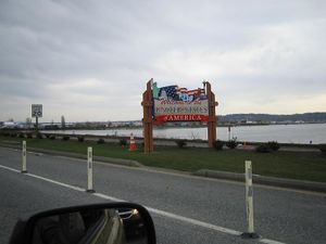
| + | This was to be Wade's first border hash, although the difficulty he had with the ribbon leads us to wonder if ordinary achievements can be claimed in conjunction with the globalhash. The Peace Arch crossing has a system where you get in line and shut off your engine, then every fifteen minutes or so they turn a traffic light green and everyone moves up 500 metres or so, then stops and turns off their ignition again. There's a countdown timer on the light so everyone can get out and play in the park and not sit in the car and develop road rage. But after we got in line and shut off the engine, some cars inched forward. The ones in the other line inched forward more, but that's one of those facts of life. Robyn started the car again and closed up the gap before shutting down again and giving dirty looks to the people who were still idling their cars, pointedly glancing at the signs instructing engines off while the light was red. But the cars kept inching forward. | ||
| + | |||
| + | [[Image:20100328G.border.jpg|thumb|left|We crossed the border after an hour in line.]] | ||
| + | |||
| + | We were definitely in the wrong line, too. We decided to let the gap open further to reduce the number engine starts, but as soon as the gap in front opened to two car lengths, a woman in the lane next to us, yes, the faster moving lane, changed lanes to jump into ours. It made Robyn giggle all the way through the hour wait to think of her changing lanes for no reason. If we'd been sharp we could have switched lanes into her spot at the same time. But the ignition was off. After that we put the car in neutral and Wade pushed with his foot out the door until we reached the downhill and could hold it just with the brake. When we got to within sight of the light, we could see that people were running it, treating it like a stop sign. Robyn decided to set a good example and stop and '''wait''' at the light, but there was the additional problem that the two lanes condensed into one lane basically at the traffic light. So everyone was merging while running the red light really slowly. Thus after about twenty seconds of waiting behind/beside Robyn at the light, the vehicle ''behind'' us pulled around and ran the light in front of us. We surrendered to peer pressure and ran the light. Maybe it was broken. The timer wasn't running. | ||
| + | |||
| + | When we finally got to the border control point we handed over our passports and announced our agreed upon and perfectly true intentions, "We're going to look at some property in Idaho." The agent posed the testing question of "how many acres?" at which point Robyn admitted that she didn't really know, we were really looking, not buying, but we were going to get to go for a helicopter ride, and how cool is that? He gave us our passports back and let us in. | ||
| + | |||
| + | ===Driving to Coeur d'Alene=== | ||
| + | The I-5 south is a familiar route for both of us, as when Wade and Robyn were first married their places of residence were separated by about 200 km of said highway. It winds through lots of scenic forested terrain, but we didn't take any pictures because we were saving the camera battery packs for for the helicopter ride. You may refer to pictures of the area from previous expeditions [[:Category:Meetup in 48 -122|in the area]]. | ||
| + | |||
| + | In addition to enjoying the scenery, we listened to the Geohash Mix CD from [[2009-03-29 49 -124|thepiguy's birthday hash]] last year and played an alphabet game. Not I-Spy, or with licence plates, both of which require the driver to take her eyes off the road, but one we may have made up where you start with a letter of the alphabet and an animal and then cooperate to tell the most elaborate story possible about that animal, using the letter as often as possible. Our story was about Iggy, who is an iguana and who works as an international intelligence inspector for Iberian Airlines. Iggy, as we intercept its (Iggy is intersex) itinerary is in transit from Idaho (which it inhabits) to Indiana, via Iowa, in order to investigate an incident involving an interloper inferred to be an Italian informant from Israel. You get the idea. | ||
| + | |||
| + | We exited the I-5 just north of Seattle and connected to I-90, then exited in Issaquah where, after some negotiations with the zūmo driving GPS, we found both a gas station and a source of quick food that was not fast food. If you know one word of Vietnamese (and you're not the protagonist in John Irvings '''A Prayer for Owen Meany''), that word should be Phở. Yummy, yummy vegetables, tofu, vermicelli and peanut sprinkles, with that hot sauce that come in a big bottle with a picture of a cock on it. | ||
| + | |||
| + | Bellies and fuel tanks refilled, we overrode the GPS instructions to go around the block and do a U-turn, and just hung a left and a right back onto the freeway. The I-90 goes up over the not super-high but still lovely mountains (highest pass we saw labeled was 3005'), winding between spectacular lakes and over the rolling foothills and into the plains of eastern Washington, but we didn't see the last, because it got dark. On account of the oncoming headlights, Wade, who was now driving, suggested that modern technology should include advanced peril-sensitive sunglasses that contain "a camera" that detects oncoming headlights and blacks out just the headlight beam. Robyn disagreed that that would be a camera, saying it would be "a sensor" and declaring that a camera requires a sensor ''and'' a recorder. Wade agreed that the eye is not a camera (and we didn't get into whether eye plus brain was a camera), and Robyn conceded that she wouldn't ''object'' to CCTV pickups being called cameras, even if no recording was made, but that technically if it was only used to display an image on a screen with no more persistence than the phosphors, that it was a sensor not a camera. | ||
| + | |||
| + | The driving GPS and the points of light reflecting in the water told us we were passing a number of towns and lakes and reservoirs. We traversed a county in Washington which proclaimed itself the premier potato producing county in the nation, kind of a let down, because we were under the impression that our destination Idaho was the potato capital of the nation. We just took it as a sign that we were drawing nearer to Idaho. | ||
| + | |||
| + | And eventually we did reach Idaho. There was a '''Welcome To Idaho''' sign, and everything, but we didn't photograph it, in that it was dark and after eleven and we were tired. Idaho is a pretty skinny state, so we were in Coeur d'Alene quite soon after crossing the border and checked into a hotel near the airport, where we posted the following status message. | ||
| + | |||
| + | ''We're in Coeur d'Alene. We're fighting over Robyn's iPod and it's a pain to edit wiki pages. It was really fun driving down, but not as cool as the helicopter will be. Neener. -[[User:Wade|Wade]] 07:01, 28 March 2010 (UTC)'' | ||
| + | |||
| + | ===Finding the Airport=== | ||
| + | Our instructions from the helicopter pilot has been to call in the morning for directions to the hangar. When you go on a helicopter, you don't just follow the little airplane-shaped signs to the terminal and check in at a gate, and there isn't a trail of little helicopter-shaped signs, so you have to follow the directions given to you by the pilot. These were as follows: | ||
| + | |||
| + | *Drive north on I-95 for seven miles | ||
| + | *Turn left on Dakota | ||
| + | *Keep driving until Dakota ends | ||
| + | *Turn right onto Atlas | ||
| + | *Continue on Atlas until just before it becomes gravel | ||
| + | *Turn right there onto a road with no sign, but which has a name (if he told me what the name was, I didn't record it, but he *assured me it had a name) | ||
| + | *Drive until you see the letter Q on a fence | ||
| + | *Turn left at the Q | ||
| + | *Turn right 25' later at a gravel driveway | ||
| + | *Turn right on Sikorsky | ||
| + | *Stop at gate #16 | ||
| + | |||
| + | [[Image:20100328G.Q.jpg|thumb|We turned left at the Q.]] | ||
| + | |||
| + | He said he would have to let us through the gate, then we should continue by taking the right fork in the gravel around the building, and park between the gravel driveway and the building. Surprisingly, the directions contained no reference to old oak trees and no distances given in paces. It looked like getting to the hangar could prove more challenging than reaching the geohash itself. | ||
| + | |||
| + | We followed the directions, which could pretty much be reduced to "Go to the airport and then drive around the left side of the fence until you reach gate #16" but upon reaching gate #16 we met an impasse. That being Gate #16. It was not equipped with an intercom, just a numeric keypad and a notice that the gate code was the airport VOR frequency. Robyn hadn't thought to bring her aviation charts when someone else was flying an aircraft with which she was unfamiliar, so after waiting a bit and honking the horn once, we resorted to knowledge and subterfuge. We checked for wireless -- none-- and Robyn did not have an iPod app that contained lists of foreign VOR frequencies. We knew that VORs use a frequency range between 108.00 and 117.95 MHz, in 50 kHz steps. Wade scrutinized the keypad and noted that the '''1''' key was cleanest, followed by the '''6''', '''4''' and '''9''' keys. The '''5''' and '''0''' definitely displayed an undisturbed layer of dirt and dust. That meant a four digit code, as any five digit frequency would have to end in 0 or 5. We'd tried 116.4, 114.6 and 116.9 when a guy pulled up beside us on a motorcycle. He turned out to be Jim and he gave us the correct code, which Wade entered and we all went in and parked beside the hangar. | ||
| + | |||
| + | ===Helicopter Ride=== | ||
| + | ====Preflight==== | ||
| + | The helicopter was bright red, spotlessly clean, and only bigger than Robyn's car because it had a rotor on top and a tailboom at the back. Pilot Jim attached little dolly wheels to the skids and towed it out of the hangar up an incline using the assistance of a small electric towbar. He left it there and went to get his truck. | ||
| + | |||
| + | [[Image:20100328G.R44.jpg|thumb|Don't say it's tiny.]] | ||
| + | |||
| + | We knew perfectly well in advance that we were going in a small helicopter, and, being a pilot who used to give tours in the equivalent four-seater piston ''airplane'', Robyn has much experience mocking passengers who look at the aircraft an gasp "It's so small!" For this reason when the pilot returned Robyn was biting her tongue and giggling instead of saying, "It's ''so'' small!" but of course he could tell what we were thinking anyway. He gave us safety briefing cards and explained the operation of the doors and seatbelts, the location of the teeny tiny fire extinguisher, and what not to step on. While we were learning this important information a squall swept in, buffeting us with wind and rain, so we finished the briefing inside the hangar, learning how not to get ourselves chopped up by the rotors. The weather calmed again within a minute. He fueled the helicopter from a tank on his truck and then we boarded according to his directions and did up our seatbelts. | ||
| + | |||
| + | [[Image:20100328G.fuelling.jpg|thumb|Fuelling the helicopter out of the truck]] | ||
| + | |||
| + | ====Startup & Deparature==== | ||
| + | Jim warned us that the helicopter wouldn't start on the first or second try, but that that was perfectly normal. It started on the third, and he let it run very quietly while we put on our headsets and he tested the various systems and made a telephone call. He was calling a weather specialist, who gave him what must be the most thorough briefing ever for a 50 km flight, but when he was done Jim told us that it was currently raining at the globalhash, but that the rain would stop by the time we got there. (Of course he didn't ''say'' "globalhash," but that's what it was. OMG! Globalhash! And at this point we're either going to get to the globalhash, or we're going to get a custom ribbon for crashing a helicopter en route to one. Either would be epic.) | ||
| + | |||
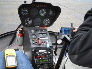
| + | [[Image:20100328G.inst.jpg|thumb|left|Helicopter instrument panel]] | ||
| + | |||
| + | Robyn offered to enter the globalhash coordinates in Jim's GPS, which was a Garman 496, a model with which Robyn is familiar, but he declined, using the map pointer to fly direct an approximate location, saying we could use our GPS to pinpoint the location later. | ||
| + | |||
| + | Everything ready, Jim checked the wind one more time and then we floated off the ground. It's not dramatic like an airplane takeoff. You're just on the ground, and then you aren't. | ||
| + | |||
| + | ====Enroute==== | ||
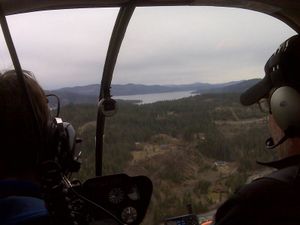
| + | [[Image:20100328G.Enroute1.jpg|thumb|The view from the back seat]] | ||
| + | [[Image:20100328G.Enroute2.jpg|thumb|Getting closer]] | ||
| + | |||
| + | We climbed to about 500' above the ground and then flew out over the suburbs of Coeur d'Alene, they looked like Fort Saskatchewan, with all new driveways and homes under construction. There's a lake at the edge of town, and a river flowing out, and more rivers flowing in the other end. Jim told us all their names and pointed out things like the "cabin" of the guy who owns half the town, and his son's equally palatial vacation home a little ways up the hill. There was even a giant conifer with a star on top: I guess they didn't want to climb it every year to decorate for Christmas. As we approached the geohash the terrain rose, as we of course knew it did from the terrain view in Google maps, and the hillsides were mostly regrowth after selective cutting, with some mature trees, some regrowth and clearings. We suspected that we might not be able to land at the actual site of the geohash, but a helicopter airhash globalhash is "enough," don't you think? | ||
| + | |||
| + | |||
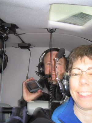
| + | [[Image:20100328G.inside.jpg|thumb|Inside the helicopter]] | ||
| + | |||
| + | ===Approaching the Globalhash=== | ||
| + | After we passed St Maries, Jim was navigating by my directions, which were based on a Garmin eTrex. That's not exactly the apex of navigational instruments, and nowhere near as good as the G496 that was ''right in front of him'' but which he wouldn't let me program. I let passengers program the G496 on my plane, but I suppose it isn't ''mine'' mine the way this pristine helicopter was his. I directed left and right but the display on the eTrex is slow to update and doesn't pivot as fast as a helicopter. We got within 42 m of the spot, then overshot. "Can you go backwards?" I asked. He could, and it was very cool. I mean wow, was it cool. Perhaps I was not concentrating quite as hard on the eTrex as I should have been, seeing as we were suspended in midair above the globalhash. The eTrex got confused by going backwards, or its display confused me, so while I was trying to figure out how to recover and direct Jim for another pass, he said, "I'm going to land down there." | ||
| + | |||
| + | [[Image:20100328G.landed.jpg|thumb|left|420 m from the globalhash]] | ||
| + | |||
| + | He checked out the spot, then gradually brought the helicopter down and set it on a narrow one-lane road, I'd call it a a generous ATV trail, with small trees all around. The touchdown was about the same impact as a walking footfall. He let the engine run at low power for a few minutes to cool down, then shut it off and we waited for the rotors to stop spinning before following his directions for getting out of the helicopter. The Garmin read 402 m from the globalhash. ''Globalhash!'' | ||
| + | |||
| + | ===The Last 402 Metres=== | ||
| + | |||
| + | [[Image:20100328G.AirhashAttempt.jpg|thumb|right|Almost close enough for an airhash]] | ||
| + | [[Image:20100328G.Landed.jpg|thumb|left|Touchdown!]] | ||
| + | |||
| + | Jim said, "It doesn't look like there's anyone else here," which was hilarious, seeing as we hadn't explained geohashing as a sport where you happen to meet people at the chosen location. It hadn't seemed relevant on this occasion. In retrospect Jim was probably considering the possibility of another vehicle being on the road, or hikers molesting his helicopter, but it would have been great had someone used a more normal geohashing technique for the approach. | ||
| + | |||
| + | Robyn yelled "Geohash!" and was off running down the track in the direction of the GPS arrow. Someone should put a leash on Robyn when they bring her to geohashes, or at least train her to heel. Wade and Jim followed at a more sedate pace. When the trail started to diverge from the geohash, Robyn continued along it for a while, picking up a few more metres on the destination before turning up the lightly wooded hill. The stupidity distance was approximately 145 metres. The terrain was pretty open, not too steep, brown grassland not recovered from the snow, in many places torn up, presumably by animals. There were a lot of animal droppings, some small deer-sized ones and some larger ones, bear-sized, but too even a consistency for bear, with no berries, fur or bones in them. Robyn guessed moose. Inside a hundred metres the familiar and addictive, "I'm going to reach the geohash" feeling cut in, but at 37 metres something large became audible crashing around in the bushes in the direction of the geohash. | ||
| + | |||
| + | All of a sudden Robyn's dropping identification certainty dropped a few notches. "Wade?" Wade answered, but not from the direction of the crashing. Robyn backtracked a bit, safety in numbers. Perhaps that will teach her to heel. Together Robyn and Wade circumnavigated a thick copse between Wade's slightly different route and the geohash and discovered the coordinates lay on the edge of a little clearing that, to our untrained eyes, looked big enough to land a helicopter in after all. | ||
| + | |||
| + | ===At the Globalhash=== | ||
| + | Besides being a globalhash, it wasn't that different from dozens of other locations randomly chosen by the Internet and visited by Robyn and/or Wade since the announcement of The Algorithm. The location the eTrex determined to be ''the spot'' was already marked by a pile of droppings, not only fragrant but still warm, suggesting that despite our technological ways, a moose or elk had reached the globalhash before us, and showed us exactly what it thought of our feeble efforts. The preexisting marker removed any desire to lie down and wallow in the success of the expedition. | ||
| + | |||
| + | <gallery perrow=3> | ||
| + | Image:20100328G.clearing.jpg|The helicopter could have landed here, but probably not taken off. | ||
| + | Image:20100328G.xkcd.jpg|Some ungulate had already marked the spot, so our marking was superfluous. | ||
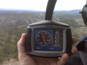
| + | Image:20100328G.gps.jpg|Obligatory proof of location | ||
| + | Image:20100328G.GPS1.jpg|Obligatory proof of location - distance | ||
| + | Image:20100328G.GPS2.jpg|Obligatory proof of location - accuracy | ||
| + | Image:20100328G.grins.jpg|Equally obligatory geohasher grins | ||
| + | </gallery> | ||
| + | |||
| + | There's a certain pressure that having a helicopter waiting for you puts on the geohashing spirit. The hasty nature of the departure from home, and the ridiculousness of the mission had prevented us from bringing any epic marker, and we didn't want to litter. Robyn actually brought a geohashing flag, but forgot to move it to the correct jacket pocket when selecting helicoptering garb, so the site is marked only with twigs. On the way back to the helicopter we found much more poop, and these huge bird tracks. The bird's foot is the size of my palm, and it walked for at least 20 m up the dirt road. | ||
| + | |||
| + | [[Image:20100328G.prints.jpg|thumb|giant three toes chicken tracks]] | ||
| + | |||
| + | After returning to the helicopter and lifting off, we realized that we should have scuffed a big marking so that photographs would show us over the clearing on our subsequent flyover for airhash proof, but we didn't. | ||
| + | |||
| + | ===Helicoptering Home=== | ||
| + | |||
| + | [[Image:20100328G.overhead.jpg|thumb|left|Overhead the geohash]] | ||
| + | |||
| + | We circled the area and then flew straight back to the airport. We followed a slightly different route, over a luxury golf course community, with each spacious lot worth ... exactly as much as an ordinary one-house lot in East Vancouver. Jim pointed out various bodies of water by name, but we didn't remember them all. | ||
| + | |||
| + | As we approached the airport Robyn remarked that it was a higher approach than she expected. That distance from the airport an airplane would be lower, because for best results airplanes don't go straight down, so you have to descend gradually on the way in. Jim agreed that it was a high approach, "Because I'm going to demonstrate an autorotation." He set the engine throttle to idle and we felt the helicopter drop at first, like the Grouse Mountain Skyride going over a tower --Vancouver area geohashers will recognize that, but for others: a mild roller coaster drop. Then the descent rate became constant at around 2000 feet per minute, maybe more, the vertical speed indicator looked pegged, but Jim still had steering control of the helicopter and swung around targeting a point he had announced before. Close to the ground and almost at the point he moved a control and slowed the descent to almost nothing. We would at than point have thumped onto the ground, probably like jumping down the last couple of stairs of a staircase, but at the last moment he added power to make it a perfectly soft landing. He also demonstrated a few aspects of helicopter control, which I hope Wade will write up, because he was in the front seat for that part and could see what was going on. | ||
| + | |||
| + | [[Image:20100328G.robyn.jpg|thumb|Robyn in the back seat]] | ||
| + | |||
| + | After the flight we did a bit of "hangar flying" -- standing in the hangar and telling stories of flying adventures. Jim had once been flying with another pilot in really terrible weather, and they kept going over wires and getting into cloud, but there was a car on the highway with its 4-way flashers on, so it stood out and they could follow it. It went right along the road by the airport, so they landed and then someone called them and said there was a man there looking for the pilot of the helicopter who has just landed. Turns out that he had heard the helicopter low over the house, thought "wow, I wonder how they can see anything: maybe I'll help them out!" so he bundled his kids into the car and drove to the airport with his blinkers on. He wasn't even a pilot, just decided that might be a good idea. How cool is that? | ||
| + | |||
| + | As we were leaving the airport we saw this odd conveyor belt leading out of a building at the airport. What would they be loading into trucks from that building? Potatoes? | ||
| + | |||
| + | [[Image:20100328G.whatisthis.jpg|thumb|left|What is this for?]] | ||
| + | |||
| + | ===Driving West & North=== | ||
| + | |||
| + | Wade wanted to have Idaho potatoes before we left the state, but Jim said all of the potatoes in Couer d'Alene came from Washington, so we just piled into the car and started driving west. I'll just show you the scenery and describe the trip that way. | ||
| + | |||
| + | <gallery> | ||
| + | Image:20100328G.plains.jpg|Idaho and eastern Washington has a lot of cultivated farmland with rolling plains. | ||
| + | Image:20100328G.hills.jpg|As we drove west, hills rose up out of the plains. And clouds rose up around the hills. | ||
| + | Image:20100328G.lake.jpg|We drove across this lake on a bridge | ||
| + | Image:20100328G.mtn.jpg|And into the mountains and the rain. | ||
| + | Image:20100328G.cone.jpg|There were some spectacular sights | ||
| + | Image:20100328G.snowshed.jpg|And moments when we couldn't see anything at all. | ||
| + | Image:20100328G.Seattle.jpg|But we made it to Seattle. | ||
| + | </gallery> | ||
| + | |||
| + | We met up with some friends in a suburb of Seattle and they showed us their renovations in progress. They have black belts in karate and needed to remove some drywall, and surely you can see the obvious connection. They let me try. Let me tell you, it is almost as fun to make bare foot-shaped holes in someone's living room wall as it is to helicopter to a globalhash. They took us out for dinner and then we drove back up I-5 to the border. | ||
| + | |||
| + | ===Another Border Crossing=== | ||
| + | Seeing as we had been out of the country for over twenty-four hours, we decided to take advantage of duty-free liquor savings and buy a bottle to take home. We were en route to the Peace Arch crossing, but Wade said there wasn't a duty free shop there, or at least he had never been able to actually find one there before being forced to cross the border, so we would take the truck crossing, which is right beside the Peace Arch, and which allows cars to cross. Robyn found a duty free shop listed in the GPS database, so set us to navigate to there. It asked us to take exit 275, the exit ''after'' the truck crossing exit, but we decided to trust it. It did find us a duty free shop, the one Wade had never managed to find, kind of around behind the entrance to the Canadian border. They moved the border access at some point so it is no longer obvious. And it was closed for the night. | ||
| + | |||
| + | So we decided to go to the truck crossing, and again tried the GPS, the two next nearest duty free shops in the database had Canadian addresses, so that wouldn't work. We plugged in the nearest American one and the GPS directed us back south on I-5 to exit 270. We hypothesized that exit 274, for the truck crossing, was only available to northbound traffic, so this was the nearest thing. The directions weren't exactly what we were expecting, but we figured we'd give it a try. We crossed Badger Road, and sang one chorus of the [http://www.badgerbadgerbadger.com Badger Mushroom Snake] song. "Hey," said Robyn, "This is the border crossing where they are always mean to us when we cross by bike." | ||
| + | |||
| + | There was a duty free shop there, but it closed three minutes before we got there. (Yes, we are aware of the irony of people who have just taken a helicopter to a geohash driving around all night to try and get a half-price bottle of Baileys). The border still seemed to be open, but there didn't look to be anyone at the booth. We stopped at the stop sign and discussed strategy for a bit, then pulled forward to the booth. It turned out that it was occupied, by a woman with Sarah Palin glasses and hairstyle, who taunted us sarcastically for waiting at a stop/arrêt sign as if it were going to change, and for not being able to find a duty-free shop that was open. So the good news is that the Sumas Canadian border crossing is not prejudiced against cyclists: they're mean to everyone. | ||
| + | |||
| + | We finally got home just before 11:30, too late to see Rhonda, let alone take her up on her offer: | ||
| + | |||
| + | :I have leg of lamb in the slow cooker. If you're back in Vancouver about 8PM you're welcome to join us. -- [[User:Rhonda|Rhonda]] 17:29, 28 March 2010 (UTC) | ||
| + | |||
| + | Also, it should be mentioned that this is not the [[2009-06-02 49 10|first geohashing expedition known to have involved a helicopter]], but it is the first that was ''planned'' that way. | ||
| − | + | {{globalhash | |
| + | | date = 2010-03-28 | ||
| + | | name = Robyn, Wade | ||
| + | }} | ||
| − | + | [[Category:Meetup on 2010-03-28]][[Category:Meetup in 47 -116]] | |
| + | [[Category:Expeditions]] | ||
| + | [[Category:Globalhash]] | ||
| + | [[Category:Coordinates reached]] | ||
| + | {{location|US|ID|BA}} | ||
Latest revision as of 08:07, 15 July 2019
To celebrate the size and diversity of the Earth for Earth Day, we decided to visit a random location on the globe. The point happened to be 800 km away on a mountain in Idaho, so we drove to Idaho, chartered a helicopter to get close, then hiked to the spot. What did you do for Earth day? Oh, you turned out the lights for a while. That's nice too.
|
Globalhash on Sun 28 Mar 2010: |
Contents
- 1 Location
- 2 Participants
- 3 Planning
- 4 Expedition
Location
In Idaho, only 800 km away from Vancouver across one international border. That's about ten hours drive, plus we need to ford a river and climb 700' in elevation up a steep mountainside. We didn't check the global hash until Danatar alerted us, so planning was hasty.
Until I figure out how to put a map inline, we'll make do with this link: http://maps.google.com/maps?q=47.273779,-116.521377
Participants
Planning
Planning personnel initially included Robyn, Wade and Rhonda. Knowing it was possible that the roads in the area were blocked by snow, as was discovered by intrepid geohasher David Souther last year about this time, we started research. The geohash is on top of a plateau near the town of St. Maries. Highway three gets to within hiking distance of the point, with a river to ford, and there are some logging roads that get very close (and up the hill), but as mentioned, they may have been blocked by snow this time of year. In the Google satellite view, the area is a cutblock, so it's probably all young trees and dense underbrush by now. We've spent hours in the past going a few hundred metres in terrain like that. Vancouver geohashers may be stupidly obsessed in pursuit of their goals, but they do learn from experience.
It's not that members of the Vancouver graticule hesitate to traverse brambles, steep hills, large bodies of water or other obstacles. It's just that the geohash was over eight hundred kilometres away, and the last hundred or so would be on some twisty local roads of unknown condition. And some geohashers need to get to work on Monday morning. Investigation of the local area and goading from other geohashers revealed that St. Maries has a small local airport. Not entirely seriously, just really to prove that we tried our hardest within the constraints, we checked into helicopter charter. There is no helicopter outfit out of St Maries, but Coeur d'Alene, about 50 kilometres away as the crow--or helicopter--flies, has a helicopter company called Big Country whose owner/dispatcher/pilot Jim Van Sky answers his phone promptly and doesn't say "you want to do what?" when presented with a set of lat long coordinates. He could take up to three people, totaling with their gear up to 600 lbs. And the price was about the same as an inflatable kayak. Robyn told him she'd discuss it with the group and get back to him.
Jim also told us that the snow level was above 4000', so we could have taken that information and realized that we could drive to the base of the hill on highway three and hike up. Xore said if Rhonda was going "he's not bloody well going to miss it," and both favoured the drive-and-hike approach, so Robyn called back the helicopter pilot and said they would not require his services. Rhonda then rolled a sanity check, and she must have a very high wisdom score indeed, because she successfully made the sanity check and was unable to justify the expedition to herself. That removed the condition that forced Xore to go, so it was back to Wade and Robyn.
They too could have hiked, but once the idea of taking a helicopter to a globalhash had been raised, it was hard to let go. In Wade's words, "I want to go for a helicopter ride." Coeur d'Alene is on I90, a major US highway, so it was guaranteed to be clear. Only driving as far as Coeur d'Alene instead of all the way to St. Maries would take four hours off the round trip, and not hiking up and down the hill an unknown amount, but possibly another four. It made the trip more possible. And way way cool. Hmm. Was this going to happen?
The weather had to permit the helicopter--and the tiny car--to make the trip. The forecast for Sunday morning was mostly cloudy in Coeur d'Alene, but the aviation weather assured us those clouds would be high above. We were not guaranteed able to land at the geohash. The pilot would have to approve the the site as safe, but at minimum we would achieve an airhash. Robyn packed for the trip while we thought about it. It was about 3:30 pm by the time planning and discussion was complete. Robyn called Jim back again and said we'd see him at 9:45 the next morning.
Expedition
Leaving Home
Sadly, Robyn couldn't find T-Rex. She thought he was in the car, but he wasn't. We left with two GPS receivers, an iPod touch for communications, a change of underwear and socks, and no dinosaurs. We'd got as far as the Knight Street bridge when neither one of us could guarantee having closed the garage door. Robyn took the first exit and doubled back over the bridge to go and see.
"You know," said Wade. "This is a chance for us to change our minds." But you know what, we like road trips. It was a weekend getaway. In addition to the helicopter charter, this would cost us two and a half tanks of cheap American gasoline, a night in a cheap motel, and some fast food. We put it in perspective. What else would we spend it on? It was better than a carload of IKEA furniture. It was better than a new suit. It was better than airfare and a hotel in Vegas. The globalhash it was. We drove up our street and the garage was already closed. One of those reflex things that you do without recording that you've done it. We set off again and reached the US border just before four p.m.
Border Crossing
This was to be Wade's first border hash, although the difficulty he had with the ribbon leads us to wonder if ordinary achievements can be claimed in conjunction with the globalhash. The Peace Arch crossing has a system where you get in line and shut off your engine, then every fifteen minutes or so they turn a traffic light green and everyone moves up 500 metres or so, then stops and turns off their ignition again. There's a countdown timer on the light so everyone can get out and play in the park and not sit in the car and develop road rage. But after we got in line and shut off the engine, some cars inched forward. The ones in the other line inched forward more, but that's one of those facts of life. Robyn started the car again and closed up the gap before shutting down again and giving dirty looks to the people who were still idling their cars, pointedly glancing at the signs instructing engines off while the light was red. But the cars kept inching forward.
We were definitely in the wrong line, too. We decided to let the gap open further to reduce the number engine starts, but as soon as the gap in front opened to two car lengths, a woman in the lane next to us, yes, the faster moving lane, changed lanes to jump into ours. It made Robyn giggle all the way through the hour wait to think of her changing lanes for no reason. If we'd been sharp we could have switched lanes into her spot at the same time. But the ignition was off. After that we put the car in neutral and Wade pushed with his foot out the door until we reached the downhill and could hold it just with the brake. When we got to within sight of the light, we could see that people were running it, treating it like a stop sign. Robyn decided to set a good example and stop and wait at the light, but there was the additional problem that the two lanes condensed into one lane basically at the traffic light. So everyone was merging while running the red light really slowly. Thus after about twenty seconds of waiting behind/beside Robyn at the light, the vehicle behind us pulled around and ran the light in front of us. We surrendered to peer pressure and ran the light. Maybe it was broken. The timer wasn't running.
When we finally got to the border control point we handed over our passports and announced our agreed upon and perfectly true intentions, "We're going to look at some property in Idaho." The agent posed the testing question of "how many acres?" at which point Robyn admitted that she didn't really know, we were really looking, not buying, but we were going to get to go for a helicopter ride, and how cool is that? He gave us our passports back and let us in.
Driving to Coeur d'Alene
The I-5 south is a familiar route for both of us, as when Wade and Robyn were first married their places of residence were separated by about 200 km of said highway. It winds through lots of scenic forested terrain, but we didn't take any pictures because we were saving the camera battery packs for for the helicopter ride. You may refer to pictures of the area from previous expeditions in the area.
In addition to enjoying the scenery, we listened to the Geohash Mix CD from thepiguy's birthday hash last year and played an alphabet game. Not I-Spy, or with licence plates, both of which require the driver to take her eyes off the road, but one we may have made up where you start with a letter of the alphabet and an animal and then cooperate to tell the most elaborate story possible about that animal, using the letter as often as possible. Our story was about Iggy, who is an iguana and who works as an international intelligence inspector for Iberian Airlines. Iggy, as we intercept its (Iggy is intersex) itinerary is in transit from Idaho (which it inhabits) to Indiana, via Iowa, in order to investigate an incident involving an interloper inferred to be an Italian informant from Israel. You get the idea.
We exited the I-5 just north of Seattle and connected to I-90, then exited in Issaquah where, after some negotiations with the zūmo driving GPS, we found both a gas station and a source of quick food that was not fast food. If you know one word of Vietnamese (and you're not the protagonist in John Irvings 'A Prayer for Owen Meany), that word should be Phở. Yummy, yummy vegetables, tofu, vermicelli and peanut sprinkles, with that hot sauce that come in a big bottle with a picture of a cock on it.
Bellies and fuel tanks refilled, we overrode the GPS instructions to go around the block and do a U-turn, and just hung a left and a right back onto the freeway. The I-90 goes up over the not super-high but still lovely mountains (highest pass we saw labeled was 3005'), winding between spectacular lakes and over the rolling foothills and into the plains of eastern Washington, but we didn't see the last, because it got dark. On account of the oncoming headlights, Wade, who was now driving, suggested that modern technology should include advanced peril-sensitive sunglasses that contain "a camera" that detects oncoming headlights and blacks out just the headlight beam. Robyn disagreed that that would be a camera, saying it would be "a sensor" and declaring that a camera requires a sensor and a recorder. Wade agreed that the eye is not a camera (and we didn't get into whether eye plus brain was a camera), and Robyn conceded that she wouldn't object to CCTV pickups being called cameras, even if no recording was made, but that technically if it was only used to display an image on a screen with no more persistence than the phosphors, that it was a sensor not a camera.
The driving GPS and the points of light reflecting in the water told us we were passing a number of towns and lakes and reservoirs. We traversed a county in Washington which proclaimed itself the premier potato producing county in the nation, kind of a let down, because we were under the impression that our destination Idaho was the potato capital of the nation. We just took it as a sign that we were drawing nearer to Idaho.
And eventually we did reach Idaho. There was a Welcome To Idaho sign, and everything, but we didn't photograph it, in that it was dark and after eleven and we were tired. Idaho is a pretty skinny state, so we were in Coeur d'Alene quite soon after crossing the border and checked into a hotel near the airport, where we posted the following status message.
We're in Coeur d'Alene. We're fighting over Robyn's iPod and it's a pain to edit wiki pages. It was really fun driving down, but not as cool as the helicopter will be. Neener. -Wade 07:01, 28 March 2010 (UTC)
Finding the Airport
Our instructions from the helicopter pilot has been to call in the morning for directions to the hangar. When you go on a helicopter, you don't just follow the little airplane-shaped signs to the terminal and check in at a gate, and there isn't a trail of little helicopter-shaped signs, so you have to follow the directions given to you by the pilot. These were as follows:
- Drive north on I-95 for seven miles
- Turn left on Dakota
- Keep driving until Dakota ends
- Turn right onto Atlas
- Continue on Atlas until just before it becomes gravel
- Turn right there onto a road with no sign, but which has a name (if he told me what the name was, I didn't record it, but he *assured me it had a name)
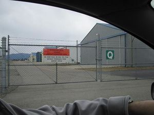
- Drive until you see the letter Q on a fence
- Turn left at the Q
- Turn right 25' later at a gravel driveway
- Turn right on Sikorsky
- Stop at gate #16
He said he would have to let us through the gate, then we should continue by taking the right fork in the gravel around the building, and park between the gravel driveway and the building. Surprisingly, the directions contained no reference to old oak trees and no distances given in paces. It looked like getting to the hangar could prove more challenging than reaching the geohash itself.
We followed the directions, which could pretty much be reduced to "Go to the airport and then drive around the left side of the fence until you reach gate #16" but upon reaching gate #16 we met an impasse. That being Gate #16. It was not equipped with an intercom, just a numeric keypad and a notice that the gate code was the airport VOR frequency. Robyn hadn't thought to bring her aviation charts when someone else was flying an aircraft with which she was unfamiliar, so after waiting a bit and honking the horn once, we resorted to knowledge and subterfuge. We checked for wireless -- none-- and Robyn did not have an iPod app that contained lists of foreign VOR frequencies. We knew that VORs use a frequency range between 108.00 and 117.95 MHz, in 50 kHz steps. Wade scrutinized the keypad and noted that the 1 key was cleanest, followed by the 6, 4 and 9 keys. The 5 and 0 definitely displayed an undisturbed layer of dirt and dust. That meant a four digit code, as any five digit frequency would have to end in 0 or 5. We'd tried 116.4, 114.6 and 116.9 when a guy pulled up beside us on a motorcycle. He turned out to be Jim and he gave us the correct code, which Wade entered and we all went in and parked beside the hangar.
Helicopter Ride
Preflight
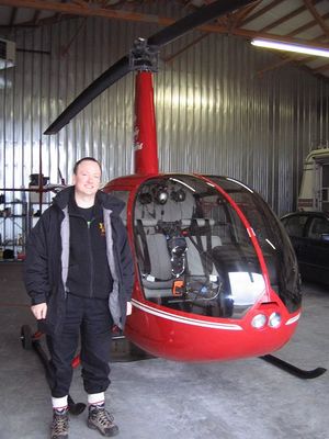
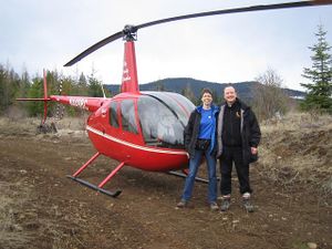
The helicopter was bright red, spotlessly clean, and only bigger than Robyn's car because it had a rotor on top and a tailboom at the back. Pilot Jim attached little dolly wheels to the skids and towed it out of the hangar up an incline using the assistance of a small electric towbar. He left it there and went to get his truck.
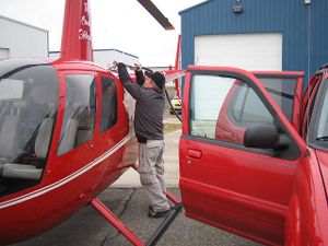
We knew perfectly well in advance that we were going in a small helicopter, and, being a pilot who used to give tours in the equivalent four-seater piston airplane, Robyn has much experience mocking passengers who look at the aircraft an gasp "It's so small!" For this reason when the pilot returned Robyn was biting her tongue and giggling instead of saying, "It's so small!" but of course he could tell what we were thinking anyway. He gave us safety briefing cards and explained the operation of the doors and seatbelts, the location of the teeny tiny fire extinguisher, and what not to step on. While we were learning this important information a squall swept in, buffeting us with wind and rain, so we finished the briefing inside the hangar, learning how not to get ourselves chopped up by the rotors. The weather calmed again within a minute. He fueled the helicopter from a tank on his truck and then we boarded according to his directions and did up our seatbelts.
Startup & Deparature
Jim warned us that the helicopter wouldn't start on the first or second try, but that that was perfectly normal. It started on the third, and he let it run very quietly while we put on our headsets and he tested the various systems and made a telephone call. He was calling a weather specialist, who gave him what must be the most thorough briefing ever for a 50 km flight, but when he was done Jim told us that it was currently raining at the globalhash, but that the rain would stop by the time we got there. (Of course he didn't say "globalhash," but that's what it was. OMG! Globalhash! And at this point we're either going to get to the globalhash, or we're going to get a custom ribbon for crashing a helicopter en route to one. Either would be epic.)
Robyn offered to enter the globalhash coordinates in Jim's GPS, which was a Garman 496, a model with which Robyn is familiar, but he declined, using the map pointer to fly direct an approximate location, saying we could use our GPS to pinpoint the location later.
Everything ready, Jim checked the wind one more time and then we floated off the ground. It's not dramatic like an airplane takeoff. You're just on the ground, and then you aren't.
Enroute
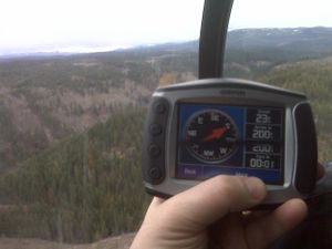
We climbed to about 500' above the ground and then flew out over the suburbs of Coeur d'Alene, they looked like Fort Saskatchewan, with all new driveways and homes under construction. There's a lake at the edge of town, and a river flowing out, and more rivers flowing in the other end. Jim told us all their names and pointed out things like the "cabin" of the guy who owns half the town, and his son's equally palatial vacation home a little ways up the hill. There was even a giant conifer with a star on top: I guess they didn't want to climb it every year to decorate for Christmas. As we approached the geohash the terrain rose, as we of course knew it did from the terrain view in Google maps, and the hillsides were mostly regrowth after selective cutting, with some mature trees, some regrowth and clearings. We suspected that we might not be able to land at the actual site of the geohash, but a helicopter airhash globalhash is "enough," don't you think?
Approaching the Globalhash
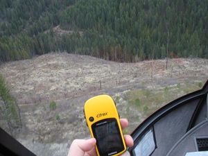
After we passed St Maries, Jim was navigating by my directions, which were based on a Garmin eTrex. That's not exactly the apex of navigational instruments, and nowhere near as good as the G496 that was right in front of him but which he wouldn't let me program. I let passengers program the G496 on my plane, but I suppose it isn't mine mine the way this pristine helicopter was his. I directed left and right but the display on the eTrex is slow to update and doesn't pivot as fast as a helicopter. We got within 42 m of the spot, then overshot. "Can you go backwards?" I asked. He could, and it was very cool. I mean wow, was it cool. Perhaps I was not concentrating quite as hard on the eTrex as I should have been, seeing as we were suspended in midair above the globalhash. The eTrex got confused by going backwards, or its display confused me, so while I was trying to figure out how to recover and direct Jim for another pass, he said, "I'm going to land down there."
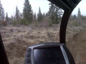
He checked out the spot, then gradually brought the helicopter down and set it on a narrow one-lane road, I'd call it a a generous ATV trail, with small trees all around. The touchdown was about the same impact as a walking footfall. He let the engine run at low power for a few minutes to cool down, then shut it off and we waited for the rotors to stop spinning before following his directions for getting out of the helicopter. The Garmin read 402 m from the globalhash. Globalhash!
The Last 402 Metres
Jim said, "It doesn't look like there's anyone else here," which was hilarious, seeing as we hadn't explained geohashing as a sport where you happen to meet people at the chosen location. It hadn't seemed relevant on this occasion. In retrospect Jim was probably considering the possibility of another vehicle being on the road, or hikers molesting his helicopter, but it would have been great had someone used a more normal geohashing technique for the approach.
Robyn yelled "Geohash!" and was off running down the track in the direction of the GPS arrow. Someone should put a leash on Robyn when they bring her to geohashes, or at least train her to heel. Wade and Jim followed at a more sedate pace. When the trail started to diverge from the geohash, Robyn continued along it for a while, picking up a few more metres on the destination before turning up the lightly wooded hill. The stupidity distance was approximately 145 metres. The terrain was pretty open, not too steep, brown grassland not recovered from the snow, in many places torn up, presumably by animals. There were a lot of animal droppings, some small deer-sized ones and some larger ones, bear-sized, but too even a consistency for bear, with no berries, fur or bones in them. Robyn guessed moose. Inside a hundred metres the familiar and addictive, "I'm going to reach the geohash" feeling cut in, but at 37 metres something large became audible crashing around in the bushes in the direction of the geohash.
All of a sudden Robyn's dropping identification certainty dropped a few notches. "Wade?" Wade answered, but not from the direction of the crashing. Robyn backtracked a bit, safety in numbers. Perhaps that will teach her to heel. Together Robyn and Wade circumnavigated a thick copse between Wade's slightly different route and the geohash and discovered the coordinates lay on the edge of a little clearing that, to our untrained eyes, looked big enough to land a helicopter in after all.
At the Globalhash
Besides being a globalhash, it wasn't that different from dozens of other locations randomly chosen by the Internet and visited by Robyn and/or Wade since the announcement of The Algorithm. The location the eTrex determined to be the spot was already marked by a pile of droppings, not only fragrant but still warm, suggesting that despite our technological ways, a moose or elk had reached the globalhash before us, and showed us exactly what it thought of our feeble efforts. The preexisting marker removed any desire to lie down and wallow in the success of the expedition.
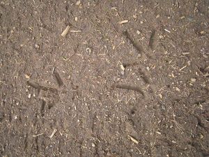
There's a certain pressure that having a helicopter waiting for you puts on the geohashing spirit. The hasty nature of the departure from home, and the ridiculousness of the mission had prevented us from bringing any epic marker, and we didn't want to litter. Robyn actually brought a geohashing flag, but forgot to move it to the correct jacket pocket when selecting helicoptering garb, so the site is marked only with twigs. On the way back to the helicopter we found much more poop, and these huge bird tracks. The bird's foot is the size of my palm, and it walked for at least 20 m up the dirt road.
After returning to the helicopter and lifting off, we realized that we should have scuffed a big marking so that photographs would show us over the clearing on our subsequent flyover for airhash proof, but we didn't.
Helicoptering Home
We circled the area and then flew straight back to the airport. We followed a slightly different route, over a luxury golf course community, with each spacious lot worth ... exactly as much as an ordinary one-house lot in East Vancouver. Jim pointed out various bodies of water by name, but we didn't remember them all.
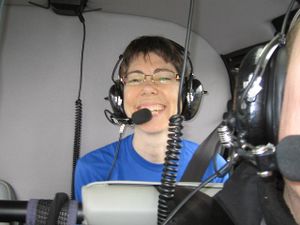
As we approached the airport Robyn remarked that it was a higher approach than she expected. That distance from the airport an airplane would be lower, because for best results airplanes don't go straight down, so you have to descend gradually on the way in. Jim agreed that it was a high approach, "Because I'm going to demonstrate an autorotation." He set the engine throttle to idle and we felt the helicopter drop at first, like the Grouse Mountain Skyride going over a tower --Vancouver area geohashers will recognize that, but for others: a mild roller coaster drop. Then the descent rate became constant at around 2000 feet per minute, maybe more, the vertical speed indicator looked pegged, but Jim still had steering control of the helicopter and swung around targeting a point he had announced before. Close to the ground and almost at the point he moved a control and slowed the descent to almost nothing. We would at than point have thumped onto the ground, probably like jumping down the last couple of stairs of a staircase, but at the last moment he added power to make it a perfectly soft landing. He also demonstrated a few aspects of helicopter control, which I hope Wade will write up, because he was in the front seat for that part and could see what was going on.
After the flight we did a bit of "hangar flying" -- standing in the hangar and telling stories of flying adventures. Jim had once been flying with another pilot in really terrible weather, and they kept going over wires and getting into cloud, but there was a car on the highway with its 4-way flashers on, so it stood out and they could follow it. It went right along the road by the airport, so they landed and then someone called them and said there was a man there looking for the pilot of the helicopter who has just landed. Turns out that he had heard the helicopter low over the house, thought "wow, I wonder how they can see anything: maybe I'll help them out!" so he bundled his kids into the car and drove to the airport with his blinkers on. He wasn't even a pilot, just decided that might be a good idea. How cool is that?
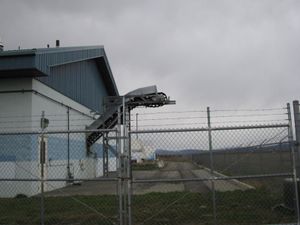
As we were leaving the airport we saw this odd conveyor belt leading out of a building at the airport. What would they be loading into trucks from that building? Potatoes?
Driving West & North
Wade wanted to have Idaho potatoes before we left the state, but Jim said all of the potatoes in Couer d'Alene came from Washington, so we just piled into the car and started driving west. I'll just show you the scenery and describe the trip that way.
We met up with some friends in a suburb of Seattle and they showed us their renovations in progress. They have black belts in karate and needed to remove some drywall, and surely you can see the obvious connection. They let me try. Let me tell you, it is almost as fun to make bare foot-shaped holes in someone's living room wall as it is to helicopter to a globalhash. They took us out for dinner and then we drove back up I-5 to the border.
Another Border Crossing
Seeing as we had been out of the country for over twenty-four hours, we decided to take advantage of duty-free liquor savings and buy a bottle to take home. We were en route to the Peace Arch crossing, but Wade said there wasn't a duty free shop there, or at least he had never been able to actually find one there before being forced to cross the border, so we would take the truck crossing, which is right beside the Peace Arch, and which allows cars to cross. Robyn found a duty free shop listed in the GPS database, so set us to navigate to there. It asked us to take exit 275, the exit after the truck crossing exit, but we decided to trust it. It did find us a duty free shop, the one Wade had never managed to find, kind of around behind the entrance to the Canadian border. They moved the border access at some point so it is no longer obvious. And it was closed for the night.
So we decided to go to the truck crossing, and again tried the GPS, the two next nearest duty free shops in the database had Canadian addresses, so that wouldn't work. We plugged in the nearest American one and the GPS directed us back south on I-5 to exit 270. We hypothesized that exit 274, for the truck crossing, was only available to northbound traffic, so this was the nearest thing. The directions weren't exactly what we were expecting, but we figured we'd give it a try. We crossed Badger Road, and sang one chorus of the Badger Mushroom Snake song. "Hey," said Robyn, "This is the border crossing where they are always mean to us when we cross by bike."
There was a duty free shop there, but it closed three minutes before we got there. (Yes, we are aware of the irony of people who have just taken a helicopter to a geohash driving around all night to try and get a half-price bottle of Baileys). The border still seemed to be open, but there didn't look to be anyone at the booth. We stopped at the stop sign and discussed strategy for a bit, then pulled forward to the booth. It turned out that it was occupied, by a woman with Sarah Palin glasses and hairstyle, who taunted us sarcastically for waiting at a stop/arrêt sign as if it were going to change, and for not being able to find a duty-free shop that was open. So the good news is that the Sumas Canadian border crossing is not prejudiced against cyclists: they're mean to everyone.
We finally got home just before 11:30, too late to see Rhonda, let alone take her up on her offer:
- I have leg of lamb in the slow cooker. If you're back in Vancouver about 8PM you're welcome to join us. -- Rhonda 17:29, 28 March 2010 (UTC)
Also, it should be mentioned that this is not the first geohashing expedition known to have involved a helicopter, but it is the first that was planned that way.
Robyn, Wade earned the Globalhash achievement
|
