Difference between revisions of "2009-06-14 49 -122"
(→Planning: added plypkie) |
m (More specific location) |
||
| (73 intermediate revisions by 12 users not shown) | |||
| Line 11: | Line 11: | ||
==Participants== | ==Participants== | ||
* [[User:Elbie|Elbie]] | * [[User:Elbie|Elbie]] | ||
| + | * [[User:plypkie|plypkie]] | ||
* [[User:Rhonda|Rhonda]] | * [[User:Rhonda|Rhonda]] | ||
* [[User:Xore|Xore]] | * [[User:Xore|Xore]] | ||
* [[User:yangman|yangman]] | * [[User:yangman|yangman]] | ||
| − | * [[User:SueB|SueB]] | + | * [[User:SueB|SueB]] |
| + | * [[User:Fbfree|Fbfree]] | ||
==Planning== | ==Planning== | ||
| + | |||
Getting there by bus: | Getting there by bus: | ||
* nearest bus stop: the 351 stops on King George and 32 Ave | * nearest bus stop: the 351 stops on King George and 32 Ave | ||
| Line 23: | Line 26: | ||
For those taking the bus, you can join us at these meetpoints: | For those taking the bus, you can join us at these meetpoints: | ||
| − | |||
* '''8:50 at Burrard Station''' | * '''8:50 at Burrard Station''' | ||
* '''9:00 at Broadway and Granville''' | * '''9:00 at Broadway and Granville''' | ||
| − | + | Bicyclists: caution, there are '''only 2 bike rack spots''' on each 351 bus, and the buses are half an hour apart on sunday. | |
| − | |||
| − | + | ''Detailed planning and schedules moved to [[Talk:2009-06-14_49_-122|talk page]]'' | |
| − | == | + | ==Expeditions== |
| − | + | To summarize, success. The two groups managed to converge on the hash point at almost exactly the same time, and we were given permission to enter the property. Ambassador achievement for all, cycling achievement for some, and yangman got lost, again. Then we had a picnic about a block away. | |
| − | |||
| − | |||
| − | |||
===Rhonda=== | ===Rhonda=== | ||
| − | + | ||
| − | + | I made it down to the 8:30 AM seabus just in time to catch it, but with not enough time to buy additional tickets for the trip back. Oh well, I have change. I won't be stranded. | |
| − | + | ||
| − | + | Despite being reasonably certain that I could walk fast enough from the seabus terminal to Burrard station where I was catching the 351, I opted to take the skytrain for one station, to make sure I wasn't late. The train was even in the station with its doors open when I arrived on the platform, so I hurried inside. | |
| + | |||
| + | And waited. A few more people came down the stairs, spotted the train with its doors open, and ran to get inside. | ||
| + | |||
| + | Really it was only a couple of minutes before it started its route, but it feels longer when you've run to catch it and the doors don't close right behind you. It zoomed along the underground skytrain track and I got off at the very next station, and climbed the stairs out into the sunlight. After a pause to re-orient myself, I decided that the 351 stop was probably to my left, and headed that way to look for it. | ||
| + | |||
| + | When I reached the corner and looked at the row of bus stop signs halfway down the block, I saw Xore juggling at one of them and knew I was in the right place. | ||
===Xore=== | ===Xore=== | ||
| − | + | ||
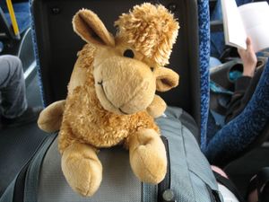
| − | + | [[Image:2009-06-14 49 -122 Wump1.jpg|thumb|right|Wump, my hashscot]] | |
| − | + | After a casual morning stroll through downtown with Wump, I arrived at burrard station and the 351 stop. Seeing nobody around and having approximately 15 minutes to wait before the bus left, I took out my juggling sacks and set to. Shortly thereafter Rhonda showed up, introductions with Wump were made, and finally the bus showed up. We got on the bus, heading south to pick up Elbie. | |
| + | |||
| + | ===Elbie=== | ||
| + | I left UBC on bike, and discovered that it was a lot cooler and windier outside than in my east-facing apartment. I arrived at Broadway and Granville around 8:50. Soon after, Xore phoned to warn me that one cyclist had gotten on the bus. I then set myself up for waiting at the bus stop such that I could run and lock up my bike as quickly as possible, should the 351's racks be taken. | ||
| + | |||
| + | I spent the next ten or so minutes standing in suspense, watching for that yellow bus to cross the bridge. When it did, and when it left the cloverleaf stop -- I continued waiting anxiously until I could see the bike rack -- only half full! I quickly nabbed that last bike rack as soon as the bus came to a halt, and came aboard to sit near Rhonda and Xore. | ||
| + | |||
| + | ===Elbie, Rhonda, Xore=== | ||
| + | |||
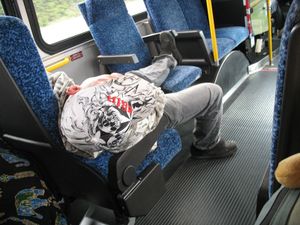
| + | [[Image:2009-06-14_49_-122_hangover.jpg|thumb|right|Hung-over guy, taking a nap]] | ||
| + | The three of us settled in to the comfy seats on the express long-route bus and chatted as we roared down Granville, making express-bus spaced stops to pick up the occasional passenger. | ||
| + | |||
| + | The obviously hung-over and tired passenger draped over three seats in the wheelchair section directly in front of us didn't seem too impressed by the fact that we were talking, but still managed to doze intermittently in a position that looked somewhere between uncomfortable and painful. Once he roused himself to ask if we were talking about Dungeons and Dragons, which we were. It looked like he was trying to join the conversation, but was unable to maintain focus much longer than the one question; his eyes glazed over and he slumped into his half asleep position again. We laughed a bit when he almost missed his stop but woke up while the bus was still in the bus loop and convinced the driver to let him off. | ||
| + | |||
| + | We discussed our route and where we would be meeting SueB, who was on a different bus that would drop her off at a different point on 32nd. | ||
| + | |||
| + | At our stop, while Elbie was getting her bike off the front of the bus, Rhonda noticed that there was a cell phone and jacket on the seat and told the driver the hung over guy had left that behind when he got off. The driver collected them and tossed them in the corner of the dash to bring to the translink lost and found later. | ||
| + | |||
| + | Also, Sue was at our stop instead of half a kilometre away, to general surprise. | ||
| + | |||
| + | ===SueB=== | ||
| + | |||
| + | I was awake before my alarm clock - a nasty habit I seem to be developing lately. My bus was a few minutes early and the skytrain was just pulling in when I walked up the stairs to the platform. Same thing happened when I switched trains at Columbia which trust me is virtually unheard of. All this slickness let me catch the 9:12am bus instead of the 9:30am one as planned. Contrary to what I thought, the bus travelled along King George instead of further east on 152nd. I arrived at the bus stop 5 minutes before the others. | ||
| + | |||
| + | The sun wasn't out as the weatherman promised, but being a red-head with fair skin, this boded well for me. My sun-block stood up to the test and I stayed un-red for the entire day. Seven kilometres, a successful geohash and some slightly confused homeowners later, we reached the bus stop as our bus pulled up. Elbie, Yang and I hopped on and started our journey back to the city. We parted ways at Broadway, all of us ready for a nap but with too much still to do, in our respective schedules - naps would have to wait. | ||
| + | |||
| + | Geo-hashing done, it was time to play tag in the park with Xore and Rhonda and 19 other fun-loving adults then off to meet another friend for a sunset walk to the end of Buntzen Lake and back. | ||
| + | |||
| + | ===Four walkers=== | ||
| + | |||
| + | [[Image:2009-06-14 49 -122 Three Musketeers1.jpg|thumb|right|Elbie, SueB, and Rhonda]] | ||
| + | Elbie, Rhonda, SueB and Xore departed the 351/321 stop after getting our bearings, and after a detour to what was estimated as the last public washroom opportunity, set off on the 32 Ave Diversion. The four had a leisurely 3.5km stroll down the sidewalk of 32 Ave, enjoying the fenced off portion of the area, and remarking how much more developed the area was than it looked like on Google Maps. | ||
| + | |||
| + | Eventually we wound up at the end of the suburbs, as did the sidewalk. We switched to the shoulder of the highway, walking single-file, as Elbie kept an eye on her GPS for the distance remaining. About 100 metres away from the hashpoint, a familiar-looking cyclist was spotted, along with one more. | ||
| + | |||
| + | ===yangman=== | ||
| + | For this expedition, I had planned my routes such that—depending on how the group ultimately decide to return to the core of Vancouver—the [[Tron achievement]] could be obtained. This was not my first time [[2009-06-09 49 -123|cycling to Surrey]], but it was my first time taking the [http://www.translink.ca/en/Cycling/Central-Valley-Greenway.aspx Central Valley Greenway] to get myself from Burnaby to New Westminster. I have never taken this route before because the northern-entrance to the trail is marked by mere three tiny little dots on the Burnaby cycling map, which I finally noticed the day previous; I had been looking for this entrance for weeks. | ||
| + | |||
| + | Naturally, I got lost. | ||
| + | |||
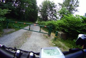
| + | [[Image:2009-06-14 49 -122_wrong_gate.jpg|thumb|right|Hey look, an unmarked gate with a trail]] | ||
| + | As the trail makes its transition from Burnaby to New Westminster, it zig-zags along the road that coincides with the city border, leaving a gap of more than 50 meters between the trail heads in each respective city. This, of course, is not evident from the 2 separate cycling maps I were working off of. To make matters worse, across the street from the Burnaby side of the trail is a unmarked gate, with a trail of its own leading off into the distance. | ||
| + | |||
| + | You can guess what happens next. | ||
| + | |||
| + | By the time I came to the realization that this path was definitely ''not'' a well-maintained multi-use trail, I was already so far along it that there was nothing to do but to see it to its end. Adventure! Ultimately, I was lead to rail tracks, and was forced to turn around, not because I didn't dare to cross the tracks when I clearly shouldn't have been there in the first place, but because I also realized that I must cross a creek to get to where I wanted to go. At this point, a seasoned Tron player would have made a skillful 180 degree turn, avoiding a collision with his own wall, and lived to race another day. Unfortunately, I am not very good at Tron. Also, the above mentioned gate only had a single opening big enough to squeeze a bike with panniers through, which left me no choice but to forfeit my achievement attempt. | ||
| + | <gallery> | ||
| + | Image:2009-06-14_49_-122_wrong_path.jpg|Something's not right here... | ||
| + | Image:2009-06-14_49_-122_wrong_way.jpeg|This is definitely ''not'' where I wanted to go | ||
| + | </gallery> | ||
| + | |||
| + | After some back tracking, I locate the proper entrance to the New Westminster portion of the Central Valley Greenway, which turned into several kilometers of gravel riding. This was quite unpleasant on a narrow-tire bicycle loaded with several kilos of gear and food. The gravel is eventually replaced by asphalt, and after making a few steep but short climbs, I was forced to detour several blocks due to construction, and was directed up a fairly substantial hill. This was very disappointing as a major reason for attempting this new route was to find a way around the hilly portions of New Westminster instead of having to go over it every single time. | ||
| + | |||
| + | Making a mental note to avoid this portion of the Greenway for future trips, I quickly made my way to and over the Patello Bridge, then waited for plypkie's arrival. | ||
===plypkie=== | ===plypkie=== | ||
| − | |||
| − | |||
| − | |||
| − | |||
| − | ===yangman=== | + | I was on irc until late the previous night, but i managed to get 7hrs of sleep and wake up at 7:30am. I planned to leave on my bike at 8am, but was about 10 minutes late. Traveling southeast under the skytrain tracks, i soon decided that it was 8am on a sunday and there'd probably be no traffic around, so i took a slight detour to get onto Kingsway. Once on Kingsway i took an entire lane for myself, leaving the other two southeast lanes for the meager car traffic. Cutting diagonally across town, with a slight downhill slant, and an entire lane for myself....it was truly the Way of Kings. |
| − | + | ||
| + | About 15km later, i arrived at the end of Kingsway in New Westminster (known for its hills). i took a rather suboptimal route through there, but managed to not climb too many hills. I made a wrong turn looking for the easy bridge access route, and ended up having to cut through an area overgrown with weeds while winding along a tiny single-track dirt trail. luckily the weeds were not thorny. I crossed the Pattullo Bridge and found [[User:Yangman|yangman]] waiting patiently on the other side. by my watch it was 9:09, so it took me exactly an hour to get there. This was somewhat disappointing, as my previous best time to there was 45 minutes, and by a longer route too. clearly i need to get my fitness back up and plan the route better ;) | ||
| + | |||
| + | ===plypkie and yangman=== | ||
| + | |||
| + | After meeting yangman, plypkie decided that it was time for nourishing snacks. Lamenting the apparent lack of nutrimite-containing sports drink, bananas and granola bars were consumed instead, fueling up for the remainder of the ride to deepest Surrey. The first step was finding a way up the nearby ridge. Old Yale Road was selected, mostly because it was NOT 104th (known to have a crazy steep hill), but Old Yale turned out to have quite a hill too. At the top of said hill, Old Yale actually secretly splits off southeast, but our heroes bravely continued on 108th, in a direction away from our next intended checkpoint ("I don't think we were meant to be here, Mr. Frodo", or so plypkie was rumoured to have said). Instead of meeting up with Fraser Highway, which heads south-east towards the hash point, they ended up going several kilometers straight east, and then had to correct course several kilometers straight south in order to find the highway. | ||
| + | |||
| + | Once our cyclists finally make the turn on to Fraser Highway, things went swimmingly; dedicated bike route, slightly downhill...the duo flew until they reached 168th st, which was their designated route the rest of the way south. From here on, it was farmland. Apart from one insane downhill portion (causing plypkie to pedal madly on his fixed-gear bike), it was entirely flat and quite scenic. Out of the south, however, loomed a massive dark forboding hill. Since the two of them were on a quest, and were split up from the rest of their group (numbering only 6 total, but perhaps they had lost a Baromir and two others along the way), plypkie named this hill the Gates of Mordor. At the time, it appeared that they may have to conqure this beast of a hill and pass through the Gates in order to complete their quest. | ||
| + | |||
| + | [[Image:2009-06-14_49_-122_gates_of_mordor.jpeg|thumb|left|The Gates of Mordor loom menacingly in the distance...]] | ||
| + | Kilometer after kilometer ticked by, and every moment the Gates grew larger in the distance. Truly it was a fearsome hill, rising like a wide earthen tsunami out of the flat plain. As they neared it, yangman declared that their next turn may be right at the base of the hill. This was discovered to be true mere minutes later, much to the relief of our weary riders. Turning right onto 32nd Ave., the two cyclists rode only a few blocks before sighting the other members of their party, some with shoes, some bearing their feet, and all walking on the gravelly shoulder of the road about 100ft away from the driveway of our eventual destination. Greetings were exchanged, some introductions made, and soon the full party made the final push towards the hash point. | ||
| + | |||
| + | ===At the hash point=== | ||
| + | |||
| + | With Elbie in the lead with her GPS and Xore right behind with his google maps printout, we identified the correct driveway and walked up to the gate across it. It was a big gate, and it was locked, and it had "beware of dog" and "guard dog on duty" signs, but no "keep out" signs, so we figured the owners might be friendly enough to talk to. We didn't see the dog, but that doesn't always mean anything... | ||
| + | |||
| + | Elbie started ringing her bike bell, and a few shouts of "hellooooooo!" caused two people to leave the house and come down to the gate to see what the commotion was all about. | ||
| + | |||
| + | Since Elbie had just given a talk explaining geohashing, she was nominated to explain why we were here, and Xore offered his google maps page as backup evidence. The owners looked very confused, but were also friendly and unlocked the gate for us. Elbie took the lead again, and all of us including the confused but curious owners, followed her around to the back of the house. | ||
| + | |||
| + | |||
| + | [[Image:2009-06-14 49 -122 group.jpg|thumb|right|Most comfortable hash point ev4r]]The square patch, which we had worried was a garden plot and which contained the hash point, turned out to be a concrete patio. We followed Elbie across the patio, directly toward a porch swing underneath a freestanding awning. After checking around it, we determined that the porch swing was directly on the hash point! | ||
| + | |||
| + | The owner declined to have her photo taken with us, but offered to take a group photo of us on her porch swing. All six geohashers, plus Wump the camel and Octavius the sextopus posed for the photo. | ||
| + | |||
| + | Success! | ||
| + | |||
| + | ===Fbfree=== | ||
| + | |||
| + | My second attempt at geohashing was foiled by an RCMP officer. As the hash coincided with the pedestrian only opening of the Golden Ears Bridge[http://www.vancouversun.com/travel/Pedestrian+traffic+rams+Golden+Ears+Bridge+opening+celebration/1695318/story.html] I decided to travel across it to the hash. I had e-mailed [[User:Thepiguy|Thepiguy]] to inquire about a meetup and was directed to this page at 9am on the morning of the hash :( | ||
| + | |||
| + | I departed Mission at 11am and arrived at the bridge near 12:30pm. I planned to walk my bike across the bridge, partake in the ceremony, then continue to the hashpoint. Regrettably, officers stationed at the bridge ramps did not allow any bikes to pass. There was a 5 minute wait at the bicycle valet before walking ahead. I soon understood why unmounted bicycles were prohibited; there was insufficient room for pedestrian traffic. Congestion arrived the moment the day the bridge opened! As the hash point was too far to reach without a means of transportation, I returned to the north end of the bridge after the ribbon cutting. Although, I could have traveled to one of the neighbouring crossings, the distance traveled would have been excessive. I traveled through Pitt Meadows then returned home. | ||
| + | |||
| + | ===After=== | ||
| + | [[Image:2009-06-14_49_-122_picnic02.jpeg|thumb|left|A fine spot for a picnic]] | ||
| + | We decided to spare the confused property owner further celebrations, and thanked her and left the property, heading west for a Surrey block, before finding a grassy shoulder suitable for a picnic. | ||
| + | |||
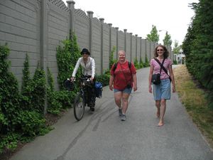
| + | [[Image:2009-06-14 49 -122 Path1.jpg|thumb|right|Parts of the route were rather pretty]] | ||
| + | While we relaxed and ate and juggled and chatted, several residents driving by gave us startled stares, several spiders came to see what we were eating, and Xore heard some raptors growling from the other side of the brush behind us. No raptors actually attacked; perhaps they were busy with some other adventurers. | ||
| + | |||
| + | After the picnic, we all walked along the shoulder of the road until a sidewalk appeared, then navigated the sidewalk (which occasionally ended and reappeared on the opposite side of the road) back to the bus stop. | ||
| + | |||
| + | One bus pulled up to the lights just as we started to cross, and we hurried to the bus stop so that half the group could catch it (the 321); the other half of the group waited a few minutes more for the 351 to appear. | ||
| + | |||
| + | Elbie and yangman went on to the [http://www.carfreevancouver.org/ car-free Vancouver] celebrations, plypkie went to jericho beach for sailing lessons (in hopes of a future water geohash), while Rhonda, Xore, and SueB went on to play [http://www.meetup.com/play-tag/ tag] with some other random internet people. | ||
| + | |||
| + | ==Photos== | ||
| + | <gallery> | ||
| + | Image:2009-06-14_49_-122_Tunnel2.jpg|Entering the Massey Tunnel | ||
| + | Image:2009-06-14_49_-122_Tunnel3.jpg|Exiting the Massey Tunnel | ||
| + | Image:2009-06-14_49_-122_Boats1.jpg|What the Massey Tunnel goes underneath | ||
| + | Image:2009-06-14 49 -122 Wump1.jpg|Wump | ||
| + | Image:2009-06-14_49_-122_hangover.jpg|Hung over guy having an uncomfortable nap on the bus | ||
| + | Image:2009-06-14_49_-122_retrohash1.jpg|Passing by my first ever geohash on the side of the highway | ||
| + | Image:2009-06-14_49_-122_Three_Musketeers1.jpg|Elbie, SueB, and Rhonda, the three musketeers? | ||
| + | Image:2009-06-14_49_-122_pete.jpeg|plypkie riding southbound on 168th Street | ||
| + | Image:2009-06-14_49_-122_gates_of_mordor.jpeg|The Gates of Mordor looms menacingly in the distance. Our lucky heroes narrowly avoid doom as the they make a right turn at its foot | ||
| + | Image:2009-06-14_49_-122_meeting1.jpeg|Is that yangman up ahead? I do believe it is! | ||
| + | Image:2009-06-14_49_-122_meeting.jpeg|The expedition parties unite | ||
| + | Image:2009-06-14_49_-122_gate.jpeg|"Uh... Some backup here, guys?" | ||
| + | Image:2009-06-14_49_-122_swing.jpeg|The hashers ready themselves for the group photos, with our gracious host just off the frame to the left; they declined to be included in our photos | ||
| + | Image:2009-06-14 49 -122 group.jpg | Group shot at the hashpoint | ||
| + | Image:2009-06-14_49_-122_hashers.jpeg|And another | ||
| + | Image:2009-06-14_49_-122_chalking.jpeg|Our host agreed to let us leave chalk markings behind the swing | ||
| + | Image:2009-06-14_49_-122_marking_the_point.jpeg|Yay! | ||
| + | Image:2009-06-14_49_-122_chalk1.jpg|Yangman and Elbie posing with the chalk markings | ||
| + | Image:2009-06-14_49_-122_picnic01.jpeg|This spot should do... | ||
| + | Image:2009-06-14 49 -122 yangcam1.jpg|Yangman and his awesome bike cam | ||
| + | Image:2009-06-14_49_-122_picnic02.jpeg|Street side picnic | ||
| + | Image:2009-06-14_49_-122_picnicing1.jpg|Another shot of the picnic | ||
| + | Image:2009-06-14_49_-122_petes_kitchen.jpeg|plypkie reaches into this bag of holding and pulls out a +1 Kit of Sandwich Making | ||
| + | Image:2009-06-14_49_-122_juggling.jpeg|Xore makes the unwise decision to juggle with his back to the dense foliage, exposing himself to potential raptor attacks | ||
| + | Image:2009-06-14_49_-122_hashcots.jpeg|Octavius gets a camelback-ride from Wump | ||
| + | Image:2009-06-14_49_-122_hashscots.jpg|Another shot of Octavius and Wump | ||
| + | Image:2009-06-14_49_-122_walking.jpeg|Our heroes making their way to transit after the picnic | ||
| + | Image:2009-06-14_49_-122_Path1.jpg|The scenic route | ||
| + | Image:2009-06-14_49_-122_Bus1.jpg|Elbie, yangman, and SueB caught the bus right in front of us | ||
| + | Image:Golden_Ears_Pic.jpg|Fbfree among the throng at the Golden Ears Bridge ribbon cutting ceremony. | ||
| + | </gallery> | ||
| + | |||
| + | ==Achievements== | ||
| + | {{Ambassador geohash | ||
| + | | latitude = 49 | ||
| + | | longitude = -122 | ||
| + | | date = 2009-06-14 | ||
| + | | granter = the property owners | ||
| + | | name = We all | ||
| + | | image = | ||
| + | }} | ||
| + | {{Bicycle geohash | ||
| + | |||
| + | | latitude = 49 | ||
| + | | longitude = -122 | ||
| + | | date = 2009-06-14 | ||
| + | | name = [[User:Plypkie|plypkie]] and [[User:Yangman|yangman]] | ||
| + | | distance = 43km and 40km, respectively, | ||
| + | | image = | ||
| − | + | }} | |
| + | * Elbie met plypkie | ||
| + | * SueB met plypkie | ||
| − | |||
| − | |||
| − | |||
| − | |||
| − | |||
| − | |||
| − | [[Category: | + | [[Category:Expeditions]] |
| + | [[Category:Coordinates reached]] | ||
| + | [[Category:Elbie]] | ||
| + | {{location|CA|BC|MV}} | ||
Latest revision as of 23:02, 9 August 2020
| Sun 14 Jun 2009 in 49,-122: 49.0595272, -122.7652863 geohashing.info google osm bing/os kml crox |
Contents
Location
Back yard of a farm near South Surrey, on 32 Ave
Participants
Planning
Getting there by bus:
- nearest bus stop: the 351 stops on King George and 32 Ave
- the stop is about 3.4 km away from the hashpoint; quick bike ride, or longish walk
- 351 route map and time table
For those taking the bus, you can join us at these meetpoints:
- 8:50 at Burrard Station
- 9:00 at Broadway and Granville
Bicyclists: caution, there are only 2 bike rack spots on each 351 bus, and the buses are half an hour apart on sunday.
Detailed planning and schedules moved to talk page
Expeditions
To summarize, success. The two groups managed to converge on the hash point at almost exactly the same time, and we were given permission to enter the property. Ambassador achievement for all, cycling achievement for some, and yangman got lost, again. Then we had a picnic about a block away.
Rhonda
I made it down to the 8:30 AM seabus just in time to catch it, but with not enough time to buy additional tickets for the trip back. Oh well, I have change. I won't be stranded.
Despite being reasonably certain that I could walk fast enough from the seabus terminal to Burrard station where I was catching the 351, I opted to take the skytrain for one station, to make sure I wasn't late. The train was even in the station with its doors open when I arrived on the platform, so I hurried inside.
And waited. A few more people came down the stairs, spotted the train with its doors open, and ran to get inside.
Really it was only a couple of minutes before it started its route, but it feels longer when you've run to catch it and the doors don't close right behind you. It zoomed along the underground skytrain track and I got off at the very next station, and climbed the stairs out into the sunlight. After a pause to re-orient myself, I decided that the 351 stop was probably to my left, and headed that way to look for it.
When I reached the corner and looked at the row of bus stop signs halfway down the block, I saw Xore juggling at one of them and knew I was in the right place.
Xore
After a casual morning stroll through downtown with Wump, I arrived at burrard station and the 351 stop. Seeing nobody around and having approximately 15 minutes to wait before the bus left, I took out my juggling sacks and set to. Shortly thereafter Rhonda showed up, introductions with Wump were made, and finally the bus showed up. We got on the bus, heading south to pick up Elbie.
Elbie
I left UBC on bike, and discovered that it was a lot cooler and windier outside than in my east-facing apartment. I arrived at Broadway and Granville around 8:50. Soon after, Xore phoned to warn me that one cyclist had gotten on the bus. I then set myself up for waiting at the bus stop such that I could run and lock up my bike as quickly as possible, should the 351's racks be taken.
I spent the next ten or so minutes standing in suspense, watching for that yellow bus to cross the bridge. When it did, and when it left the cloverleaf stop -- I continued waiting anxiously until I could see the bike rack -- only half full! I quickly nabbed that last bike rack as soon as the bus came to a halt, and came aboard to sit near Rhonda and Xore.
Elbie, Rhonda, Xore
The three of us settled in to the comfy seats on the express long-route bus and chatted as we roared down Granville, making express-bus spaced stops to pick up the occasional passenger.
The obviously hung-over and tired passenger draped over three seats in the wheelchair section directly in front of us didn't seem too impressed by the fact that we were talking, but still managed to doze intermittently in a position that looked somewhere between uncomfortable and painful. Once he roused himself to ask if we were talking about Dungeons and Dragons, which we were. It looked like he was trying to join the conversation, but was unable to maintain focus much longer than the one question; his eyes glazed over and he slumped into his half asleep position again. We laughed a bit when he almost missed his stop but woke up while the bus was still in the bus loop and convinced the driver to let him off.
We discussed our route and where we would be meeting SueB, who was on a different bus that would drop her off at a different point on 32nd.
At our stop, while Elbie was getting her bike off the front of the bus, Rhonda noticed that there was a cell phone and jacket on the seat and told the driver the hung over guy had left that behind when he got off. The driver collected them and tossed them in the corner of the dash to bring to the translink lost and found later.
Also, Sue was at our stop instead of half a kilometre away, to general surprise.
SueB
I was awake before my alarm clock - a nasty habit I seem to be developing lately. My bus was a few minutes early and the skytrain was just pulling in when I walked up the stairs to the platform. Same thing happened when I switched trains at Columbia which trust me is virtually unheard of. All this slickness let me catch the 9:12am bus instead of the 9:30am one as planned. Contrary to what I thought, the bus travelled along King George instead of further east on 152nd. I arrived at the bus stop 5 minutes before the others.
The sun wasn't out as the weatherman promised, but being a red-head with fair skin, this boded well for me. My sun-block stood up to the test and I stayed un-red for the entire day. Seven kilometres, a successful geohash and some slightly confused homeowners later, we reached the bus stop as our bus pulled up. Elbie, Yang and I hopped on and started our journey back to the city. We parted ways at Broadway, all of us ready for a nap but with too much still to do, in our respective schedules - naps would have to wait.
Geo-hashing done, it was time to play tag in the park with Xore and Rhonda and 19 other fun-loving adults then off to meet another friend for a sunset walk to the end of Buntzen Lake and back.
Four walkers
Elbie, Rhonda, SueB and Xore departed the 351/321 stop after getting our bearings, and after a detour to what was estimated as the last public washroom opportunity, set off on the 32 Ave Diversion. The four had a leisurely 3.5km stroll down the sidewalk of 32 Ave, enjoying the fenced off portion of the area, and remarking how much more developed the area was than it looked like on Google Maps.
Eventually we wound up at the end of the suburbs, as did the sidewalk. We switched to the shoulder of the highway, walking single-file, as Elbie kept an eye on her GPS for the distance remaining. About 100 metres away from the hashpoint, a familiar-looking cyclist was spotted, along with one more.
yangman
For this expedition, I had planned my routes such that—depending on how the group ultimately decide to return to the core of Vancouver—the Tron achievement could be obtained. This was not my first time cycling to Surrey, but it was my first time taking the Central Valley Greenway to get myself from Burnaby to New Westminster. I have never taken this route before because the northern-entrance to the trail is marked by mere three tiny little dots on the Burnaby cycling map, which I finally noticed the day previous; I had been looking for this entrance for weeks.
Naturally, I got lost.
As the trail makes its transition from Burnaby to New Westminster, it zig-zags along the road that coincides with the city border, leaving a gap of more than 50 meters between the trail heads in each respective city. This, of course, is not evident from the 2 separate cycling maps I were working off of. To make matters worse, across the street from the Burnaby side of the trail is a unmarked gate, with a trail of its own leading off into the distance.
You can guess what happens next.
By the time I came to the realization that this path was definitely not a well-maintained multi-use trail, I was already so far along it that there was nothing to do but to see it to its end. Adventure! Ultimately, I was lead to rail tracks, and was forced to turn around, not because I didn't dare to cross the tracks when I clearly shouldn't have been there in the first place, but because I also realized that I must cross a creek to get to where I wanted to go. At this point, a seasoned Tron player would have made a skillful 180 degree turn, avoiding a collision with his own wall, and lived to race another day. Unfortunately, I am not very good at Tron. Also, the above mentioned gate only had a single opening big enough to squeeze a bike with panniers through, which left me no choice but to forfeit my achievement attempt.
After some back tracking, I locate the proper entrance to the New Westminster portion of the Central Valley Greenway, which turned into several kilometers of gravel riding. This was quite unpleasant on a narrow-tire bicycle loaded with several kilos of gear and food. The gravel is eventually replaced by asphalt, and after making a few steep but short climbs, I was forced to detour several blocks due to construction, and was directed up a fairly substantial hill. This was very disappointing as a major reason for attempting this new route was to find a way around the hilly portions of New Westminster instead of having to go over it every single time.
Making a mental note to avoid this portion of the Greenway for future trips, I quickly made my way to and over the Patello Bridge, then waited for plypkie's arrival.
plypkie
I was on irc until late the previous night, but i managed to get 7hrs of sleep and wake up at 7:30am. I planned to leave on my bike at 8am, but was about 10 minutes late. Traveling southeast under the skytrain tracks, i soon decided that it was 8am on a sunday and there'd probably be no traffic around, so i took a slight detour to get onto Kingsway. Once on Kingsway i took an entire lane for myself, leaving the other two southeast lanes for the meager car traffic. Cutting diagonally across town, with a slight downhill slant, and an entire lane for myself....it was truly the Way of Kings.
About 15km later, i arrived at the end of Kingsway in New Westminster (known for its hills). i took a rather suboptimal route through there, but managed to not climb too many hills. I made a wrong turn looking for the easy bridge access route, and ended up having to cut through an area overgrown with weeds while winding along a tiny single-track dirt trail. luckily the weeds were not thorny. I crossed the Pattullo Bridge and found yangman waiting patiently on the other side. by my watch it was 9:09, so it took me exactly an hour to get there. This was somewhat disappointing, as my previous best time to there was 45 minutes, and by a longer route too. clearly i need to get my fitness back up and plan the route better ;)
plypkie and yangman
After meeting yangman, plypkie decided that it was time for nourishing snacks. Lamenting the apparent lack of nutrimite-containing sports drink, bananas and granola bars were consumed instead, fueling up for the remainder of the ride to deepest Surrey. The first step was finding a way up the nearby ridge. Old Yale Road was selected, mostly because it was NOT 104th (known to have a crazy steep hill), but Old Yale turned out to have quite a hill too. At the top of said hill, Old Yale actually secretly splits off southeast, but our heroes bravely continued on 108th, in a direction away from our next intended checkpoint ("I don't think we were meant to be here, Mr. Frodo", or so plypkie was rumoured to have said). Instead of meeting up with Fraser Highway, which heads south-east towards the hash point, they ended up going several kilometers straight east, and then had to correct course several kilometers straight south in order to find the highway.
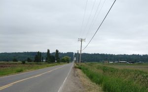
Once our cyclists finally make the turn on to Fraser Highway, things went swimmingly; dedicated bike route, slightly downhill...the duo flew until they reached 168th st, which was their designated route the rest of the way south. From here on, it was farmland. Apart from one insane downhill portion (causing plypkie to pedal madly on his fixed-gear bike), it was entirely flat and quite scenic. Out of the south, however, loomed a massive dark forboding hill. Since the two of them were on a quest, and were split up from the rest of their group (numbering only 6 total, but perhaps they had lost a Baromir and two others along the way), plypkie named this hill the Gates of Mordor. At the time, it appeared that they may have to conqure this beast of a hill and pass through the Gates in order to complete their quest.
Kilometer after kilometer ticked by, and every moment the Gates grew larger in the distance. Truly it was a fearsome hill, rising like a wide earthen tsunami out of the flat plain. As they neared it, yangman declared that their next turn may be right at the base of the hill. This was discovered to be true mere minutes later, much to the relief of our weary riders. Turning right onto 32nd Ave., the two cyclists rode only a few blocks before sighting the other members of their party, some with shoes, some bearing their feet, and all walking on the gravelly shoulder of the road about 100ft away from the driveway of our eventual destination. Greetings were exchanged, some introductions made, and soon the full party made the final push towards the hash point.
At the hash point
With Elbie in the lead with her GPS and Xore right behind with his google maps printout, we identified the correct driveway and walked up to the gate across it. It was a big gate, and it was locked, and it had "beware of dog" and "guard dog on duty" signs, but no "keep out" signs, so we figured the owners might be friendly enough to talk to. We didn't see the dog, but that doesn't always mean anything...
Elbie started ringing her bike bell, and a few shouts of "hellooooooo!" caused two people to leave the house and come down to the gate to see what the commotion was all about.
Since Elbie had just given a talk explaining geohashing, she was nominated to explain why we were here, and Xore offered his google maps page as backup evidence. The owners looked very confused, but were also friendly and unlocked the gate for us. Elbie took the lead again, and all of us including the confused but curious owners, followed her around to the back of the house.
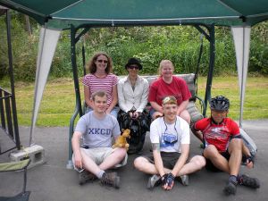
The square patch, which we had worried was a garden plot and which contained the hash point, turned out to be a concrete patio. We followed Elbie across the patio, directly toward a porch swing underneath a freestanding awning. After checking around it, we determined that the porch swing was directly on the hash point!
The owner declined to have her photo taken with us, but offered to take a group photo of us on her porch swing. All six geohashers, plus Wump the camel and Octavius the sextopus posed for the photo.
Success!
Fbfree
My second attempt at geohashing was foiled by an RCMP officer. As the hash coincided with the pedestrian only opening of the Golden Ears Bridge[1] I decided to travel across it to the hash. I had e-mailed Thepiguy to inquire about a meetup and was directed to this page at 9am on the morning of the hash :(
I departed Mission at 11am and arrived at the bridge near 12:30pm. I planned to walk my bike across the bridge, partake in the ceremony, then continue to the hashpoint. Regrettably, officers stationed at the bridge ramps did not allow any bikes to pass. There was a 5 minute wait at the bicycle valet before walking ahead. I soon understood why unmounted bicycles were prohibited; there was insufficient room for pedestrian traffic. Congestion arrived the moment the day the bridge opened! As the hash point was too far to reach without a means of transportation, I returned to the north end of the bridge after the ribbon cutting. Although, I could have traveled to one of the neighbouring crossings, the distance traveled would have been excessive. I traveled through Pitt Meadows then returned home.
After
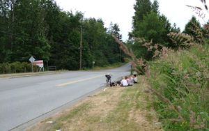
We decided to spare the confused property owner further celebrations, and thanked her and left the property, heading west for a Surrey block, before finding a grassy shoulder suitable for a picnic.
While we relaxed and ate and juggled and chatted, several residents driving by gave us startled stares, several spiders came to see what we were eating, and Xore heard some raptors growling from the other side of the brush behind us. No raptors actually attacked; perhaps they were busy with some other adventurers.
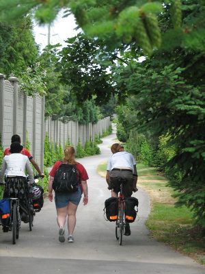
After the picnic, we all walked along the shoulder of the road until a sidewalk appeared, then navigated the sidewalk (which occasionally ended and reappeared on the opposite side of the road) back to the bus stop.
One bus pulled up to the lights just as we started to cross, and we hurried to the bus stop so that half the group could catch it (the 321); the other half of the group waited a few minutes more for the 351 to appear.
Elbie and yangman went on to the car-free Vancouver celebrations, plypkie went to jericho beach for sailing lessons (in hopes of a future water geohash), while Rhonda, Xore, and SueB went on to play tag with some other random internet people.
Photos
Achievements
We all earned the Ambassador achievement
|
plypkie and yangman earned the Bicycle geohash achievement
|
- Elbie met plypkie
- SueB met plypkie
