Difference between revisions of "2022-04-02 40 -4"
m (Location) |
|||
| Line 106: | Line 106: | ||
[[Category:Expeditions with photos]] | [[Category:Expeditions with photos]] | ||
[[Category:Coordinates reached]] | [[Category:Coordinates reached]] | ||
| + | {{location|ES|MD}} | ||
Revision as of 18:42, 5 April 2022
| Sat 2 Apr 2022 in 40,-4: 40.3347081, -4.3221671 geohashing.info google osm bing/os kml crox |
Location
At the end of a substantial hike near Pelayos de la Presa.
Participants
Plans
My last expedition had been three weeks ago. Since then, temperatures had been too low for the season and it had also been somewhat rainy most days, quite unusual for central Spain over such a long period. Now, that day, it was at least sunny, albeit the temperature not surpassing 9°C.
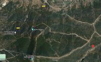
The geohash was relatively close, just a twenty minutes motorcycle ride, but then a relatively long walk. The plan was to park the Goldwing just above the yellow M-541 sign in the top center of the map and then make it along one of the possible paths to the geohash in the lower right (the mark is in fact a bit off, the geohash is more to the southeast, on the other side of the path; this seems to be a “feature” of the satellite view in the Maps). It looked like a hike of about 4 to 5 km, which should turn out to be a considerable underestimation.
Expedition
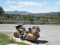
After a short ride along well known roads, I could indeed conveniently park the Goldwing at the planned place.
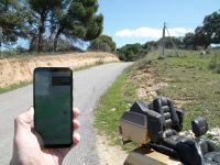
A path lead towards the geohash and the Droid indicated a distance of 2.7 km as the crow flies. That looked as expected. So I took my photo case, switched on the tracklog, and walked on.
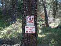
Along the way, there were many signs prohibiting to leave the path, but I had anyway planned to follow some paths for almost the whole walk.
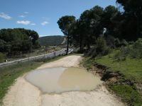
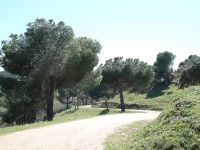
There were some traces of the recent rainy period.
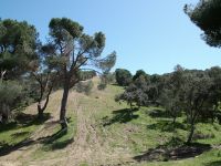
At some point the path got very wide and very steep. I would have taken that for a firebreak, but it was not completely free of trees. Climbing all the way up was anyway quite exhausting. The image shows the view from the summit looking back from where I came.
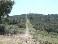
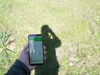
From there I could follow a trail in a swath under a power line. In the map above it is the quite straight line from North to South in the right half. Most of it was a little bit less steep than the presumed firebreak, but still there was substantial (mostly) up and down. At least, as one can see in the image, there was no need to worry about internet connection (which I had lost in expedition 2022-03-06_40_-4).
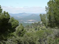
Between some trees, I had a view on the reservoir Embalse de San Juan, in which the geohash of expedition 2022-02-06_40_-4 had resided.
Finally, I reached a crossroad from which I could follow a much more convenient path almost up to the geohash.
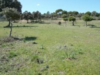
It was only a few tens of meters away from the path.
The image shows the view back to the path from where I came.
For the walk back, I decided to take exactly the same route. At least I knew it was manageable. I put the SLR camera in the photo case which hung from my shoulder so that it was better protected for the more difficult sections of the hike. So I took no photos on the walk back. Now it was mostly down and not up. That got me less out of breath but it made my legs hurt more.
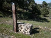
Just when I was almost back at the bike, I took a photo of something that had made me wonder already when I had passed it on the way to the geohash. I don't have the faintest idea what the purpose of this is.
In the end, the walk was almost 7 km, considerably more than the estimated 4-5 km, and took more than two hours. I was really exhausted after this substantial hike. The more I enjoyed the effortless glide home on the Goldwing.
Tracklog
