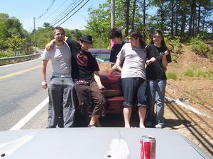
Providence, Rhode Island
| Springfield, MA | Boston, MA | Lynn, MA |
| Hartford, CT | Providence, Rhode Island | Cape Cod, MA |
| Riverhead, NY | – | – |
[[Category:Meetup in {{{lat}}} {{{lon}}}| ]]
Contents
Graticule Mottto
"To the Coke!"
Preferred Raptor Defense System
Velociraptor Species: Crowbar
Aquaraptor Species: Speargun
Officialish Welcome
Welcome! The Providence, Rhode Island graticule is at latitude 41, longitude -71. Note that this graticule contains nearly all of the state of Rhode Island, as well as bits of Massachusetts, Connecticut, and the tip of Long Island, NY. And also, possibly, aquaraptors.
Today's Location: [Providence, RI]
Notable Dates
2008-05-26: First successful geohash in this graticule!
2008-05-30: First unsuccessful geohash in this graticule!
2008-06-01: First successful land geohash in this graticule!
2008-06-03: First successful Bicycle Geohash in this graticule!
Daily Locations
2008-05-21: 41.179467°, -71.861537° Long Island Sound. (No visits.)
2008-05-22: 41.972874°, -71.238697° Near Norton, MA. (No visits.)
2008-05-23: 41.400246°, -71.722772° Near Bradford, RI. (No visits.)
2008-05-24: 41.126648°, -71.547533° Long Island Sound. (No visits.)
2008-05-25: 41.941774°, -71.182874° Wading River, near Norton Center, MA. (No visits.)
2008-05-26: 41.673128°, -71.607309° Near bridge on Hill Farm Rd., Coventry, RI.
Meeting SUCCESSFUL!!! Click above for details and pics.
2008-05-27: 41.209677°, -71.101442° Between Rhode Island Sound and Nantucket Sound. (No visits.)
2008-05-28: 41.68745°, -71.212208° Mt. Hope Bay, between Bristol, RI and southern Fall River, MA. (No visits.)
2008-05-29: 41.464701°, -71.034125° Buzzards Bay, Westport, MA. (No visits.)
2008-05-30: 41.853102°, -71.244603° North of Winthrop St. (Route 44) in Rehoboth, MA.
Geohash UNREACHABLE!!! Click above for details; pics may be forthcoming.
2008-05-31: 41.037487°, -71.281266° Block Island Sound. (No visits.)
2008-06-01: 41.349107°, -71.916239° Behind houses near Stony Brook on Stonington Rd. (Route 1) in Stonington, CT.
GEOHASH SUCCESSFUL!
2008-06-02: 41.509526°, -71.521592° Woods east of rail and west of Slocum Rd. in Kingston, RI. (No visits.)
2008-06-03: 41.957992°, -71.128935° Near Myles Standish Industrial Park in Taunton, MA.
GEOHASH SUCCESSFUL! Bicycle Geohash completed by Ben and Grace!
2008-06-04: 41.180292°, -71.845033° Block Island Sound. (No visits.)
2008-06-05: 41.066439°, -71.18439° Block Island Sound. (No visits.)
2008-06-06: 41.759663°, -71.825383° South of Saw Mill Hill Rd., in South Killingly, CT. (No visits.)
2008-06-07: 41.501784°, -71.114371° In Richmond Pond, Westport, MA. (No visits.)
2008-06-08: 41.047581°, -71.230916° Block Island Sound. (No visits.)
2008-06-09: 41.03773°, -71.790508° Block Island Sound. (No visits.) 41.875845°, -71.099769° 2008-06-10: 41.875845°, -71.099769° Industrial site on West side of W Water St., in Taunton, MA. Looks to be private, especially near railroad tracks and, if guessed correctly, waste treatment facility just south of here. Sounds appetizing, no? (No visits yet.)
Statistics
Starting May 21st, Updated to 6/10/08 (attempted/reached/generated)
Land Locations - (3/2/8)
Water Locations - (1/1/13)
Total Locations Reached - 3
Total Persons to Have Arrived - 5
Records
Consecutive Arrivals - 1
Consecutive Saturdays - 0
Most People - 5 (only 2 of this group successfully completed Water Geohash)
2008-05-26:
Geohasher with most arrivals - 5 tied with 1 each
