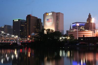
Newark, New Jersey
| Scranton, PA | Newburgh, NY | Danbury, CT |
| Philadelphia, PA (North) | Newark, New Jersey | New York, NY |
| Philadelphia, PA (South) | Atlantic City | – |
[[Category:Meetup in {{{lat}}} {{{lon}}}| ]]
The Newark graticule is at 40 N, -74 W. This may very well be the most densely populated graticule in the United States, as it includes almost the entire northern half of New Jersey, the mostly densely populated state (Census), as well as Staten Island, western sections of Brooklyn and lower Manhattan in New York, and a part of Pennsylvania northeast of Philadelphia. In addition, other than Raritan Bay, there are no large sections of water.
You can click here for Today's Location.
A Facebook Group has been created for this graticule.
Cities in this Graticule
- Newark, NJ
- Jersey City, NJ
- New Brunswick, NJ
- Trenton, NJ
- Lower Manhattan, New York, NY
- New Hope, PA
- Levittown, PA
- Langhorne, PA
- East Brunswick, NJ
Local Geohashers
- Madalis
- bjimba
- krip
- trntr

- TorsionalMetric
- Direwulf
- Jevanyn


 20px
20px

- LangleyLGLF (When @Rutgers)


- Esteban

- Science Works!

- sve
- Zubenelgenubi


- Mike
Attempted geohashes
- Main page: Meetup in 40 -74
- Saturday, July 26, 2008
- Sandburg Drive, Marlboro. Jevanyn and Zubenelgenubi made the geohash on a residential street, allowing them to mark the spot and Zubenelgenubi claims an uncommon Speed Racer geohash on a bicycle.
- Friday, July 4, 2008
- In the woods of Spring Hill Road, Amwell. Not a good place to view fireworks ;-) Zubenelgenubi made this geohash by bicycle, and uploaded a photo.
- Monday, June 30, 2008
- 17 Cornell St, West Orange. A lovely split-level, very close to Francis Byrne Golf Course - but it would take an intentional Bad Shot to achieve the Golf Geohash here. Science_Works! was there for a meetup of one(?)
- Saturday, June 28, 2008
- Brightwood Avenue, Westfield. Near Watchung Reservation. Jevanyn claims he was there with two drag-alongs, but has not yet provided proof. (start here)
- Monday, June 16, 2008
- Northbound Garden State Parkway past exit 116, off the shoulder after the Holmdel Rd. overpass. LangleyLGLF claims to have gotten the Speed Racer Achievement, but has not yet provided proof. (start here)
- Friday, June 13, 2008
- Forest Hill Rd, Staten Island, New York. There may have been a meetup at the Staten Island Mall, but no claim has been made yet. (start here)
- Thursday, June 12, 2008
- US 206, Hillsborough. Jevanyn has claimed a Cubicle Geohash honorable mention, but has not yet provided proof. (start here).
- Sunday, June 1, 2008
- A backyard in Denville. trntr claims he was there, but has not yet provided proof. (start here).
Daily Locations
White Pine Road, between Bordentown and Georgetown.
Farmer's field just east of I-95 turnpike exit 49, on Newton Yardley Road, Woodside, PA.
McGuire Air Force base, walking dsistance from the control tower. Yes, it's restricted. If you or any member of your XKCD expedition is captured or killed, we will disavow all knowledge of your actions. This wiki will self-destruct in 5 seconds.
- Update 11:54AM: The geohash on irc.peeron.com is on Castle Point Blvd., Society Hill, just north of the Rutgers New Brunswick campus. The staticfree Atom RSS feed had the correct location after all. Not quite a gated community, but very likely to run off any layabouts and loiterers.
 According to the Atlas geohash implementation, the geohash is in Raritan Bay, just outside Great Kills Harbor, Staten Island. The staticfree Atom RSS feed has a different location, possible because it is using yesterday's Dow opening. The irc.peeron.com map had no market data as of 10:30AM.
In the power line right-of-way between Roosevelt and Perrineville, Monmouth County. You'll probably need permission from the farmer at the end of Fairplay Road to get to the hashpoint.
A "plot of undeveloped land" along Kasper Road, in Long Bridge, Allamuchy Township, Warren County. Look out for Shades of Death Road!
A front lawn on Jefferson Street, Washington Township, Bergen county. Parkway exit 166 or 168.
Rutherford Place, North Arlington, NJ. Front lawn of the house next door to Queen of Peace High School.
Toward the end of Sandburg Drive, Morganville.
Newark Airport, in the parking lot for the Budget rental car franchise. If you take the monorail past terminal A (I think the one at the south end is A), it's just before the second stop.
Bellmans Creek, Fairview. Just to the north is an train station, I think it's Essex County light rail.
A farmer's field on Brynmore Road, New Egypt. Just north of Fort Dix.
A McMansion on Hillcroft Way, Newtown, PA. Yes, that's five PA geohashes in 18 days. Not that we don't like Pennsylvania, just sayin'.
Older locations can be looked up using the geohash calculator.
