2009-05-17 48 -123
| Sun 17 May 2009 in 48,-123: 48.7104108, -123.4668811 geohashing.info google osm bing/os kml crox |
Location
Between Saanich Peninsula, and Salt Spring Island.
Participants
- Elbie, with a bike trailer containing, amazingly enough, a kayak.
The Plan
- 13:00 - ferry leaves Tsawwassen to Swartz Bay
- 15:00 - arrive at the public boat launch on Lands End Road, at the northern tip of the Saanich Peninsula
- hopefully 15:30 - get on the water
- hopefully 16:30 - get to the hashpoint
- 18:00 - start packing up kayak, head back to the ferry terminal
- 19:00 - ferry leaves Swartz Bay to Tsawwassen
Expedition
Abridged: I biked, I bussed, I ferried, I biked some more, then I kayaked, got there, paddled back, biked some more, ferried, bussed, and then biked home.
Proper writeup pending.
Photos
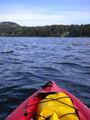
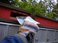
I point to where I want to go.
To the "Public Beach Access"!
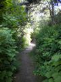
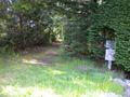
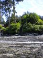
Along the path to the beach.
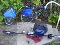
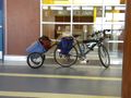
I left my bike as close to the beach as possible.
Stairs prevented me from biking all the way to the beach.
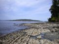
View of Swartz Bay from the beach.

Yarr?
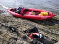
At the coordinates.
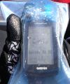
Less blurry GPS shot to show my elevation (-6m).
Heading back to land.
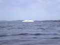
The 15:00 ferry worryingly close, causing waves well over a metre tall.
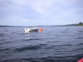
This abandoned boat attached to a buoy was my only landmark getting back to the beach.
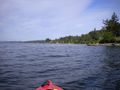
In sight of the beach again.
Back on land!
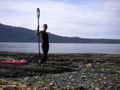
A Calendar Girl photo op while waiting for the kayak to dry.
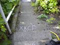
I left a chalk message on the stairs.
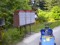
Stopped at a mailbox on the ride back to the ferry terminal.
Hashcard!
They sold out of passenger tickets for the 19:00 ferry an hour in advance.
Waited around Swartz Bay for three hours to get on a ferry.
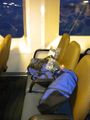
I sprawled out on these three seats on the same ferry for both rides.
Biking home well past midnight.


Achievements
Elbie earned the Water geohash achievement
|
Elbie earned the Lowest Geohash Achievement
|
Elbie earned the Buccaneer Geohash Achievement
|
Elbie earned the Calendar girl achievement
|
Elbie earned the Bicycle geohash achievement
|