Difference between revisions of "2010-05-21 49 -122"
imported>Yangman (Vehicle 3's occupant has been relocated into vehicle 1) |
m (More specific location) |
||
| (42 intermediate revisions by 11 users not shown) | |||
| Line 1: | Line 1: | ||
| − | [[Image:2010-05-21 49 -122.cake.jpg| | + | [[Image:2010-05-21 49 -122.cake.jpg|The Cake Was Not a Lie|thumb|left]] |
| − | Welcome to the official wiki page of the Vancouver graticule's Second Annual [[Geohashing Day]] celebration. If you | + | Welcome to the official wiki page of the Vancouver graticule's Second Annual [[Geohashing Day]] celebration. If you enjoy this account you may also be interested in reading about [[2010-05-22 49 -123|the following day's Mouseover Day festivities]]. |
{{meetup graticule | {{meetup graticule | ||
| Line 13: | Line 13: | ||
__NOTOC__ | __NOTOC__ | ||
== Location == | == Location == | ||
| − | A short bushwhack from a logging road between Dewdney Trunk Road and Alouette Lake. Quality of the logging road is unknown. | + | A short bushwhack from a logging road between Dewdney Trunk Road and Alouette Lake. Quality of the logging road is unknown. Google maps street view shows an open gate across the access to the road, so we knew there was a small chance that the road would be gated, thus arrived prepared for a 4 km walk from the known good roads. |
== Participants == | == Participants == | ||
| + | [[Image:2010-05-21 49 -122 hashers.JPG | thumb|left |Geohashers!]] | ||
| + | |||
| + | |||
| + | <div style="column-count:2;-moz-column-count:2;-webkit-column-count:2"> | ||
*[[User:thepiguy|thepiguy]] | *[[User:thepiguy|thepiguy]] | ||
*[[User:Rhonda|Rhonda]] | *[[User:Rhonda|Rhonda]] | ||
| Line 24: | Line 28: | ||
*[[User:Arbron|Arbron]] | *[[User:Arbron|Arbron]] | ||
*[[User:srs0|srs0]] | *[[User:srs0|srs0]] | ||
| + | *[[User:Elbie|Elbie]] | ||
| + | * Kyle (a.k.a Thor) | ||
| + | * Denise | ||
| + | </div> | ||
| + | It is very exciting that we now have so many participants in a Vancouver event that we needed to figure out how to display the list in two columns. | ||
== Plans == | == Plans == | ||
| − | + | For Vancouverites the Geohashing Day coordinates are released at 6:30 a.m. the same day, so the first meetup was at hash o'clock sharp in the #geohashing channel. Geohashing Day meetup point selection prefers an attempt at the actual coordinates for the day, but while Vancouver's was in the middle of the water, Surrey's was close enough to civilization that it was easily chosen as our destination. | |
| + | |||
| + | Planning from there was confusing and fluid, involving five different vehicles, one of which didn't exist and three of which were eventually used, four different pick-up locations for people in at least three cities, about seven different proposed departure times, buses and SkyTrain. | ||
| + | |||
| + | '''Sample Conversation''' | ||
| − | + | ''Rhonda has just agreed to meet pi at Waterfront Station at 16:10, then take the Skytrain to Yaletown where they will rendezvous with Wade and Rhonda's car at 16:30. The wiki has been updated with this plan.'' | |
| − | + | :Xore has joined #geohashing | |
| − | :: | + | :<Xore> Wade, I'm going to drive my car to work and then we can leave about 4:30 to go to the geohash. |
| − | : | + | :<Wade> Sounds like a plan. |
| − | + | :<Robyn> Or you could go with the other plan on the wiki that we already made. Rhonda is bringing her car. | |
| − | + | ''Robyn is informed that "Rhonda's car" and "Xore's car" is the same vehicle.'' | |
| − | : | + | :<Wade> I told you it sounded like a plan. In fact it sounded like THE plan, but I wasn't going to say that. |
| − | ===Vehicle 1 ( | + | We struggled to adhere to the principle of geohashing as a mostly ''unplanned'' mass meet-up, while balancing the desire to use transit and carpool rather than single-occupant vehicles, and acknowledging the fact that most of the group has to work on a Friday, in one case until seven p.m. That's the sort of thing Mouseover Day was created to address, but this graticule strives to overcome such petty barriers as darkness and gravity. The final roster was something like this: |
| + | |||
| + | ===Vehicle 1 (Xore)=== | ||
*Rhonda and pi meet at Waterfront Station at 16:10 | *Rhonda and pi meet at Waterfront Station at 16:10 | ||
*Travel via Canada line Skytrain to Yaletown station, near the car | *Travel via Canada line Skytrain to Yaletown station, near the car | ||
*Leaves downtown at 16:30 | *Leaves downtown at 16:30 | ||
| − | *Contains: Rhonda, pi, Xore, Wade, | + | *Stop at Braid Skytrain station for 17:00 for one final pickup |
| + | *Contains: Rhonda, pi, Xore, Wade, yangman | ||
===Vehicle 2 (Arbron)=== | ===Vehicle 2 (Arbron)=== | ||
| − | *Leaves UBC CS Building at 19:00. | + | *Leaves UBC CS Building at 19:00 (between X-wing and Dempster). |
| − | *Contains: Robyn, Arbron, srs0, Elbie, possibly | + | *Contains: Robyn, Arbron, srs0, Elbie |
| + | |||
| + | ===Vehicle 3 (Kyle)=== | ||
| + | *New geohashers Kyle and Denise, leaving from their home in a convoy with Vehicle 1 | ||
| + | |||
| + | == Expedition == | ||
| + | |||
| + | Recollections of two of the eleven geohashers are now in. Participants, please add your stories, as we couldn't be in 11! places at once. | ||
| + | |||
| + | ===Vehicles 1 and 3: Dining and Reverse Abducting=== | ||
| + | As Xore bravely piloted the hashmobile through rush-hour traffic toward Maple Ridge, the conversation turned to food. After a surprisingly long discussion, we determined that most of us were hungry now, and those who weren't hungry now would certainly be hungry by the time we finished waiting for the UBC car and hiked up to the hashpoint. Rather than picking any random food supplying venue, Xore suggested we call Kyle --- who lives in the area --- to get a recommendation on a good restaurant and invite him to join us for dinner. | ||
| + | |||
| + | Kyle was called, and he suggested a nearby White Spot. He could not join us, however, as Denise was not yet home with the car, and he was expected to cook tonight, so he had to make sure there was food available when Denise got home. Apparently, leaving a note on the kitchen table saying "We're at White Spot, come join us!" does not count as cooking in that household. Strange. Must be a Maple Ridge thing. | ||
| + | |||
| + | We enjoyed tasty White Spot food, then pi and Wade had a very important discussion on how the credit cards should be placed ''just so'' on the receipts while waiting for the waiter to pick them up, while he was processing the other cards. The waiter, in a display of awesomely perceptive customer service, replaced the cards with the customer copy of the receipts on the table in ''precisely'' the same layout while pi and Wade were signing the other copy of their respective receipts. | ||
| + | |||
| + | After dinner, we discovered (possibly by telepathy, but probably by cell phone) that Kyle had cooked dinner, Denise had come home to enjoy said dinner, and during dinner Denise and Kyle had decided to join us geohashing. The hashmobile and passengers then backtracked a couple of kilometers to Kyle and Denise's new house. We all met the orange and grey cats (two of each, for a total of four cats), admired the huge and well manicured back yard, and waited for Denise and Kyle to finish eating. Knowing that soon the UBC car would be ahead of us, we left after quickly agreeing that Kyle would follow the hashmobile to the gate. | ||
| + | |||
| + | Wade had been backseat driving all along with his motorcycle GPS telling us the correct route to drive. As we approached the gate, the GPS confidently told us we should turn right at a fork in the road, and Wade confidently relayed that info to Xore who was driving. Xore foolishly followed the instruction. Kyle confusedly continued to follow Xore. Eventually we concluded that the road was getting further away from the hash point, and went into a cul-de-sac to turn around. After a brief driver-to-driver conversation which involved ignoring the idiot with the GPS, Kyle and Xore agreed we should have gone left at the fork, and we were off again. A couple of minutes backtracking, and we were at the gate where Arbron's car and two geohashers were waiting. Once more, Wade's trusty GPS succeeded in turning a simple drive into an adventure! | ||
| + | |||
| + | ===Vehicle 2: Driving=== | ||
| + | Considering that Friday happened to be the last working day before the Victoria Day long weekend in British Columbia, the traffic heading out of town was not disastrously bad. A few highlights. | ||
| + | |||
| + | *Elbie got out of work early, but didn't know what kind of car she was waiting for. To entertain herself while waiting she tried to persuade srs0 to join her in waving at ''all'' the cars that passed. The first one turned out to be Arbron. | ||
| + | |||
| + | *Robyn talked Arbron into taking the Lougheed Highway instead of Highway #1. As we reached the end of 12th Avenue where Robyn demanded he take the left ramp onto the Lougheed and not the right ramp onto the #1, not only was the left ramp barricaded off, but the sign identifying it as an on-ramp was painted over. We took the #1. | ||
| + | |||
| + | *While on Dewdney Trunk Road, we passed a vehicle whose front seat passenger gave an astonished gasp of delighted recognition and waved at us. We all looked delighted to see him and waved back. By the time it was determined that no one on board had the faintest clue who this person was, we had passed the vehicle and it had turned off down a side street. We still don't know if he misrecognized one of us, one of us failed to recognize him, or if that's a game he likes to play in cars. | ||
| + | |||
| + | *The gate to the logging road was locked. | ||
| + | |||
| + | ===Hiking=== | ||
| + | In case the car arrangements didn't make that clear, in order to truly plan this expedition, one has to calculate how many ways there are to disperse a group of eleven people into subgroups along a trail. Order matters, both of the subgroups and within the subgroups, but walking to the left or right of another person is counted as the same arrangement. I'll leave the factorial calculations to the physics majors in the group, but the chemical engineer, software architects, or theatre production design major are welcome to do it first. This calculation is necessary in order to quantitatively describe the confusion involved in getting eleven people up a hill along a relatively straight road. | ||
| + | |||
| + | The car that had to leave last, because of the person who had to work late, turned out to be the first to arrive at the locked gate, so the group waited for the others. It was a bit cold standing around, so Elbie and Robyn set off first as a scouting party. Thepiguy, who had been with the car that had left first but arrived last, ran and caught up. | ||
| + | |||
| + | While the rest of the group was getting bags and lights organized for the trip (it turned out there were almost twice as many lights as people on this trip), a friendly local with a dog advised us that cars were very often ticketed where we had parked, probably due to the normal sized "no parking" signs and a very large one next to the gate that said that unlicensed all terrain and recreational vehicles were prohibited on the paved part of the roads. She also advised us that just back at the fork that Wade's GPS had misdirected us through was a wide shoulder we could safely park at. The three drivers duly moved the vehicles as directed, while the rest of the group waited for them before departing to try and catch up to the advance group. For safety, we left a note on the dash of one of the vehicles with our destination, a note saying we'd be back at 11, and two phone numbers from two phones which were on entirely different cellular networks. | ||
| + | |||
| + | The advance group explored and marked side trails with arrows showing the way they had gone, or the way they recommended going. We think one of the trails we took was actually a river, not a trail. It got us to within 950 m of the geohash, and then turned away, plus the geohash was on the wrong side of the trail from the trail we thought we should be on. We had marked that trail with a big wooden arrow showing we had gone that way, so to prevent the rest of the group from following attempted to phone or text them. It turned out that the some people had missed seeing the arrow, some had misinterpreted it as pointing to the main fork, and three were coming down the wrong trail towards us. | ||
| + | |||
| + | Xore received one of the phone call attempts, and we determined that we were probably at the arrow mentioned as incorrect. The bulk of the group at the arrow decided to wait for the group who had digressed. While waiting, two people changed the arrow so it pointed up the correct fork instead of the right fork, and one went to hide in the bushes to do a raptor attack, but got bored waiting and returned to the group. Xore decided he wanted to keep walking, and headed up the correct trail. | ||
| + | |||
| + | Reunited farther up the trail, it was dark enough by that time that we decided a count off was in order. | ||
| + | |||
| + | You'd think that a group of such highly educated people could grasp the concept of a count off. Here are some sample attempts: | ||
| + | |||
| + | "One! Two! Two! (pause) Three! Four! (silence) We said FOUR, you guys COUNT! Start again!" | ||
| + | |||
| + | "One! Two! Three! Four! No I'm four! (pause) Five! Six! (long pause) Six! (more silence) SIX!" | ||
| + | |||
| + | "One! (pause) Two! Three! Four! Five! Six! Seven! Seven! (pause) Eight! Nine! Ten! Twelve! ROAR!" | ||
| + | |||
| + | "One! Two! Pi! e! i! Negative i! We're all here, damnit!" | ||
| + | |||
| + | Despite such poor people tracking, we were relatively certain that we had enough manpower to scare off any bears we encountered, so as long as they weren't stealthy enough to quietly grab someone from the tail end right after they had said "twelve." We didn't lose anyone on the trail, and the closest we knowingly got to bears was an area where there were some black felt scraps that looked like bear scat. | ||
| + | |||
| + | Xore's phone was the first of several to receive a text message welcoming him to the United States. | ||
| + | |||
| + | The main uphill trail was mostly large rocks, and then further up two banks with a fairly deep trench between them where, had it been raining this week, there would probably have been a sizeable river. Even if the gate had been open the rugged car that belongs to Xore and/or Rhonda would not have been able to negotiate it. It didn't look so bad in the dark, though. The road started going away, but Rhonda's map assured us that it would go away a bit, then there would be a fork, then we would get closer again. Eventually we reached the fork that was supposed to get us nearer to the geohash. It did for a while. A bit closer, there was a break in the trees and a couple of people charged toward it, eager for a trail instead of bushwhacking. The break in the trees, however, turned out to be a pond. "Everybody in the water!" Strangely, there were no takers. | ||
| + | |||
| + | Eventually we reached an equilibrium point about 350 metres from the geohash where despite going forward, we didn't get any closer to the coordinates. This matched the limited research we (and by we we mean mostly Rhonda) had done. The geohash was through the trees to the right of the trail, and we were out of trail. | ||
| + | |||
| + | ===Bushwhacking=== | ||
| + | The entrance to the bush didn't look any worse than the trail we had come up. That is to say that both were pitch black. The [[Stupidity distance]] was about 370 metres. It was after ten p.m. by this time but the spirit of geohashing and the fact that the person carrying the cake had already entered the bushes carried everyone through that first barrier of bushy undergrowth. | ||
| + | |||
| + | "Don't walk too close, the branches are whipping back!" | ||
| + | |||
| + | "Don't lag behind, we don't want anyone lost!" | ||
| − | + | A few metres in it wasn't quite as bad, because the trees above were so dense that there was no greenery, just the trunks and roots of trees with needles and little crispy dead branches underfoot. Nevertheless, at this point some group members started to roll for sanity and called for a halt. pi was still avidly calling for us to advance "only" another 360 metres through the bush. He and all experienced geohashers in our and any forested graticule ''well'' knew just how long it could take to go a relatively short distance through bush, even in daylight. It's not unusual to take [[2009-12-30 49 -123|over a minute]] per metre of progress into dense vegetation. Then pi took one more step and suddenly agreed that now and here was a good place to celebrate. He did not immediately reveal what it was that he had seen beyond the next layer of trees. | |
| − | |||
| − | + | In this case we had progressed 20 metres in our initial five minute burst of enthusiasm, if we were able to extrapolate that speed over the remaining distance, that would be an hour and a half of night bushwhacking. In a remarkable display of increasing group sanity, we determined that the sort-of clearing we were in would be adequate for the celebration. As someone pointed out, the actual geohash was going to look exactly like this, even with the flashlights on. There was brief discussion about which particular slightly flattened area we would use, the one two metres closer to our goal or the one that was large enough to accommodate our group. We chose the latter. It even had a flattish stump on which to set the cake. | |
| − | |||
| − | |||
| − | |||
| − | |||
| − | |||
| − | |||
| − | == | + | ===Celebrating=== |
| − | + | The cake (what, you mean ''you'' don't bring a cake on a four kilometre uphill hike in the dark?) was placed on the stump and unwrapped. First time geohasher (can you imagine your very first geohash being like this?) Denise accepted the invitation to have the honour of making the first cut, and then Wade held a flashlight while Robyn continued slicing the rest, Rhonda handed out forks and someone else beyond the radius of the flashlight beam distributed cake. For the record it was a two layer chocolate cake with white Amaretto icing and decorations clumsily piped in chocolate Amaretto icing, plus a big candle '''2''', as this was the second anniversary of the announcement of the geohashing algorithm. Robyn had gone almost all the way through the cake before she realized that with this many geohashers present, there probably should have been some preplanning to ensure that everyone got a slice of cake. But as a tribute to the way geohashing ''just works'', the cake remaining as she thought this was just enough to make three more slices of the size she had been making, and there were just three more geohashers who had not yet had cake. | |
| + | |||
| + | The feast also included vegetarian samosas, Nibs, and there would also have been hot chocolate, except that the consensus was that Yangman should not light a white gas stove on the forest floor. There is no geohashing achievement ribbon for starting a forest fire at the geohash. | ||
| + | |||
| + | There were also balloons. Rhonda brought balloons. Because it's not a party without balloons. When all the cake had been eaten and the garbage packed away, and our night vision totally destroyed by numerous camera flashes, we all hiked the twenty metres back out to the trail. It's all downhill now. What could go wrong? | ||
| + | |||
| + | ===Returning=== | ||
| + | Hiking four kilometres downhill ought to be easier than hiking uphill, but although it is less work by the physics definition, it really isn't a huge amount easier. For best results you do not fling yourself headlong, but have to have control over your descent, which uses a lot of muscles. I'm not sure of all their names, but I imagine many of the participants could point out which muscles those had been, the next morning. The trip down was a bit faster, as there were no trail decisions to make, no side trails explored and less to see, so mostly no pauses to admire or photograph the scenery. There was one short pause in which everybody turned off their headlamps and flashlights to admire the stars, at which time we realized that the half moon was so bright we could probably safely walk down the trail by its light alone. Most people opted to use their flashlights, however. A second short pause occurred at the abandoned Coke machine that was lying down next to an area with only baby replanted trees, and somebody suggested seeing if there was still product inside. The group consensus, with a further increasing show of sanity over time, was to leave it undisturbed as there was a higher probability of the the box containing a wild animal than soft drinks. | ||
| + | |||
| + | We reached the cars just before midnight and negotiated which drivers would take which passengers with the cars finally pulling out at 12:01. Geohashing Day complete! Now it's Mouseover Day and [[2010-05-22 49 -123|a new adventure]] begins. Sleep preceding Mouseover Day was as little as four hours for some participants. | ||
== Tracklog == | == Tracklog == | ||
| − | + | This is the tracklog of Wade, who was in vehicle #1. If you zoom in in Map mode, you can even see the lake. | |
| + | |||
| + | http://www.everytrail.com/view_trip.php?trip_id=631163 | ||
| + | |||
| + | == Video == | ||
| + | |||
| + | In case you don't quite believe that a group of grown allegedly sane adults would have difficulties counting to 11, the [http://www.youtube.com/watch?v=ukvRAdVnJ9A following] video [http://www.youtube.com/watch?v=4ioYPjgNigM evidence] is supplied for your amusement. (Rated PG - for thePiGuy almost falling down a mountain.) | ||
== Photos == | == Photos == | ||
| − | |||
| − | |||
| − | |||
<gallery perrow="5"> | <gallery perrow="5"> | ||
| + | Image:2010-05-21 49 -122.quiet.jpg|We didn't realize before that some trees are sensitive to noise. | ||
| + | Image:2010-05-21 49 -122.sunset.jpg|View of the Fraser Valley and the North Cascades at sunset, from a kilometre or so up the trail. | ||
| + | Image:2010-05-21 49 -122.moon.jpg|The moon illuminated the trail well enough that where it was not hidden behind trees, it was possible to walk safely without flashlights. | ||
</gallery> | </gallery> | ||
| − | |||
| − | |||
| − | |||
| + | === Pictures from [[user:srs0|srs0's]] perspective === | ||
| + | For some reason, most of the photos look jagged if you don't look click through to the full image. I don't know why, sorry! | ||
| − | <!-- | + | Trip to the hashpoint: |
| − | + | <gallery perrow="5"> | |
| + | Image:2010-05-21 49 -122 arriveUBC.JPG|Arriving at UBC. | ||
| + | Image:2010-05-21 49 -122 meetElbie.JPG|Meeting up with [[user:Elbie|Elbie]]. | ||
| + | Image:2010-05-21 49 -122 meetRobynArbron.JPG|Meeting with [[user:Robyn|Robyn]] and [[user:Arbron|Arbron]]. | ||
| + | Image:2010-05-21 49 -122 cameras.JPG|Cameras abound in this geohashing vehicle! | ||
| + | Image:2010-05-21 49 -122 fieldVancouver.JPG|Driving through Vancouver. | ||
| + | Image:2010-05-21 49 -122 bridge.JPG|Crossing the river. | ||
| + | Image:2010-05-21 49 -122 mcnutt.JPG|On the destination street. | ||
| + | Image:2010-05-21 49 -122 arrived.JPG|Arrived at the start point of the hike. | ||
| + | Image:2010-05-21 49 -122 waiting.JPG|Waiting for the others to arrive. | ||
| + | Image:2010-05-21 49 -122 gate.JPG|The gate blocking further vehicle progress. | ||
| + | </gallery> | ||
| − | <!-- | + | Arrival of the other groups: |
| + | <gallery perrow="5"> | ||
| + | Image:2010-05-21 49 -122 arrived2.JPG|The second vehicle arrives... | ||
| + | Image:2010-05-21 49 -122 arrived3.JPG|...closely followed by the third. | ||
| + | Image:2010-05-21 49 -122 arrived4.JPG|Everyone's here! | ||
| + | Image:2010-05-21 49 -122 arrived5.JPG|Preparing to set out. | ||
| + | Image:2010-05-21 49 -122 drivers.JPG|The drivers returning. | ||
| + | </gallery> | ||
| − | + | Hiking to the hashpoint: | |
| + | <gallery perrow="5"> | ||
| + | Image:2010-05-21 49 -122 leaving.JPG|Time to leave the road. | ||
| + | Image:2010-05-21 49 -122 starting.JPG|That's where we are. | ||
| + | Image:2010-05-21 49 -122 arrow.JPG|A mysterious arrow. | ||
| + | Image:2010-05-21 49 -122 groupWalking.JPG|The group hiking up the mountain. | ||
| + | Image:2010-05-21 49 -122 darker.JPG|It's getting dark... | ||
| + | Image:2010-05-21 49 -122 dark.JPG|Now it is dark! | ||
| + | Image:2010-05-21 49 -122 badArrow.JPG|A false arrow. | ||
| + | Image:2010-05-21 49 -122 waitAtArrow.JPG|Waiting at the arrow. | ||
| + | Image:24 2010-05-21 49 -122 xoreDenise.JPG|At the hashpoint, geohashers #1 and #2. | ||
| + | Image:25 2010-05-21 49 -122 arbron.JPG|At the hashpoint, geohasher #3. | ||
| + | Image:2010-05-21 49 -122 elbie.JPG|At the hashpoint, geohasher #4. | ||
| + | Image:2010-05-21 49 -122 piYang.JPG|At the hashpoint, geohashers #5 and #6. | ||
| + | Image:2010-05-21 49 -122 kyle.JPG|At the hashpoint, geohasher #7. | ||
| + | Image:2010-05-21 49 -122 wadeRobyn.JPG|At the hashpoint, geohashers #8 and #9. | ||
| + | Image:2010-05-21 49 -122 robynRhonda.JPG|At the hashpoint, geohashers #9 and #10. | ||
| + | Image:2010-05-21 49 -122 srs0.JPG|At the hashpoint, geohasher #11. | ||
| + | Image:2010-05-21 49 -122 cake.JPG|Cake! | ||
| + | Image:2010-05-21 49 -122 balloons.JPG|Balloons! | ||
| + | Image:2010-05-21 49 -122 eatingCake.JPG|At the hashpoint, eating cake. | ||
| + | </gallery> | ||
| + | == Achievements == | ||
| + | {{#vardefine:ribbonwidth|800px}} | ||
| + | {{Geohashing Day | ||
| + | |||
| + | | latitude = 49 | ||
| + | | longitude = -122 | ||
| + | | year = 2010 | ||
| + | | coorddate= 2010-05-21 | ||
| + | | name = The Vancouver Graticule | ||
| + | | celebration = hiking uphill in the dark with cake | ||
| + | | image = 2010-05-21 49 -122.cake.jpg | ||
| + | |||
| + | }} | ||
| − | |||
[[Category:Expeditions]] | [[Category:Expeditions]] | ||
| − | |||
[[Category:Expeditions with photos]] | [[Category:Expeditions with photos]] | ||
[[Category:Expeditions with videos]] | [[Category:Expeditions with videos]] | ||
| − | |||
| − | |||
| − | |||
| − | |||
| − | |||
| − | |||
| − | |||
| − | |||
[[Category:Coordinates not reached]] | [[Category:Coordinates not reached]] | ||
| − | |||
[[Category:Not reached - Mother Nature]] | [[Category:Not reached - Mother Nature]] | ||
| − | + | {{location|CA|BC|MV}} | |
| − | |||
| − | |||
| − | |||
Latest revision as of 23:22, 9 August 2020

Welcome to the official wiki page of the Vancouver graticule's Second Annual Geohashing Day celebration. If you enjoy this account you may also be interested in reading about the following day's Mouseover Day festivities.
| Fri 21 May 2010 in 49,-122: 49.2624552, -122.4351431 geohashing.info google osm bing/os kml crox |
Location
A short bushwhack from a logging road between Dewdney Trunk Road and Alouette Lake. Quality of the logging road is unknown. Google maps street view shows an open gate across the access to the road, so we knew there was a small chance that the road would be gated, thus arrived prepared for a 4 km walk from the known good roads.
Participants

It is very exciting that we now have so many participants in a Vancouver event that we needed to figure out how to display the list in two columns.
Plans
For Vancouverites the Geohashing Day coordinates are released at 6:30 a.m. the same day, so the first meetup was at hash o'clock sharp in the #geohashing channel. Geohashing Day meetup point selection prefers an attempt at the actual coordinates for the day, but while Vancouver's was in the middle of the water, Surrey's was close enough to civilization that it was easily chosen as our destination.
Planning from there was confusing and fluid, involving five different vehicles, one of which didn't exist and three of which were eventually used, four different pick-up locations for people in at least three cities, about seven different proposed departure times, buses and SkyTrain.
Sample Conversation
Rhonda has just agreed to meet pi at Waterfront Station at 16:10, then take the Skytrain to Yaletown where they will rendezvous with Wade and Rhonda's car at 16:30. The wiki has been updated with this plan.
- Xore has joined #geohashing
- <Xore> Wade, I'm going to drive my car to work and then we can leave about 4:30 to go to the geohash.
- <Wade> Sounds like a plan.
- <Robyn> Or you could go with the other plan on the wiki that we already made. Rhonda is bringing her car.
Robyn is informed that "Rhonda's car" and "Xore's car" is the same vehicle.
- <Wade> I told you it sounded like a plan. In fact it sounded like THE plan, but I wasn't going to say that.
We struggled to adhere to the principle of geohashing as a mostly unplanned mass meet-up, while balancing the desire to use transit and carpool rather than single-occupant vehicles, and acknowledging the fact that most of the group has to work on a Friday, in one case until seven p.m. That's the sort of thing Mouseover Day was created to address, but this graticule strives to overcome such petty barriers as darkness and gravity. The final roster was something like this:
Vehicle 1 (Xore)
- Rhonda and pi meet at Waterfront Station at 16:10
- Travel via Canada line Skytrain to Yaletown station, near the car
- Leaves downtown at 16:30
- Stop at Braid Skytrain station for 17:00 for one final pickup
- Contains: Rhonda, pi, Xore, Wade, yangman
Vehicle 2 (Arbron)
- Leaves UBC CS Building at 19:00 (between X-wing and Dempster).
- Contains: Robyn, Arbron, srs0, Elbie
Vehicle 3 (Kyle)
- New geohashers Kyle and Denise, leaving from their home in a convoy with Vehicle 1
Expedition
Recollections of two of the eleven geohashers are now in. Participants, please add your stories, as we couldn't be in 11! places at once.
Vehicles 1 and 3: Dining and Reverse Abducting
As Xore bravely piloted the hashmobile through rush-hour traffic toward Maple Ridge, the conversation turned to food. After a surprisingly long discussion, we determined that most of us were hungry now, and those who weren't hungry now would certainly be hungry by the time we finished waiting for the UBC car and hiked up to the hashpoint. Rather than picking any random food supplying venue, Xore suggested we call Kyle --- who lives in the area --- to get a recommendation on a good restaurant and invite him to join us for dinner.
Kyle was called, and he suggested a nearby White Spot. He could not join us, however, as Denise was not yet home with the car, and he was expected to cook tonight, so he had to make sure there was food available when Denise got home. Apparently, leaving a note on the kitchen table saying "We're at White Spot, come join us!" does not count as cooking in that household. Strange. Must be a Maple Ridge thing.
We enjoyed tasty White Spot food, then pi and Wade had a very important discussion on how the credit cards should be placed just so on the receipts while waiting for the waiter to pick them up, while he was processing the other cards. The waiter, in a display of awesomely perceptive customer service, replaced the cards with the customer copy of the receipts on the table in precisely the same layout while pi and Wade were signing the other copy of their respective receipts.
After dinner, we discovered (possibly by telepathy, but probably by cell phone) that Kyle had cooked dinner, Denise had come home to enjoy said dinner, and during dinner Denise and Kyle had decided to join us geohashing. The hashmobile and passengers then backtracked a couple of kilometers to Kyle and Denise's new house. We all met the orange and grey cats (two of each, for a total of four cats), admired the huge and well manicured back yard, and waited for Denise and Kyle to finish eating. Knowing that soon the UBC car would be ahead of us, we left after quickly agreeing that Kyle would follow the hashmobile to the gate.
Wade had been backseat driving all along with his motorcycle GPS telling us the correct route to drive. As we approached the gate, the GPS confidently told us we should turn right at a fork in the road, and Wade confidently relayed that info to Xore who was driving. Xore foolishly followed the instruction. Kyle confusedly continued to follow Xore. Eventually we concluded that the road was getting further away from the hash point, and went into a cul-de-sac to turn around. After a brief driver-to-driver conversation which involved ignoring the idiot with the GPS, Kyle and Xore agreed we should have gone left at the fork, and we were off again. A couple of minutes backtracking, and we were at the gate where Arbron's car and two geohashers were waiting. Once more, Wade's trusty GPS succeeded in turning a simple drive into an adventure!
Vehicle 2: Driving
Considering that Friday happened to be the last working day before the Victoria Day long weekend in British Columbia, the traffic heading out of town was not disastrously bad. A few highlights.
- Elbie got out of work early, but didn't know what kind of car she was waiting for. To entertain herself while waiting she tried to persuade srs0 to join her in waving at all the cars that passed. The first one turned out to be Arbron.
- Robyn talked Arbron into taking the Lougheed Highway instead of Highway #1. As we reached the end of 12th Avenue where Robyn demanded he take the left ramp onto the Lougheed and not the right ramp onto the #1, not only was the left ramp barricaded off, but the sign identifying it as an on-ramp was painted over. We took the #1.
- While on Dewdney Trunk Road, we passed a vehicle whose front seat passenger gave an astonished gasp of delighted recognition and waved at us. We all looked delighted to see him and waved back. By the time it was determined that no one on board had the faintest clue who this person was, we had passed the vehicle and it had turned off down a side street. We still don't know if he misrecognized one of us, one of us failed to recognize him, or if that's a game he likes to play in cars.
- The gate to the logging road was locked.
Hiking
In case the car arrangements didn't make that clear, in order to truly plan this expedition, one has to calculate how many ways there are to disperse a group of eleven people into subgroups along a trail. Order matters, both of the subgroups and within the subgroups, but walking to the left or right of another person is counted as the same arrangement. I'll leave the factorial calculations to the physics majors in the group, but the chemical engineer, software architects, or theatre production design major are welcome to do it first. This calculation is necessary in order to quantitatively describe the confusion involved in getting eleven people up a hill along a relatively straight road.
The car that had to leave last, because of the person who had to work late, turned out to be the first to arrive at the locked gate, so the group waited for the others. It was a bit cold standing around, so Elbie and Robyn set off first as a scouting party. Thepiguy, who had been with the car that had left first but arrived last, ran and caught up.
While the rest of the group was getting bags and lights organized for the trip (it turned out there were almost twice as many lights as people on this trip), a friendly local with a dog advised us that cars were very often ticketed where we had parked, probably due to the normal sized "no parking" signs and a very large one next to the gate that said that unlicensed all terrain and recreational vehicles were prohibited on the paved part of the roads. She also advised us that just back at the fork that Wade's GPS had misdirected us through was a wide shoulder we could safely park at. The three drivers duly moved the vehicles as directed, while the rest of the group waited for them before departing to try and catch up to the advance group. For safety, we left a note on the dash of one of the vehicles with our destination, a note saying we'd be back at 11, and two phone numbers from two phones which were on entirely different cellular networks.
The advance group explored and marked side trails with arrows showing the way they had gone, or the way they recommended going. We think one of the trails we took was actually a river, not a trail. It got us to within 950 m of the geohash, and then turned away, plus the geohash was on the wrong side of the trail from the trail we thought we should be on. We had marked that trail with a big wooden arrow showing we had gone that way, so to prevent the rest of the group from following attempted to phone or text them. It turned out that the some people had missed seeing the arrow, some had misinterpreted it as pointing to the main fork, and three were coming down the wrong trail towards us.
Xore received one of the phone call attempts, and we determined that we were probably at the arrow mentioned as incorrect. The bulk of the group at the arrow decided to wait for the group who had digressed. While waiting, two people changed the arrow so it pointed up the correct fork instead of the right fork, and one went to hide in the bushes to do a raptor attack, but got bored waiting and returned to the group. Xore decided he wanted to keep walking, and headed up the correct trail.
Reunited farther up the trail, it was dark enough by that time that we decided a count off was in order.
You'd think that a group of such highly educated people could grasp the concept of a count off. Here are some sample attempts:
"One! Two! Two! (pause) Three! Four! (silence) We said FOUR, you guys COUNT! Start again!"
"One! Two! Three! Four! No I'm four! (pause) Five! Six! (long pause) Six! (more silence) SIX!"
"One! (pause) Two! Three! Four! Five! Six! Seven! Seven! (pause) Eight! Nine! Ten! Twelve! ROAR!"
"One! Two! Pi! e! i! Negative i! We're all here, damnit!"
Despite such poor people tracking, we were relatively certain that we had enough manpower to scare off any bears we encountered, so as long as they weren't stealthy enough to quietly grab someone from the tail end right after they had said "twelve." We didn't lose anyone on the trail, and the closest we knowingly got to bears was an area where there were some black felt scraps that looked like bear scat.
Xore's phone was the first of several to receive a text message welcoming him to the United States.
The main uphill trail was mostly large rocks, and then further up two banks with a fairly deep trench between them where, had it been raining this week, there would probably have been a sizeable river. Even if the gate had been open the rugged car that belongs to Xore and/or Rhonda would not have been able to negotiate it. It didn't look so bad in the dark, though. The road started going away, but Rhonda's map assured us that it would go away a bit, then there would be a fork, then we would get closer again. Eventually we reached the fork that was supposed to get us nearer to the geohash. It did for a while. A bit closer, there was a break in the trees and a couple of people charged toward it, eager for a trail instead of bushwhacking. The break in the trees, however, turned out to be a pond. "Everybody in the water!" Strangely, there were no takers.
Eventually we reached an equilibrium point about 350 metres from the geohash where despite going forward, we didn't get any closer to the coordinates. This matched the limited research we (and by we we mean mostly Rhonda) had done. The geohash was through the trees to the right of the trail, and we were out of trail.
Bushwhacking
The entrance to the bush didn't look any worse than the trail we had come up. That is to say that both were pitch black. The Stupidity distance was about 370 metres. It was after ten p.m. by this time but the spirit of geohashing and the fact that the person carrying the cake had already entered the bushes carried everyone through that first barrier of bushy undergrowth.
"Don't walk too close, the branches are whipping back!"
"Don't lag behind, we don't want anyone lost!"
A few metres in it wasn't quite as bad, because the trees above were so dense that there was no greenery, just the trunks and roots of trees with needles and little crispy dead branches underfoot. Nevertheless, at this point some group members started to roll for sanity and called for a halt. pi was still avidly calling for us to advance "only" another 360 metres through the bush. He and all experienced geohashers in our and any forested graticule well knew just how long it could take to go a relatively short distance through bush, even in daylight. It's not unusual to take over a minute per metre of progress into dense vegetation. Then pi took one more step and suddenly agreed that now and here was a good place to celebrate. He did not immediately reveal what it was that he had seen beyond the next layer of trees.
In this case we had progressed 20 metres in our initial five minute burst of enthusiasm, if we were able to extrapolate that speed over the remaining distance, that would be an hour and a half of night bushwhacking. In a remarkable display of increasing group sanity, we determined that the sort-of clearing we were in would be adequate for the celebration. As someone pointed out, the actual geohash was going to look exactly like this, even with the flashlights on. There was brief discussion about which particular slightly flattened area we would use, the one two metres closer to our goal or the one that was large enough to accommodate our group. We chose the latter. It even had a flattish stump on which to set the cake.
Celebrating
The cake (what, you mean you don't bring a cake on a four kilometre uphill hike in the dark?) was placed on the stump and unwrapped. First time geohasher (can you imagine your very first geohash being like this?) Denise accepted the invitation to have the honour of making the first cut, and then Wade held a flashlight while Robyn continued slicing the rest, Rhonda handed out forks and someone else beyond the radius of the flashlight beam distributed cake. For the record it was a two layer chocolate cake with white Amaretto icing and decorations clumsily piped in chocolate Amaretto icing, plus a big candle 2, as this was the second anniversary of the announcement of the geohashing algorithm. Robyn had gone almost all the way through the cake before she realized that with this many geohashers present, there probably should have been some preplanning to ensure that everyone got a slice of cake. But as a tribute to the way geohashing just works, the cake remaining as she thought this was just enough to make three more slices of the size she had been making, and there were just three more geohashers who had not yet had cake.
The feast also included vegetarian samosas, Nibs, and there would also have been hot chocolate, except that the consensus was that Yangman should not light a white gas stove on the forest floor. There is no geohashing achievement ribbon for starting a forest fire at the geohash.
There were also balloons. Rhonda brought balloons. Because it's not a party without balloons. When all the cake had been eaten and the garbage packed away, and our night vision totally destroyed by numerous camera flashes, we all hiked the twenty metres back out to the trail. It's all downhill now. What could go wrong?
Returning
Hiking four kilometres downhill ought to be easier than hiking uphill, but although it is less work by the physics definition, it really isn't a huge amount easier. For best results you do not fling yourself headlong, but have to have control over your descent, which uses a lot of muscles. I'm not sure of all their names, but I imagine many of the participants could point out which muscles those had been, the next morning. The trip down was a bit faster, as there were no trail decisions to make, no side trails explored and less to see, so mostly no pauses to admire or photograph the scenery. There was one short pause in which everybody turned off their headlamps and flashlights to admire the stars, at which time we realized that the half moon was so bright we could probably safely walk down the trail by its light alone. Most people opted to use their flashlights, however. A second short pause occurred at the abandoned Coke machine that was lying down next to an area with only baby replanted trees, and somebody suggested seeing if there was still product inside. The group consensus, with a further increasing show of sanity over time, was to leave it undisturbed as there was a higher probability of the the box containing a wild animal than soft drinks.
We reached the cars just before midnight and negotiated which drivers would take which passengers with the cars finally pulling out at 12:01. Geohashing Day complete! Now it's Mouseover Day and a new adventure begins. Sleep preceding Mouseover Day was as little as four hours for some participants.
Tracklog
This is the tracklog of Wade, who was in vehicle #1. If you zoom in in Map mode, you can even see the lake.
http://www.everytrail.com/view_trip.php?trip_id=631163
Video
In case you don't quite believe that a group of grown allegedly sane adults would have difficulties counting to 11, the following video evidence is supplied for your amusement. (Rated PG - for thePiGuy almost falling down a mountain.)
Photos
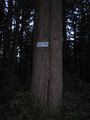
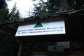
We didn't realize before that some trees are sensitive to noise.
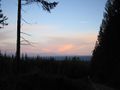
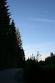
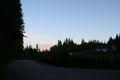
View of the Fraser Valley and the North Cascades at sunset, from a kilometre or so up the trail.

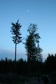
The moon illuminated the trail well enough that where it was not hidden behind trees, it was possible to walk safely without flashlights.


Pictures from srs0's perspective
For some reason, most of the photos look jagged if you don't look click through to the full image. I don't know why, sorry!
Trip to the hashpoint:
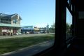
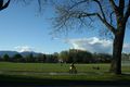
Arriving at UBC.

Meeting up with Elbie.
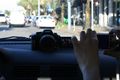
Cameras abound in this geohashing vehicle!
Driving through Vancouver.
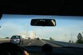
Crossing the river.
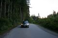
On the destination street.
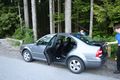
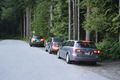
Arrived at the start point of the hike.
Waiting for the others to arrive.
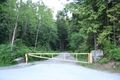
The gate blocking further vehicle progress.


Arrival of the other groups:
The second vehicle arrives...
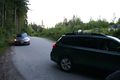
...closely followed by the third.
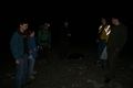
Everyone's here!
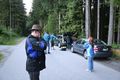
Preparing to set out.
The drivers returning.


Hiking to the hashpoint:
Time to leave the road.
That's where we are.
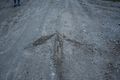
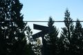
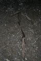
A mysterious arrow.
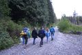
The group hiking up the mountain.
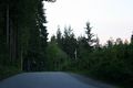
It's getting dark...
Now it is dark!
A false arrow.
Waiting at the arrow.
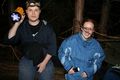
At the hashpoint, geohashers #1 and #2.
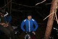
At the hashpoint, geohasher #3.
At the hashpoint, geohasher #4.
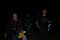
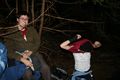
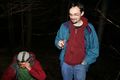
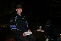
At the hashpoint, geohashers #5 and #6.
At the hashpoint, geohasher #7.
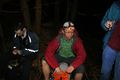
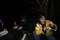
At the hashpoint, geohashers #8 and #9.
At the hashpoint, geohashers #9 and #10.

At the hashpoint, geohasher #11.
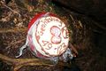
Cake!
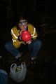
Balloons!
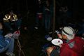
At the hashpoint, eating cake.


Achievements
The Vancouver Graticule earned the 2010 Geohashing Day achievement
|