Difference between revisions of "Newark, New Jersey"
imported>Jevanyn (How do we find out more about suggested alternate locations on the peeron lookup map?) |
(Does "Possibly flooded" go without saying?) |
||
| Line 22: | Line 22: | ||
== Daily Locations == | == Daily Locations == | ||
| − | <!-- For Monday through Thursday, use {{#time}} for the current date | + | <!-- For Monday through Thursday, use {{#time}} for the current date --> |
'''Coordinates for {{#time:Y-m-d}}: {{coordinates graticule|{{#time:Y-m-d}}|lat=40|lon=-74}}''' | '''Coordinates for {{#time:Y-m-d}}: {{coordinates graticule|{{#time:Y-m-d}}|lat=40|lon=-74}}''' | ||
| − | (3/ | + | (3/15) Industrial complex off Smith Street, in the Keasbey area of Edison, Union County. Possibly flooded. |
| − | + | ||
| − | <!-- For weekends, use fixed dates so that all three are available | + | <!-- For weekends, use fixed dates so that all three are available |
'''Coordinates for 2010-03-12: {{coordinates graticule|2010-03-12|lat=40|lon=-74}}''' | '''Coordinates for 2010-03-12: {{coordinates graticule|2010-03-12|lat=40|lon=-74}}''' | ||
| Line 42: | Line 42: | ||
: Behind a house on Lafayette Street, Rumson, Monmouth County. | : Behind a house on Lafayette Street, Rumson, Monmouth County. | ||
| + | --> | ||
== Cities in this Graticule == | == Cities in this Graticule == | ||
Revision as of 13:44, 15 March 2010
| Scranton, PA | Newburgh, NY | Danbury, CT |
| Allentown, PA | Newark | New York City |
| Philadelphia, PA | Atlantic City | 39,-73 |
|
Today's location: not yet announced | ||
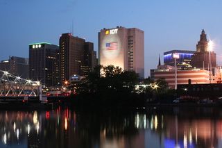
The Newark graticule is at 40 N, -74 W. This may be the most populous graticule in the United States, with a population in the neighborhood of 7 million people. It includes almost the entire northern half of New Jersey, the most densely populated state (Census), as well as Staten Island, western sections of Brooklyn and lower Manhattan in New York, and a part of Pennsylvania northeast of Philadelphia. In addition, other than Raritan Bay, there are no large sections of water.
Thanks to Meteorswarm, we have a Facebook group for the "North Jersey" graticule. Meet-ups can be coordinated here or there.
Contents
Daily Locations
Coordinates for 2024-05-17: 40.8436556, -74.0066635
(3/15) Industrial complex off Smith Street, in the Keasbey area of Edison, Union County. Possibly flooded.
Cities in this Graticule
| New Jersey | New York | Pennsylvania |
| Newark | Staten Island | New Hope |
| Jersey City | Lower Manhattan | Levittown |
| New Brunswick | Parts of Brooklyn | Langhorne |
| Trenton |
Local Geohashers
- Madalis
- bjimba
- krip
- trntr

- TorsionalMetric
- Direwulf
- Jevanyn

- LangleyLGLF (When @Rutgers)


- Esteban

- Science Works!

- sve
- Zubenelgenubi


- Mike
- darko
- jimpoz
- RminusQ

- Brandon
 20px and his father
- GISninja

- BlastOButter42, but probably only if it's near the city and New York's isn't closer
- AlexF
- Knitting Duck
- Flashbullzeye
- Kyukket
- dieKatze88
Attempted geohashes
- Main page: Category:Meetup in 40 -74
- Monday, March 8: I was just here, too!
- Thursday, March 4: Jevanyn had driven past the house a dozen times. but can he prove it?
- Tuesday, March 2: Geohashing party or sorts at Friendly's in the Princeton area.
- Sunday, February 28: An easy first geohash for dieKatze88 near Drew University.
- Tuesday, February 22: Veterans Park, Trenton, near the entrance on Klockner Rd. Across from Steinart High School.
- Saturday, February 13: Tried for a meetup at Woodbridge Mall.
- Monday, February 1: A chilly evening geohash, but only two towns from home for Jevanyn.
- Saturday, January 23: Saturday's geohash was a walk in the park, literally!
- Tuesday, January 5: Jevanyn tried for a birthday geohash with his new GPS, but the location was not reachable.
Archived geohashing expeditions for 2008 and 2009.
Links
[Bing Maps] with Bird's Eye view, better idea of scale and finding paths through complicated terrain.
[Zillow] real estate valuation site, to find out if it's private property / a rough neighborhood / both.
[NJ Transit] for public transportation geohashes
And of course [Wikipedia] to find out which township/borough/county a geohash is in :-)
Wanted: a good bike-map website. NJ Bike Map.com is okay but doesn't include a lot of local bike trails.
