Difference between revisions of "Springfield, Illinois"
From Geohashing
imported>Mystrsyko (→Expeditions) |
imported>Mystrsyko (→Expeditions) |
||
| Line 21: | Line 21: | ||
== Expeditions == | == Expeditions == | ||
| + | * [[2015-07-06 39 -89|2015-07-06]]: In the median of Veterans Parkway in Springfield. | ||
* [[2015-06-23 39 -89|2015-06-23]]: [[User:Mystrsyko|Mystrsyko]] biked to this point on the edge of a corn field. | * [[2015-06-23 39 -89|2015-06-23]]: [[User:Mystrsyko|Mystrsyko]] biked to this point on the edge of a corn field. | ||
* [[2015-05-28 39 -89|2015-05-28]]: [[User:Mystrsyko|Mystrsyko]] and [[User:Dolphintreasure|Dolphintreasure]] biked to this point near a creek in Springfield. | * [[2015-05-28 39 -89|2015-05-28]]: [[User:Mystrsyko|Mystrsyko]] and [[User:Dolphintreasure|Dolphintreasure]] biked to this point near a creek in Springfield. | ||
Revision as of 16:30, 6 July 2015
| Galesburg | Peoria | Champaign/Urbana |
| Jacksonville | Springfield | Decatur |
| St. Louis, Missouri | Belleville | Fairfield |
|
Today's location: geohashing.info google osm bing/os kml crox | ||
About
The Springfield, Illinois graticule is located at latitude 39, longitude -89.
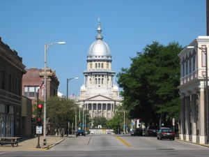
Springfield is the capital city of the U.S. state of Illinois and with a population of 116,250 as of the 2010 census, is the largest city in central Illinois. Springfield is perhaps most famous for being the home of the 16th President of the United States, Abraham Lincoln, from 1837 to 1861. The graticule is mostly rural farmland, but also includes the towns of Taylorville, Carlinville, and Litchfield, as well as parts of Decatur and Vandalia.
Expeditions
- 2015-07-06: In the median of Veterans Parkway in Springfield.
- 2015-06-23: Mystrsyko biked to this point on the edge of a corn field.
- 2015-05-28: Mystrsyko and Dolphintreasure biked to this point near a creek in Springfield.
- 2015-04-27: Mystrsyko failed to reach this point in somebody's front yard.
- 2015-04-16: Mystrsyko biked to this point in an empty farm field.
- 2014-10-24: Mystrsyko and DolphinTreasure couldn't get to this point in a restricted area behind Hobby Lobby.
- 2014-10-07: Mystrsyko and DolphinTreasure biked to the hash located in a harvested corn field.
- 2010-11-04: Expedition to a parking lot by Dvdllr of the North.
- 2009-04-06: Solo geohasher excursion by Nathan. Coordinates fell in the middle of a harvested corn field.
Notable Events
- On 2009-04-06, Nathan was the first to reach a hash point in this graticule, which earns him the Virgin Graticule Achievement.
Local Geohashers
- Nathan has completed a geohash here, although he is not from this graticule.
- Mystrsyko and DolphinTreasure recently moved to this graticule.
