Difference between revisions of "User:Ted"
From Geohashing
imported>Ted m (typo) |
imported>Ted (achievement updates) |
||
| (4 intermediate revisions by the same user not shown) | |||
| Line 1: | Line 1: | ||
* Name: Ted | * Name: Ted | ||
| − | ** Often seen associating with wife Vicki and dogs | + | ** Often seen associating with wife Vicki and dogs Rose & Roxanne. |
* Location: [http://maps.google.com/maps?f=q&hl=en&geocode=&q=37.1173+-121.969 The mountains] above [[Santa Cruz, California]], USA | * Location: [http://maps.google.com/maps?f=q&hl=en&geocode=&q=37.1173+-121.969 The mountains] above [[Santa Cruz, California]], USA | ||
** Alternate Gradicule: [[San Jose, California]] | ** Alternate Gradicule: [[San Jose, California]] | ||
| Line 23: | Line 23: | ||
: [[2008-06-07_37_-121]] (xkcd) [SCUW] Sat in a hay field in Patterson with some lovely companions. Ate @ Harley's Grub Shack. | : [[2008-06-07_37_-121]] (xkcd) [SCUW] Sat in a hay field in Patterson with some lovely companions. Ate @ Harley's Grub Shack. | ||
: [[2008-08-11_36_-122]] Santa Cruz! And GEO came and made GEO-hash :) | : [[2008-08-11_36_-122]] Santa Cruz! And GEO came and made GEO-hash :) | ||
| + | : [[2013-05-26_37_-121]] [SCUW] (Mouseover Day, observed.) About 1/4 mile from my house. | ||
== Excuses == | == Excuses == | ||
| Line 41: | Line 42: | ||
</gallery> | </gallery> | ||
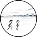
'''NOTE:''' That's an actual picture of me, in the first one (artist's rendition)! | '''NOTE:''' That's an actual picture of me, in the first one (artist's rendition)! | ||
| + | |||
{{Template:Land geohash | {{Template:Land geohash | ||
| Line 73: | Line 75: | ||
| name=Ted | | name=Ted | ||
}} | }} | ||
| − | + | {{Cold geohash | |
| + | | latitude=37 | ||
| + | | longitude=-121 | ||
| + | | date=2008-06-07 | ||
| + | | temperature=88°F (31.1° Metric) | ||
| + | | name=Ted was the first person to have | ||
| + | }} | ||
{{No trespassing | {{No trespassing | ||
| latitude=37 | | latitude=37 | ||
| Line 80: | Line 88: | ||
| name=Ted | | name=Ted | ||
}} | }} | ||
| + | {{Minesweeper geohash | ||
| + | | graticule = San_Jose%2C_California | ||
| + | | ranknumber = 1 | ||
| + | | sw = true | ||
| + | | date=2008-08-11 | ||
| + | | latitude=36 | ||
| + | | longitude=-122 | ||
| + | | name = [[User:Ted]] | ||
| + | }} | ||
| + | {{Radio Yerevan | ||
| + | | achievement = [[OpenStreetMap achievement]] | ||
| + | | detail = it was Google, not OSM, and his edit is still under review. | ||
| + | | date = 2013-05-26 | ||
| + | | latitude = 37 | ||
| + | | longitude = -121 | ||
| + | | user = [[User:Ted|User:Ted]] | ||
| + | }} | ||
| + | {{Cliffs of Despair | ||
| + | | latitude = 37 | ||
| + | | longitude = -121 | ||
| + | | date = 2013-05-26 | ||
| + | | name = [[User:Ted|User:Ted]] | ||
| + | | terrain = that damned dam | ||
| + | | image = 2013-05-26_37_-121-b.jpg | ||
| + | }} | ||
| + | {{Ambassador geohash | ||
| + | | latitude = 37 | ||
| + | | longitude = -121 | ||
| + | | date = 2013-05-26 | ||
| + | | granter = Bob | ||
| + | | name = [[User:Ted|User:Ted]] | ||
| + | }} | ||
| + | {{Geohashing Day | ||
| + | | latitude = 37 | ||
| + | | longitude = -121 | ||
| + | | year = 2013 | ||
| + | | coorddate= 2013-05-26 | ||
| + | | mouseover = true | ||
| + | | name = [[User:Ted|User:Ted]] | ||
| + | | celebration = dancing ''The Mouseover'' | ||
| + | | image = 2013-05-26_37_-121-b.jpg | ||
| + | }} | ||
| + | |||
| + | |||
| + | |||
| − | |||
| − | |||
| − | |||
| − | |||
| − | |||
| − | |||
| − | |||
* I was the first-ever achiever of the coveted [[Cold_Geohash]] award, setting the record for the coldest Geohash to date, at 88°F :) | * I was the first-ever achiever of the coveted [[Cold_Geohash]] award, setting the record for the coldest Geohash to date, at 88°F :) | ||
Latest revision as of 21:51, 27 May 2013
- Name: Ted
- Often seen associating with wife Vicki and dogs Rose & Roxanne.
- Location: The mountains above Santa Cruz, California, USA
- Alternate Gradicule: San Jose, California
- Alternate to the alternate: San Francisco, California / Salinas, California (Who had any idea so much of the bay area was so inaccessable...?)
- Alternate Gradicule: San Jose, California
I'm an instrument-rated private pilot. I may have to dust off the old license in order to effectively make some of these meetups, given the private-property nature of the several I've tried recently.
I typically bring Once Upon A Time as my game.
Geohash meetups attempted
- 2008-05-24_37_-121 (xkcd) [SCUW] Inadvertently went to the 5/23 location. It was behind private property, inaccessible. Met some very nice ranchers.
- 2008-05-31_37_-121 (xkcd) [SCUW] Was behind private property, inaccessible. Nearby cafe also closed.
- 2008-07-19_37_-121 (xkcd) [SCUW] Behind locked gate, could not contact owners. Claimed No_Trespassing_Geohash Achievement.
- * (xkcd) = Saturday, official xkcd meetup @ 4pm
- * SCUW = Santa Cruz spot under water.
Geohash meetups attended
- 2008-06-01_37_-121 [SCUW] Made it! Only minor trespassing -- "barely noticeable!" Met some fine folk...
- 2008-06-07_37_-121 (xkcd) [SCUW] Sat in a hay field in Patterson with some lovely companions. Ate @ Harley's Grub Shack.
- 2008-08-11_36_-122 Santa Cruz! And GEO came and made GEO-hash :)
- 2013-05-26_37_-121 [SCUW] (Mouseover Day, observed.) About 1/4 mile from my house.
Excuses
- 2008-06-14, -21 and -28 (xkcd*3) where all up in the Northeast end of the graticule, and I wasn't able to make it. Boo on me!
- To make up for it, I did some work on The Historic Map Page, and it's working pretty well, now.
- 2008-07-28_36_-122 Santa Cruz's hash was actually on land! But I didn't find out until late in the evening, and so missed it. :(
- 2008-08-02_37_-121 (xkcd) Is a quite convenient spot (someone's house in Campbell), but I'm hosting a pig-roast that day. SC/SF/SJ Geohashers that I've met are welcome, drop me an email.
- 2008-08-09 (xkcd) Then, this weekend, I'm out pig-hunting. <sigh> Maybe the spot will land very near where I'm headed... :)
- ... May, 2009. I've been a total slacker! In my defense, I've been posting weekly "where the spots are" notes to the newsgroup. I also haven't seen much in the way of activity, there. I guess we're all very busy. I actually made 2 hashes since last reporting, but haven't entered them, yet. Need to find the pix on my camera and figure out when/where we were.
Other

Land Geohash

GeoTrash
XKCD-100 Geohache

Circus Geohache


NOTE: That's an actual picture of me, in the first one (artist's rendition)!
Ted earned the Land geohash achievement
|
Ted earned the GeoTrash Geohash Achievement
|
Ted earned the XKCD-100 Achievement
|
Ted earned the No Batteries Geohash Achievement
|
Ted earned the Circus Geohash Achievement
|
Ted was the first person to have earned the Cold geohash achievement
|
Ted earned the No trespassing consolation prize
|
User:Ted achieved level 1 of the Minesweeper Geohash achievement
|
Is it true that User:Ted earned the OpenStreetMap achievement?
|
User:Ted earned the Cliffs of Despair consolation prize
|
User:Ted earned the Ambassador achievement
|
User:Ted earned the 2013 Mouse Over Day achievement
|
- I was the first-ever achiever of the coveted Cold_Geohash award, setting the record for the coldest Geohash to date, at 88°F :)
- I'm going to go check & see if I got the hottest, too ;)
- Darn! The folks at 2008-06-07_30_-84 beat me with 103°F
- There is no ribbon, yet, but I am claiming the Smoking achievement (with GEO-hash!) for 2008-08-11_36_-122. Pix at the expedition site.
- I don't have proof (yet!), but 2008-08-11_36_-122 was also a Déjà_Vu hash for me. Still digging for pix.
- Me getting circus achievement on 6/7/8
- I also created (but have not, yet, achieved) the Air Geohash Achievement
Categories:
- Land geohash achievement
- Geotrash achievement
- Xkcd-100 geohash achievement
- No batteries geohash achievement
- Circus geohash achievement
- Cold geohash achievement
- No trespassing consolation prize
- Minesweeper geohash achievement
- Radio Yerevan
- Cliffs of despair consolation prize
- Ambassador achievement
- Geohashing Day achievement