2015-08-09 52 0
| Sun 9 Aug 2015 in Cambridge, UK: 52.9569199, 0.6773131 geohashing.info google osm bing/os kml crox |
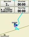
Location
In a wood south of Brancaster Staithe, Norfolk, UK.
Participants
Plans
Visit this point after midnight after a 4pm meetup at 2015-08-08 52 0. Kill time with a fish and chip supper and visits to the delights on the north Norfolk coast.
Expedition
This went more or less to plan. I got fish and chips (plaice) in King's Lynn having been warned about the queues in Wells next the Sea. Also Wells was a bit off the route. I checked out the terrain before it got dark, There was only a rabbit fence, easily stepped over. Then I went to Burnham Overy Staithe, perhaps one of my favourite places on earth. The tide was out and families were walking back from the coast 45 minutes away. Some had crossed the mud flats and looked as though they were wearing Wellington boots but it was mud. After wading the creek they emerged clean. I drank a flask of coffee 80% decaf. Then I snoozed for a bit. I don't usually need to be out at midnight two days in a row but the Cambridge meetup was special!
Back near the hashpoint I parked on some concrete hard standing and walked along the road heading south west. There was a field perimeter path next to the woodland. I got as close as possible on this path and then hopped over the bunny fence. There was a steep climb up to the hashpoint, altitude 50m, a mountain by Norfolk standards! This was a mature beech wood with a dense canopy and little vegetation on the forest floor making progress a little easier. There were some nice ferns growing. I crossed a vehicular dirt track in the wood before reaching the destination. With time to kill, it was easy to time my arrival and not have to wait too long for the day to roll over. Emerging from the trees, there was a fine view across the Wash towards the lights of Skegness. I was able to get back by a shorter route following tractor tracks in the partially harvested wheat field.
Photos

Track in Google Earth
Proof


Achievements
Sourcerer earned the Midnight Geohash achievement
|
Sourcerer earned the Two to the N achievement
|
Expeditions and Plans
| 2015-08-09 | ||
|---|---|---|
| St. Marys, Pennsylvania | Pedalpusher, Simon the dog, Myka the dog | Bradford, PA on Gates Hollow Rd next to a driveway |
| Mannheim, Germany | Tads | crop field in Egelsbach (between Frankfurt and Darmstadt) |
| Erfurt, Germany | Juja, Frankie, Benjy Mouse | In a forest near Beutnitz, Thuringia. |
| Cambridge, United Kingdom | Sourcerer | In a wood south of Brancaster Staithe, Norfolk, UK. |
Sourcerer's Expedition Links
2015-08-08 52 0 - 2015-08-09 52 0 - 2015-08-12 52 1 - KML file download of Sourcerer's expeditions for use with Google Earth.