Difference between revisions of "2010-03-13"
From Geohashing
imported>AperfectBot m (Ook.) |
imported>ReletBot m (moving from Template:auto gallery to Template:auto gallery2) |
||
| Line 1: | Line 1: | ||
<noinclude>{{date navigation}}</noinclude> | <noinclude>{{date navigation}}</noinclude> | ||
{{auto coordinates|2010-03-13}} | {{auto coordinates|2010-03-13}} | ||
| − | {{auto | + | {{auto gallery2|2010-03-13}} |
<noinclude>{{expedition summaries|2010-03-13}}</noinclude> | <noinclude>{{expedition summaries|2010-03-13}}</noinclude> | ||
Latest revision as of 22:39, 23 August 2010
Expedition Archives from March 2010
Friday 12 March 2010 | Saturday 13 March 2010 | Sunday 14 March 2010
See also: Category:Meetup on 2010-03-13
Coordinates
All locations: .8458133, .6716763
Globalhash:
62.246388631253,61.803464889175
Photo Gallery
|
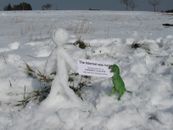
image:2010-03-13 -19 146 03-impassable-tracks.jpg | Townsville, Australia |
Expeditions and Plans
| 2010-03-13 | ||
|---|---|---|
| Townsville, Australia | Matty K | 19° 50' 44.93" S, 146° 40' 18.03" E 500m off the Flinders Highway,... |
| Melbourne East, Australia | myka, possibly Fergus, Kozz | Barber Hill Track, near Three Bridges (Locality?) |
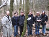
| Innsbruck, Austria | DerFlob, The T-Man | This Saturday's hash was on a hill near the village of Großhartpenning in s... |
| Pforzheim, Germany | Koepfel, Ekorren | Outside of Büchenbronn, a village incorporated to Pforzheim. |
| Mannheim, Germany | ilpadre, Fivetonsofflax, Euterkuh, Koepfel, Ekorren, A RNZ reporter | In a forest near Darmstadt. |


