2021-04-16 52 10
| Fri 16 Apr 2021 in Braunschweig: 52.2450232, 10.1473564 geohashing.info google osm bing/os kml crox |
Location
This Geohash is located on a field in Adenstedt.
Participants
Expedition
27.6 km one way. I would usually take my bicycle for a Geohash this far away, but SastRe.O's recent expedition on foot inspired me to do a similar expedition. To make up for the flatter terrain, as well as walking instead of jogging, I was going to walk a longer distance. I took two powerbanks so my phone would not run out of energy and food and water so I would not run out of energy. I left at dawn.
The first body part to hurt were my shoulders, but that quickly got better when I used my arms to support the backpack. My first pause was after half of the distance or three hours in Klein Lobke. By then my feet hurt too, but it wasn't that bad.
As I was approaching Adenstedt at noon, almost at the Geohash, JoDaEmPa asked me if I was coming today. I thought he may have been already there, but he wasn't, as it turned out he had plans for the afternoon, which he later told me he did not pursue after all. So I located the coordinates on a field in some tractor tracks alone. As I sat down to eat on the edge of the field, I noticed that I forgot to record proof, so I went back to do so. I ate a bit, but I would have prefered a bench over sitting on the ground, so I did not linger long and went on my way back.
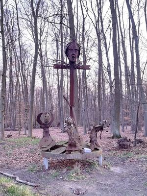
There were no benches in Bierbergen, but I found one in Hohenhameln and ate most of my lunch. My calves were hurting now too, and soon my thighs would hurt as well. I was resting in every town now, sometimes between towns too. Can't say I recommend walking this much. A man offered me a ride. Can you believe it, on a sunny day, during a pandemic? Maybe because there was no sidewalk at this stretch of the road. But said no, since I wanted to break thunk's record. In the Bockmerholz forest I encountered a creepy sculpture. I had walked past the site in the morning, had the sculpture been here before? Perhaps I just did non notice. In the end my hips were hurting too. I did not find out which body part comes next, since I arrived home. It was dusk now. Climbing the stairs was not easy.
Google Fit says I walked 58.97 km, but that seems too much, considering that Google Maps shows only 55.2 km for the distance between my home and the Geohash and back. Viking says the distance from my tracklog, which starts and ends at a nearby memorial, not my home, plus the distance from my home to the memorial and back is 56.62 km, but that could include GPS jitter. I'll go with 55.2 km.
Interestingly, I only had one small blister which I barely noticed the day afterwards. Despite all the complaining about hurting body parts, I'm actually okay. Even though my feet and legs still do hurt the day afterwards, I was able to walk more or less normally and even cycle a small distance.
Photos
On the way there
At the Geohash
On the way back
Tracklog
Achievements
Fippe earned the Land geohash achievement
|
Fippe earned the Walk geohash Achievement
|


