User:10d100h
Currently living in the south of the Santa Rosa, California (38, -122) graticule. Used to live in Tampa, Florida (27, -82), and might do some intermediate stays in Weatherford, Oklahoma (35, -98).
It must've been around September 2023 when I heard of geohashing, and of course I didn't understand it at first, but it's allowed me to finally understand world coordinates and I often imagine of going into the most nowheres with this. It also got me to look at maps more times than I'd be willing to count.
2025-01-19: moved to 38,-122
(status & updates)
Contents
Expeditions
![]() 2025-03-08 37 -122 On a fence, Richmond, CA
2025-03-08 37 -122 On a fence, Richmond, CA
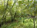
![]() 2025-02-23 40 -124 In a forest, Kneeland, CA
2025-02-23 40 -124 In a forest, Kneeland, CA
![]() 2025-02-08 38 -122 Rector Reservoir Trail, Yountville, CA
2025-02-08 38 -122 Rector Reservoir Trail, Yountville, CA
![]() 2024-12-30 28 -82 Northwest Equestrian Park, Citrus Park, FL
2024-12-30 28 -82 Northwest Equestrian Park, Citrus Park, FL
![]() 2024-12-24 28 -82 Some sort of parcel, Wesley Chapel, FL
2024-12-24 28 -82 Some sort of parcel, Wesley Chapel, FL
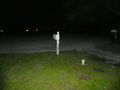
![]() 2024-10-18 35 -97 In a crop field, Union City, OK
2024-10-18 35 -97 In a crop field, Union City, OK
![]() 2024-09-15 27 -81 Next to a tree, Lakeland, FL
2024-09-15 27 -81 Next to a tree, Lakeland, FL
A gallery, if you need it


Other things
/Standards - or: maybe I should bike next time
Goals
Like everyone else, I dream... and like everyone else, maybe a bit too much. I might create a subpage detailing the difficulty of these.
- All counties of California (2/58) - lofty, but I'm here, so I'll see about it...
- All US states + DC (3/51) - definitely possible, but might prove difficult in Texas (so many fences), Alaska, and Hawaii (going out of my way to get lucky)
- All EU members (27) - or, discovering if 3 months is amazing enough. Language barriers are the main issue; some countries like Croatia (landmines) might prove harsher
- Alternatively, all CoE members (46) - this one is not likely as it requires additional language scripts, microstates[1], and more of the volatile east
- All Canadian provinces and territories (13) - yes, good luck with NWT and Nunavut[2] :)
- Globalhash - just because it's a label of prestige
- A full globetrotter (1/6) - this, too
- Graticule hopper (5/100)
- Centurion (1/100)
- A consecutive of longer than a week - it's probably hard to keep up at that point
- In Falls Church, VA; the Kentucky Bend; Kalawao County, HI (closed to non-residents)
- All boroughs and census areas of Alaska - thinking of how hard they might be to geohash
- Get there with an interesting vehicle - short list: ATV, tractor, golf cart, snowmobile, jetski, ...
Gear
- GPS unit: eTrex Solar
- It was the solar panel that sold it for me. Maybe a bad idea; 32 MB means not a lot of track (although roughly 200 hours' worth should be enough), no maps (and navigation), no screenshotting, a proprietary tracklog format (.fit instead of .gpx)... and those are the only drawbacks I can think of. These don't really bother me, so long as I'm able to locate the point, which it does fairly well as it relies on 5 different navigation systems.
- Camera: Panasonic DC-ZS70
- I wanted a camera. Weird, I already have too many. Rather, I wanted a camera I could take anywhere. 15,000 photos later, I still press on.
- Phone: iPhone 12 mini
- I don't use this terribly often for geohashing, but I do use it for navigating to the point, as a last minute rush when I don't have the coordinates, and when I ditch the ZS70 due to humidity. Elsewhere, it serves as... well, my phone. Scratches, drops, a case that looks like it's been through a war zone... but it still calls and texts and serves as a hotspot.
Mapping things
- Graticule outlines file (as shapefile .zip) from Natural Earth Data - if you want to get an idea of how graticules cover large regions (or you want to look at your graticule). Use the 1 degree link unless you want to divide France by the prime meridian. Accurate to within .0009-.0012 degrees latitude, .0009 degrees longitude (the "10M" version doesn't help).
US only
Most of these are present in OSM as well, so use these if you have to make things brighter.
- Census boundary files - for counties (including not-counties), subdivisions thereof, metro areas, and other things, all in shapefile for national maps or KML for state maps. Useful for Regional and Reverse regional along with the graticule lines above, or if you like to be too specific when inputting the location for your expedition report.
- Census TIGER/Line boundary files - basically, an alternative version of the above. Has many of the same feature groups, but includes additional things useful for planning, such as military installations, tribal land, "urban areas" (a more specific/proper definition of a metro area), railroads, and, if you're that insane, census blocks. All files are in shapefile .zip.