imported>ReletBot |
|
| (25 intermediate revisions by 12 users not shown) |
| Line 1: |
Line 1: |
| | {{graticule | | {{graticule |
| − | |map = <map lat="41" lon="-71" /> | + | | lat= 41 |
| − | |nw = [[Springfield, Massachusetts|Springfield, MA]] | + | | lon= -71 |
| − | |n = [[Boston, Massachusetts|Boston, MA]] | + | | nw = [[Springfield, Massachusetts]] |
| − | |ne = [[Lynn, Massachusetts|Lynn, MA]] | + | | n = [[Boston, Massachusetts]] |
| − | |w = [[Hartford, Connecticut|Hartford, CT]] | + | | ne = [[Lynn, Massachusetts]] |
| − | |e = [[Cape Cod, Massachusetts|Cape Cod, MA]] | + | | w = [[Hartford, Connecticut]] |
| − | |sw = [[Riverhead, New York|Riverhead, NY]] | + | | name = [[Providence, Rhode Island|Providence]] |
| − | |s = | + | | e = [[Cape Cod, Massachusetts]] |
| − | |se = | + | | sw = [[Brookhaven, New York]] |
| | + | | s = [[Atlantic Ocean 40, -71|Atlantic Ocean]] |
| | + | | se = [[40,-70]] |
| | }} | | }} |
| | | | |
| Line 22: |
Line 24: |
| | | | |
| | = Officialish Welcome = | | = Officialish Welcome = |
| − | Welcome! The Providence, Rhode Island [[graticule]] is at [http://irc.peeron.com/xkcd/map/map.html?lat=41&long=-71 latitude 41, longitude -71]. Note that this graticule contains nearly all of the state of Rhode Island, as well as bits of Massachusetts, Connecticut, and the tip of Long Island, NY (it is one of the few known graticules to span 4 US states). And also, possibly, aquaraptors. | + | Welcome! The Providence, Rhode Island [[graticule]] is at {{Today's location|lat=41|lon=-71|text=latitude 41, longitude -71}}. Note that this graticule contains nearly all of the state of Rhode Island, as well as bits of Massachusetts, Connecticut, and the tip of Long Island, NY (it is one of the few known graticules to span 4 US states). And also, possibly, aquaraptors. |
| | | | |
| | '''Today's Location:''' | | '''Today's Location:''' |
| − | [[http://irc.peeron.com/xkcd/map/map.html?date={{LOCALYEAR}}-{{LOCALMONTH}}-{{LOCALDAY2}}&lat=41&long=-71&zoom=9&abs=-1 Providence, RI]] | + | [{{Today's location|lat=41|lon=-71|text=Providence, RI}}] |
| | | | |
| | [[http://www.facebook.com/group.php?gid=16394303397 Rhode Island Geohashing Facebook Page]] | | [[http://www.facebook.com/group.php?gid=16394303397 Rhode Island Geohashing Facebook Page]] |
| Line 42: |
Line 44: |
| | = Daily Locations = | | = Daily Locations = |
| | | | |
| − | '''2008-05-21:''' 41.179467°, -71.861537° Long Island Sound. (No visits.) | + | [[2008-05-26_41_-71|'''2008-05-26:''']] 41.673128°, -71.607309° Near bridge on Hill Farm Rd., Coventry, RI. Meeting SUCCESSFUL!!! Click for details and pics. |
| | | | |
| − | '''2008-05-22:''' 41.972874°, -71.238697° Near Norton, MA. (No visits.) | + | [[2008-05-30_41_-71|'''2008-05-30:''']] 41.853102°, -71.244603° North of Winthrop St. (Route 44) in Rehoboth, MA. Geohash UNREACHABLE!!! Click date for details. |
| | | | |
| − | '''2008-05-23:''' 41.400246°, -71.722772° Near Bradford, RI. (No visits.) | + | [[2008-06-01_41_-71|'''2008-06-01:''']] 41.349107°, -71.916239° Behind houses near Stony Brook on Stonington Rd. (Route 1) in Stonington, CT. GEOHASH SUCCESSFUL! |
| | | | |
| − | '''2008-05-24:''' 41.126648°, -71.547533° Long Island Sound. (No visits.) | + | [[2008-06-03_41_-71|'''2008-06-03:''']] 41.957992°, -71.128935° Near Myles Standish Industrial Park in Taunton, MA. GEOHASH SUCCESSFUL! Bicycle Geohash completed by [[User:Ben|Ben]] and Grace! |
| | | | |
| − | '''2008-05-25:''' 41.941774°, -71.182874° Wading River, near Norton Center, MA. (No visits.) | + | [[2008-07-09_41_-71|'''2008-07-09:''']] 41.5924897°, -71.0418876° Near a driveway on Old Oak Run Rd. in Westport, MA. Geohash successful! |
| | | | |
| − | [[2008-05-26_41_-71|'''2008-05-26:''']] 41.673128°, -71.607309° Near bridge on Hill Farm Rd., Coventry, RI. | + | [[2008-07-12_41_-71|'''2008-07-12:''']] 41.6128965°, -71.2604917° Northern edge of Carnegie Abbey Golf Club property in Portsmouth, RI. Meetup successful! |
| | | | |
| − | Meeting SUCCESSFUL!!! Click above for details and pics.
| + | [[2008-07-15_41_-71|'''2008-07-15:''']] 41.9238259°, -71.5172238° Wooded area above private property north of intersection of Routes 116 and 7. Geohash technically unsuccessful, but see hash page for details. |
| | | | |
| − | '''2008-05-27:''' 41.209677°, -71.101442° Between Rhode Island Sound and Nantucket Sound. (No visits.) | + | [[2008-09-04_41_-71|'''2008-09-04:''']] 41.86017°, -71.062298° Roadside of Carlos Estates Rd. in Taunton, MA. Geohash successful. |
| | | | |
| − | '''2008-05-28:''' 41.68745°, -71.212208° Mt. Hope Bay, between Bristol, RI and southern Fall River, MA. (No visits.) | + | [[2008-09-06_41_-71|'''2008-09-06:''']] 41.899913°, -71.186548° North of Glebe St. in Rehoboth, MA. Geohash unsuccessful. |
| | | | |
| − | '''2008-05-29:''' 41.464701°, -71.034125° Buzzards Bay, Westport, MA. (No visits.)
| + | [[2009-01-03_41_-71|'''2009-01-03:''']] 41.486105°, -71.941018° On Lake of Isles Golf Course. (Route 2), in North Stonington, CT. Geohash successful!! |
| − | | |
| − | [[2008-05-30_41_-71|'''2008-05-30:''']] 41.853102°, -71.244603° North of Winthrop St. (Route 44) in Rehoboth, MA. | |
| − | | |
| − | Geohash UNREACHABLE!!! Click date for details.
| |
| − | | |
| − | '''2008-05-31:''' 41.037487°, -71.281266° Block Island Sound. (No visits.)
| |
| − | | |
| − | [[2008-06-01_41_-71|'''2008-06-01:''']] 41.349107°, -71.916239° Behind houses near Stony Brook on Stonington Rd. (Route 1) in Stonington, CT.
| |
| − | | |
| − | GEOHASH SUCCESSFUL!
| |
| − | | |
| − | '''2008-06-02:''' 41.509526°, -71.521592° Woods east of rail and west of Slocum Rd. in Kingston, RI. (No visits.)
| |
| − | | |
| − | [[2008-06-03_41_-71|'''2008-06-03:''']] 41.957992°, -71.128935° Near Myles Standish Industrial Park in Taunton, MA.
| |
| − | | |
| − | GEOHASH SUCCESSFUL! Bicycle Geohash completed by [[User:Ben|Ben]] and Grace!
| |
| − | | |
| − | '''2008-06-04:''' 41.180292°, -71.845033° Block Island Sound. (No visits.)
| |
| | | | |
| − | '''2008-06-05:''' 41.066439°, -71.18439° Block Island Sound. (No visits.) | + | [[2009-01-12_41_-71|'''2009-01-12:''']] 41.690461°, -71.533341° In West Warwick, at the back of private property on Eileen Dr. Geohash unsuccessful. |
| | | | |
| − | '''2008-06-06:''' 41.759663°, -71.825383° South of Saw Mill Hill Rd., in South Killingly, CT. (No visits.) | + | [[2009-08-08_41_-71|'''2009-08-08:''']] 41.564584°, -71.452742° Near Prospect Rd.in North Kingstown, RI. Geohash unsuccessful! |
| | | | |
| − | '''2008-06-07:''' 41.501784°, -71.114371° In Richmond Pond, Westport, MA. (No visits.) | + | [[2009-09-08_41_-71|'''2009-09-08:''']] 41.5758507°, -71.7359792° In the woods off Ten Rod Rd, About half way between I-95 and the CT border. Geohash successful! |
| | | | |
| − | '''2008-06-08:''' 41.047581°, -71.230916° Block Island Sound. (No visits.) | + | [[2010-11-03_41_-71|'''2010-11-03:''']] 41.7207298°, -71.1924789° Near Brayton Point power plant. Geohash successful! |
| | | | |
| − | '''2008-06-09:''' 41.03773°, -71.790508° Block Island Sound. (No visits.)
| + | [[2012-05-13_41_-71|'''2012-05-13:''']] Near Pine St. in Rehoboth, MA. Unsuccessful - No Trespassing. |
| − |
| |
| − | '''2008-06-10:''' 41.875845°, -71.099769° Industrial site near W Water St., in Taunton, MA. (No visits.) | |
| | | | |
| − | '''2008-06-11:''' 41.465719°, -71.72636° East of Woodville Alton Road, across from Friel Farm Way, near Canonchet Brook in Hopkinton, RI. (No visits.) | + | [[2012-06-15_41_-71|'''2012-06-15:''']] At Lincoln High School. '''Success!!!''' |
| | | | |
| − | '''2008-06-12:''' 41.511448°, -71.633267° North of Punchbowl Trail in Hillsdale section of RIchmond/Kingston, RI. (No visits.) | + | [[2012-09-22 41 -71|'''2012-09-22:''']] On route 14/102, just west of Clayville Historic District. Geohash successful! |
| | | | |
| − | '''2008-06-13:''' 41.576378°, -71.158378° Southeast of intersection of 4 Rod Rd. and Lake Rd. in Fiverton, RI. (No visits.) | + | [[2012-12-21 41 -71|'''2012-12-21:''']] In the bike lane of N Main St, in Providence. Geohash successful! |
| | | | |
| − | '''2008-06-14:''' 41.806746°, -71.038887° Near the split of Route 79 and Malbone Rd. in Freetown, MA. (No visits.) | + | [[2012-12-26 41 -71|'''2012-12-26:''']] In someone's front yard near the airport. Geohash semi-successful. |
| | | | |
| − | '''2008-06-15:''' 41.47538°, -71.761277° East of Lawton Foster Rd S., possibly a private drive, in Hopkinton, RI. (No visits.) | + | [[2013-01-22 41 -71|'''2013-01-22:''']] East bank of the Providence River. Geohash successful! |
| | | | |
| − | '''2008-06-16:''' 41.4015923°, -71.189481° 4 Mi. south of Sakonnet Point. (No visits.) | + | [[2013-04-16 41 -71|'''2013-04-16:''']] In the woods near Barden Reservoir. Geohash successful! |
| | | | |
| − | '''2008-06-17:''' 41.134594°, -71.911703° Block Island Sound, north of Montauk Point. (No visits.) | + | [[2013-04-24 41 -71|'''2013-04-24:''']] A parking area behind Exeter-West Greenwich high school. Geohash successful! |
| | | | |
| − | '''2008-06-18:''' 41.223991°, -71.163912° Nantucket Sound. (No visits.) | + | [[2013-06-02 41 -71|'''2013-06-02:''']] Parker Woodland Wildlife Refuge in Foster. Geohash unsuccessful. |
| | | | |
| − | '''2008-06-19:''' 41.844501°, -71.686916° Northeast of intersection of Routes 101 and 102 in Foster, RI. (No visits.) | + | [[2013-12-12 41 -71|'''2013-12-12:''']] Veterans Cemetery in Exeter. Geohash successful! |
| | | | |
| − | '''2008-06-20:''' 41.866395°, -71.227014° North of Ralsie Rd. in Rehoboth, MA. Looks to be private property. (No visits.) | + | [[2014-03-02 41 -71|'''2014-03-02:''']] In the parking lot of a commercial building on Clarkson St, in Providence. Geohash successful! |
| | | | |
| − | '''2008-06-21:''' 41.979318°, -71.613962° Southeast of intersection of Victory Hwy and Route 7 in Slatersville/North Smithfield, RI. (No visits.) | + | [[2014-12-03 41 -71|'''2014-12-03:''']] In the street, near the intersection of North Main St. and Rochambeau Ave., in Providence. Geohash successful! |
| | | | |
| − | '''2008-06-22:''' 41.746529°, -71.264233° East of Birch Swamp Rd. in East Warren, RI. (No visits.)
| + | [[2016-11-27 41 -71|'''2016-11-27''']] Across from South County Commons in South Kingstown. Geohash successful! |
| − | | |
| − | '''2008-06-23:''' 41.592778°, -71.219295° West of Seapowet Avenue, Tiverton, RI, in Narragansett Bay. (No visits.)
| |
| − | | |
| − | '''2008-06-24:''' 41.844313°, -71.729276° East of Winsor Rd. in Foster, RI. (No visits.)
| |
| − | | |
| − | '''2008-06-25:''' 41.673988°, -71.835259° West of Porter Pond Rd. in Oneco/Sterling, CT. (No visits.)
| |
| − | | |
| − | '''2008-06-26:''' 41.446001°, -71.696255° Off Switch Rd. in Wood River Junction, RI, in a baseball field. (No visits.)
| |
| − | | |
| − | '''2008-06-27:''' 41.618945°, -71.230619° Sakonnet River, South of Island Park, Portsmouth, RI. (No visits.)
| |
| − | | |
| − | '''2008-06-28:''' 41.658111°, -71.365635° Off the northwest coast of Patience Island. (No visits.)
| |
| − | | |
| − | '''2008-06-29:''' 41.608045°, -71.575447° Woods southwest of intersection of Hopkins Hill Rd. and Henry Brown Rd. in Exeter, RI. (No visits.)
| |
| − | | |
| − | '''2008-06-30:''' 41.782433°, -71.274833° Rocky Run inlet, off Plamer (Palmer?) Brook in Swansea, MA. (No visits.)
| |
| − | | |
| − | '''2008-07-01:''' 41.081401°, -71.787723° Off coast of Montauk, NY. (No visits.)
| |
| − | | |
| − | '''2008-07-02:''' 41.280508°, -71.927578° Off coast of Fisher Island. (No visits.)
| |
| − | | |
| − | '''2008-07-03:''' 41.643686°, -71.010804° Near Locust Ave. and Route 6 in northern Westport, MA. (No visits.)
| |
| − | | |
| − | '''2008-07-04:''' 41.413007°, -71.731143° Southwest of Unkuri Dr. in Hopkinton/Westerly, RI. (No visits.)
| |
| − | | |
| − | '''2008-07-05:''' 41.148943°, -71.921296° North of Montauk Point, in Block Island Sound. (No visits.)
| |
| − | | |
| − | '''2008-07-06:''' 41.651635°, -71.893197° Near intersection of Kate Dowling and Pratt Rds. in Plainfield, CT. (No visits.)
| |
| − | | |
| − | '''2008-07-07:''' 41.481984°, -71.357909° North of Fort Wetherill, in water off Aquidneck Island. (No visits.)
| |
| − | | |
| − | '''2008-07-08:''' 41.09442°, -71.480486° Block Island Sound. (No visits.)
| |
| − | | |
| − | [[2008-07-09_41_-71|'''2008-07-09:''']] 41.5924897°, -71.0418876° Near a driveway on Old Oak Run Rd. in Westport, MA. | |
| − | | |
| − | Geohash successful!
| |
| − | | |
| − | '''2008-07-10:''' 41.337266°, -71.946654° South of railroad line, on peninsula east of Latimer Point and Andrews Island in CT. (No visits yet.)
| |
| − | | |
| − | '''2008-07-11:''' 41.5661950°, -71.5300921° Southwest of end of Pinoak Dr. in Exeter, RI. (No visits.)
| |
| − | | |
| − | [[2008-07-12_41_-71|'''2008-07-12:''']] 41.6128965°, -71.2604917° Northern edge of Carnegie Abbey Golf Club property in Portsmouth, RI.
| |
| − | | |
| − | Meetup successful!
| |
| − | | |
| − | '''2008-07-13:''' 41.4962415°, -71.2719690° Farmland adjacent to athletic/track field off Paradise Ave. in Newport, RI. (No visits.)
| |
| − | | |
| − | '''2008-07-14:''' 41.1469375°, -71.8314698° Block Island Sound. (No visits.)
| |
| − | | |
| − | [[2008-07-15_41_-71|'''2008-07-15:''']] 41.9238259°, -71.5172238° Wooded area above private property north of intersection of Routes 116 and 7.
| |
| − | | |
| − | Geohash technically unsuccessful, but see hash page for details.
| |
| − | | |
| − | '''2008-07-16:''' 41.458701°, -71.438995° North of Boston Neck Road in Narragansett, RI. (No visits.)
| |
| − | | |
| − | '''2008-07-17:''' 41.887085°, -71.160081° Driveway off Rocky Woods Ave. in Taunton, MA. (No visits.)
| |
| − | | |
| − | '''2008-07-18:''' 41.358674°, -71.148591° Rhode Island Sound. (No visits.)
| |
| − | | |
| − | '''2008-07-19:''' 41.109403°, -71.88764° Block Island Sound, near Montauk Point, NY. (No visits.)
| |
| − | | |
| − | '''2008-07-20:''' 41.089485°, -71.754067° Block Island Sound, less near than the day before to Montauk. (No visits.)
| |
| − | | |
| − | '''2008-07-21:''' 41.0414124°, -71.0382160° Rhode Island Sound. (No visits.)
| |
| − | | |
| − | '''2008-07-22:''' 41.217859°, -71.945675° Block Island Sound, southeast of Fishers Island. (No visits.)
| |
| − | | |
| − | '''2008-07-23:''' 41.054646°, -71.512507° South of Block Island. (No visits.)
| |
| − | | |
| − | '''2008-07-24:''' 41.819804°, -71.019989° Woods near railroad tracks south of Rte. 79 in Myricks. (No visits.)
| |
| − | | |
| − | '''2008-07-25:''' 41.688099°, -71.190774° West of Bay St., in Mt. Hope Bay, Fall River, MA. (No visits.)
| |
| − | | |
| − | '''2008-07-26:''' 41.349249°, -71.319051° South of Newport, in Rhode Island Sound. (No visits.)
| |
| − | | |
| − | '''2008-07-27:''' 41.786235°, -71.132024° On Rte. 138 in northern Somerset, MA. (No visits.)
| |
| − | | |
| − | '''2008-07-28:''' 41.985629°, -71.079966° Between Rte. 138 and the northern part of Prospect Hill St. in Bridgewater, MA. (No visits.)
| |
| − | | |
| − | '''2008-07-29:''' 41.93957°, -71.847122° West of Chase and Hill Rds. in Thompson, CT. (No visits.)
| |
| − | | |
| − | '''2008-07-30:''' 41.22683°, -71.453496° NNE of Block Island. (No visits.)
| |
| − | | |
| − | '''2008-07-31:''' 41.535674°, -71.4584283° East of Shady Lea Housing Development in North Kingstown, RI. (No visits.)
| |
| − | | |
| − | '''2008-08-01:''' 41.024568°, -71.5816742° East of Montauk Point. (No visits.)
| |
| − | | |
| − | '''2008-08-02:''' 41.233043°, -71.877020° Southeast of FIshers Island. (No visits.)
| |
| − | | |
| − | '''2008-08-03:''' 41.107501°, -71.681597° Southwest of Block Island. (No visits.)
| |
| − | | |
| − | '''2008-08-04:''' 41.515970°, -71.024247° East of Horseneck Rd., north of Allens Pond in Westport, MA. (No visits.)
| |
| − | | |
| − | '''2008-08-05:''' 41.988799°, -71.407127° Near Pawtucket Reservoir, possibly on restricted land, in Cumberland, RI. (No visits.)
| |
| − | | |
| − | '''2008-08-06:''' 41.6687880°, -71.0544652° Backyard of house on Fernandes Way in Westport, MA. (No visits.)
| |
| − | | |
| − | '''2008-08-07:''' 41.610021°, -71.825272° East of Intersection of Ekonk Hill Rd. and Wylie School Rd. near Voluntown, CT. (No visits.)
| |
| − | | |
| − | '''2008-08-08:''' 41.662439°, -71.91352° In industrial/retail parking lot on Lathrop Rd. in Plainfield, CT. (No visits.)
| |
| − | | |
| − | '''2008-08-09:''' 41.091382°, -71.058595° Atlantic Ocean. (No visits.)
| |
| − | | |
| − | '''2008-08-10:''' 41.737124°, -71.737433° Woods East of Bennett Hill Rd./Johnson rd. in Foster, RI. (No visits.)
| |
| − | | |
| − | '''2008-08-11:''' 41.960837°, -71.03139° Woods southwest of Intersection of Rtes. 104 and 495 in Raynham, MA. (No visits.)
| |
| − | | |
| − | '''2008-08-12:''' 41.468934°, -71.386535° Driveway of private propoerty off Beavertail Rd. in Jamestown, RI. (No visits.)
| |
| − | | |
| − | '''2008-08-13:''' 41.057769°, -71.368977° Atlantic Ocean. (No visit.)
| |
| − | | |
| − | '''2008-08-14:''' 41.5332974°, -71.2134733° Between Tiverton and Aquidneck Island, RI. (No visits yet.)
| |
| − | | |
| − | '''2008-08-15:''' 41.100800°, -71.382492° Atlantic Ocean. (No visits yet.)
| |
| − | | |
| − | '''2008-08-16:''' 41.3351359°, -71.6121764° Block Island Sound. (No visits yet.)
| |
| − | | |
| − | '''2008-08-17:''' 41.304736°, -71.010449° Block Island Sound. (No visits yet.)
| |
| − | | |
| − | '''2008-08-18:''' 41.0633078°, -71.0248625° Rhode Island Sound. (No visits.)
| |
| − | | |
| − | '''2008-08-19:''' 41.2016628°, -71.0496741° Rhode Island Sound. (No visits.)
| |
| − | | |
| − | '''2008-08-20:''' 41.9932969°, -71.0117545° Between Scotland Ave. and North St. in swamp in Bridgewater, MA (No visits.)
| |
| − | | |
| − | '''2008-08-21:''' 41.276541°, -71.634945° Block Island Sound. (No visits.)
| |
| − | | |
| − | '''2008-08-22:''' 41.141983°, -71.365239° Rhode Island Sound. (No visits.)
| |
| − | | |
| − | '''2008-08-23:''' 41.0212979°, -71.7773962° Block Island Sound, near Montauk, NY. (No visits.)
| |
| − | | |
| − | '''2008-08-24:''' 41.273938°, -71.534529° Block Island Sound, very near ferry route from Point Judith, RI. (No visits.)
| |
| − | | |
| − | '''2008-08-25:''' 41.0834799°, -71.7135695° Block Island Sound, near Montauk, NY. (No visits.)
| |
| − | | |
| − | '''2008-08-26:''' 41.3249635°, -71.8454958° Colonel Willie Cove, Near Watch Hill in Westerly, RI. (No visits.)
| |
| − | | |
| − | '''2008-08-27:''' 41.0265997°, -71.1961107° Atlantic Ocean. (No visits.)
| |
| − | | |
| − | '''2008-08-28:''' 41.6154158°, -71.0587927° West of Pine Hill Rd. in Westport, MA. (No visits.)
| |
| − | | |
| − | '''2008-08-29:''' 41.715791°, -71.375243° In backyard of house on West Shore Rd. in Warwick, RI. (No visits.)
| |
| − | | |
| − | '''2008-08-30:''' 41.1190723°, -71.4226173° Rhode Island Sound. (No visits.)
| |
| − | | |
| − | '''2008-08-31:''' 41.306613°, -71.609025° Block Island Sound. (No visits.)
| |
| − | | |
| − | '''2008-09-01:''' 41.636010°, -71.064061° West of Fieldstone Dr. in Westport, MA. (No visits.)
| |
| − | | |
| − | '''2008-09-02:''' 41.929037°, -71.968132° Woods south of Mill Brook Ln in Woodstock, CT. (No visits.)
| |
| − | | |
| − | '''2008-09-03:''' 41.199146°, -71.944084° Block Island Sound. (No visits.)
| |
| − | | |
| − | [[2008-09-04_41_-71|'''2008-09-04:''']] 41.86017°, -71.062298° Roadside of Carlos Estates Rd. in Taunton, MA.
| |
| − | | |
| − | Geohash successful.
| |
| − | | |
| − | '''2008-09-05:''' 41.456203°, -71.994725° Woods east of Watson Rd. in Ledyard, CT. (No visits yet.)
| |
| − | | |
| − | [[2008-09-06_41_-71|'''2008-09-06:''']] 41.899913°, -71.186548° North of Glebe St. in Rehoboth, MA.
| |
| − | | |
| − | Geohash unsuccessful.
| |
| − | | |
| − | '''2008-09-07:''' 41.225922°, -71.15267° Atlantic Ocean. (No visits.)
| |
| − | | |
| − | '''2008-09-08:''' 41.841601°, -71.542716° Snake Den State Park, in Johnston, RI. (No visits.)
| |
| − | | |
| − | '''2008-09-09:''' 41.288357°, -71.670756° Block Island Sound. (No visits.)
| |
| − | | |
| − | '''2008-09-10:''' 41.380395°, -71.695153° Burlingame State Park, in Charlestown, RI. (No visits.)
| |
| − | | |
| − | '''2008-09-11:''' 41.230796°, -71.060989° Rhode Island Sound. (No visits.)
| |
| − | | |
| − | '''2008-09-12:''' 41.447592°, -71.760927° West of Bradford Woodville Rd. in Hopkinton, RI. (No visits.)
| |
| − | | |
| − | '''2008-09-13:''' 41.950377°, -71.961157° Near Woodstock Golf Couse & Driving Range, Woodstock, CT. (No visits.)
| |
| − | | |
| − | '''2008-09-14:''' 41.197935°, -71.309871° Rhode Island Sound. (No visits .)
| |
| − | | |
| − | '''2008-09-15:''' 41.845464°, -71.653942° North of Rt. 101, between Bungy and Gleaner Chapel Rds., in North Scituate, RI. (No visits.)
| |
| − | | |
| − | '''2008-09-16:''' 41.588499°, -71.651341° On Nooseneck Hill Rd. (Route 3), south of Austin Farm Rd., in Exeter, RI. (No visits yet.)
| |
| − | | |
| − | [[2009-01-03_41_-71|'''2009-01-03:''']] 41.486105°, -71.941018° On Lake of Isles Golf Course. (Route 2), in North Stonington, CT. Geohash successful!!
| |
| | | | |
| | =Statistics= | | =Statistics= |
| Line 321: |
Line 119: |
| | =Participants= | | =Participants= |
| | *[[User:Patrick|Patrick]] - the inaugural geohash in this graticule will be most...satisfying | | *[[User:Patrick|Patrick]] - the inaugural geohash in this graticule will be most...satisfying |
| | + | '''UPDATE: I NO LONGER RESIDE IN THIS GRATICULE''' |
| | *Yusuke - Slightly disturbed by the above word choice. | | *Yusuke - Slightly disturbed by the above word choice. |
| | *Tim - Less disturbed by the aforementioned word choice. | | *Tim - Less disturbed by the aforementioned word choice. |
| Line 327: |
Line 126: |
| | *[[User:Ben|Ben]] and Grace | | *[[User:Ben|Ben]] and Grace |
| | *[[User:Sonic|Victor]] - Can't wait 'till next Saturday. | | *[[User:Sonic|Victor]] - Can't wait 'till next Saturday. |
| − | *Ian(?), whose official surname will be (?), and should be addressed AND introduced with proper interrogative inflection. | + | *Ian Danskin (!) |
| | *Bruce | | *Bruce |
| | *Kelley | | *Kelley |
| | *Maria | | *Maria |
| | + | *[[User:Kyuss|Kyuss]] - Gadzooks,' quoth I, 'but here's a saucy...crowbar! |
| | + | *[[User:Azsr|azsr]] |
| | + | |
| | + | == Achievements == |
| | + | <!-- Achievements relating to the graticule --> |
| | + | {{Graticule unlocked |
| | + | | latitude = 41 |
| | + | | longitude = -71 |
| | + | | date = 2008-05-26 |
| | + | | name = 5 geohashers |
| | + | }} |
| | | | |
| | [[Category:Connecticut]] | | [[Category:Connecticut]] |
| Line 336: |
Line 146: |
| | [[Category:New York]] | | [[Category:New York]] |
| | [[Category:Rhode Island]] | | [[Category:Rhode Island]] |
| − | [[Category:Active graticules]] | + | [[Category:Inactive graticules]] |
| | [[Category:Graticules that span 4 US states]] | | [[Category:Graticules that span 4 US states]] |
Graticule Mottto
"To the Coke!"
Preferred Raptor Defense System
Velociraptor Species: Crowbar
Aquaraptor Species: Speargun
Officialish Welcome
Welcome! The Providence, Rhode Island graticule is at latitude 41, longitude -71. Note that this graticule contains nearly all of the state of Rhode Island, as well as bits of Massachusetts, Connecticut, and the tip of Long Island, NY (it is one of the few known graticules to span 4 US states). And also, possibly, aquaraptors.
Today's Location:
[Providence, RI]
[Rhode Island Geohashing Facebook Page]
Notable Dates
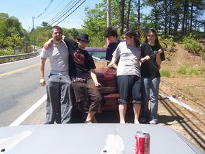
2008-05-26: First successful water and overall geohash in this graticule!
2008-05-30: First unsuccessful geohash in this graticule!
2008-06-01: First successful land geohash in this graticule!
2008-06-03: First successful Bicycle Geohash in this graticule!
2008-07-12: First successful Public Transport Geohash in this graticule!
Daily Locations
2008-05-26: 41.673128°, -71.607309° Near bridge on Hill Farm Rd., Coventry, RI. Meeting SUCCESSFUL!!! Click for details and pics.
2008-05-30: 41.853102°, -71.244603° North of Winthrop St. (Route 44) in Rehoboth, MA. Geohash UNREACHABLE!!! Click date for details.
2008-06-01: 41.349107°, -71.916239° Behind houses near Stony Brook on Stonington Rd. (Route 1) in Stonington, CT. GEOHASH SUCCESSFUL!
2008-06-03: 41.957992°, -71.128935° Near Myles Standish Industrial Park in Taunton, MA. GEOHASH SUCCESSFUL! Bicycle Geohash completed by Ben and Grace!
2008-07-09: 41.5924897°, -71.0418876° Near a driveway on Old Oak Run Rd. in Westport, MA. Geohash successful!
2008-07-12: 41.6128965°, -71.2604917° Northern edge of Carnegie Abbey Golf Club property in Portsmouth, RI. Meetup successful!
2008-07-15: 41.9238259°, -71.5172238° Wooded area above private property north of intersection of Routes 116 and 7. Geohash technically unsuccessful, but see hash page for details.
2008-09-04: 41.86017°, -71.062298° Roadside of Carlos Estates Rd. in Taunton, MA. Geohash successful.
2008-09-06: 41.899913°, -71.186548° North of Glebe St. in Rehoboth, MA. Geohash unsuccessful.
2009-01-03: 41.486105°, -71.941018° On Lake of Isles Golf Course. (Route 2), in North Stonington, CT. Geohash successful!!
2009-01-12: 41.690461°, -71.533341° In West Warwick, at the back of private property on Eileen Dr. Geohash unsuccessful.
2009-08-08: 41.564584°, -71.452742° Near Prospect Rd.in North Kingstown, RI. Geohash unsuccessful!
2009-09-08: 41.5758507°, -71.7359792° In the woods off Ten Rod Rd, About half way between I-95 and the CT border. Geohash successful!
2010-11-03: 41.7207298°, -71.1924789° Near Brayton Point power plant. Geohash successful!
2012-05-13: Near Pine St. in Rehoboth, MA. Unsuccessful - No Trespassing.
2012-06-15: At Lincoln High School. Success!!!
2012-09-22: On route 14/102, just west of Clayville Historic District. Geohash successful!
2012-12-21: In the bike lane of N Main St, in Providence. Geohash successful!
2012-12-26: In someone's front yard near the airport. Geohash semi-successful.
2013-01-22: East bank of the Providence River. Geohash successful!
2013-04-16: In the woods near Barden Reservoir. Geohash successful!
2013-04-24: A parking area behind Exeter-West Greenwich high school. Geohash successful!
2013-06-02: Parker Woodland Wildlife Refuge in Foster. Geohash unsuccessful.
2013-12-12: Veterans Cemetery in Exeter. Geohash successful!
2014-03-02: In the parking lot of a commercial building on Clarkson St, in Providence. Geohash successful!
2014-12-03: In the street, near the intersection of North Main St. and Rochambeau Ave., in Providence. Geohash successful!
2016-11-27 Across from South County Commons in South Kingstown. Geohash successful!
Statistics
Starting May 21st, Updated to 9/16/08 (attempted/reached/generated)
Land Locations - (7/5/59)
Water Locations - (1/1/61)
Total Locations Reached - 5
Total Persons to Have Arrived - 6
Records
Consecutive Arrivals - 1
Consecutive Saturdays - 0
Most People - 5 (only 2 of this group successfully completed Water Geohash)
2008-05-26:
Geohasher with most arrivals: 2 tied with 3 each - Ben and Grace
Participants
- Patrick - the inaugural geohash in this graticule will be most...satisfying
UPDATE: I NO LONGER RESIDE IN THIS GRATICULE
- Yusuke - Slightly disturbed by the above word choice.
- Tim - Less disturbed by the aforementioned word choice.
- Shannon
- The Nihilist
- Ben and Grace
- Victor - Can't wait 'till next Saturday.
- Ian Danskin (!)
- Bruce
- Kelley
- Maria
- Kyuss - Gadzooks,' quoth I, 'but here's a saucy...crowbar!
- azsr
Achievements
