Difference between revisions of "User:Dawidi"
imported>Dawidi (+ 2009-05-21 47 11 and its achievements.) |
imported>Dawidi (+Geohashing Day ribbon) |
||
| Line 47: | Line 47: | ||
| n = true | nw = true | w = true | e = true | s = true | sw=true | | n = true | nw = true | w = true | e = true | s = true | sw=true | ||
| name = dawidi so far | | name = dawidi so far | ||
| + | }} | ||
| + | {{Geohashing Day | ||
| + | | latitude = 47 | longitude = 11 | coorddate = 2009-05-21 | ||
| + | | year = 2009 | name = [[User:dawidi|dawidi]] | ||
| + | | image = 2009-05-21 47 11 at the hash.jpg | ||
}} | }} | ||
{{snowman geohash | {{snowman geohash | ||
Revision as of 21:37, 30 May 2009
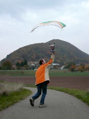
I work as a database programmer and multi-purpose geek in the "IT-Speicher" in Regensburg, Germany, and toy around with unconventional r/c aircraft, aerial photography and some other odd digital photography techniques in my free time.
I do have a website but for the moment it is horribly outdated.
I'm into Openstreetmap and Geocaching also; these combine well with Geohashing expeditions.
I now rather frequently visit hashpoints on any day (or during the night, if necessary) if I find the time, and the coordinates happen to be reachable from Regensburg by bicycle, including the corners of the neighbor graticules:
| Nürnberg 49 11 | Regensburg 49 12 |
| München 48 11 | Landshut 48 12 |
I can be found idling around in #geohashing most of the time, and I've built a program to generate Maps and Statistics about graticules and expeditions on the wiki.
Most recent expeditions
(newest first)
 |
2009-05-21 47 11 in an alpine valley near Pertisau am Achensee in Tyrol, where I went by train, steam rack train, bike, and on foot, during an all-day expedition celebrating Geohashing Day. | ||
 |
2009-05-11 48 12 on a cycleway in Burgweinting, by bike in the rain with Tomcat and Hans. |  |
2009-05-10 48 11 in a forest south of Kelheim, by bike with Tomcat. |
 |
2009-05-03 47 12 in the Chiemsee, with Tomcat and Hans in a rowing boat. A full day trip by train and bike. |  |
2009-05-02 48 12 on a small road between Niedergebraching and Hohengebraching, by bike with Matthias. |
 |
2009-04-28 49 12 at the edge of a forest, north of Schwaighausen, by bike with Tomcat in the rain. |  |
2009-04-24 49 12 in the forest near Ramspau, by bike after work. |
 |
2009-04-23 49 12 next to a small lake north of Ramspau, by bike with Tomcat after work. |  |
2009-04-19 49 12 in a meadow about 15km east of Weiden, by train and bike with Tomcat and Hans. |
 |
2009-04-11 48 13 in a forest about 20km southeast of Passau, by train and bike with Tomcat and Hans. |  |
2009-04-03 49 12 in a beautiful, mountainous forest north of Ramspau, with Tomcat and Hans. |
... and 28 other expeditions before that!
Most recent achievements
dawidi so far achieved level 6 of the Minesweeper Geohash achievement
|
dawidi earned the 2009 Geohashing Day achievement
|
dawidi earned the Snowman Geohash Achievement
|
dawidi earned the Border geohash achievement
|
dawidi with Tomcat and Hans earned the Water geohash achievement
|
dawidi earned the Drag-along achievement
|
dawidi, Tomcat and Hans earned the Border geohash achievement
|
... and several other achievements (virgin, drag-along, deja-vu, proxy, hashcard, frozen, meet-up, midnight...) which I've moved to a separate page.
I'm particularly looking for opportunities for these in the future:
another Border geohash, more Proxy Geohash variants, Calendar Girl Achievement, MNIMB Geohash, Consecutive Geohash, Multihash, more Meet-Up Achievements, Birthday Geohash, Sunrise geohash, Origin Geohash, Tron achievement.
