Location
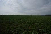
Field between Neu Boltenhagen and Lodmannshagen, VG, MV, Germany.
Participants
SastRe.O
Plans
Being in a ~80% water graticule, I have been fairly lucky that the leap-year-geohash has fallen in bike distance from home (on land). If the global hash falls in Antarctica, I am usually game. Actually it is in Neu Boltenhagen, where it would be my 3 hash in this municipality. That's some hot spot we have here.
Weather forecast gives me a rain-truce between 12:00-18:00, so my idea is to leave home around 12:00, once it stops raining, and go directly there. Probably via Kemnitz and Kemnitzerhagen on the way there, and then via Hanshagen on the way back, so to not repeat. However, I am not aiming for a tron tracklog, the nature of the position of this hash makes it not really possible. Juggernaut is also not possible.
Expedition
Weather was behaving as planned. At 10:00 it was still raining but starting to look better. The rain would also give me a truce (I was calling it a Truce Rain because it sounded like the name of Batman and it made me laugh...). However, between 11:00 and 12:00 it was going on and off, thin rain, and I decided I would approach the hash backwards as intended, meaning, I started going first via Hanshagen. That is because this way I would be going through the forest on the way there, and if then it still rained a bit, at least I would be protected under the trees (having the same idea, in the same area, when I went here).
So I grabbed Winterbuche at around 12:15 and started. It was a little bit chilly and at that moment it was raining. After the forest of Eldena, I realised that going through the forest would be good against rain and wind, but on the downside, I would end up full of mud (as I eventually did). Some parts of the paths where impracticable, mostly after Hanshagen but I kind of expected it. It could not be all going great.
One thing of this thin rain, is that you don't necessarily feel it, but after some minutes under it you end up pretty soaked. It accumulates without you noticing. Right before Neu Boltenhagen I passed right next to this hash I visited a few months ago, and right after the houses of Neu Boltenhagen, I passed tight next to this other hash I visited almost a year ago. Like a reverse Déja-vu.
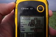
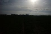
And now I was almost arriving to today's leap-geohash. I parked Winterbuche and approach the last meters on foot. Right when I was reaching the hash and taking some picture the sun shined a while for me, as some sort of congratulation. It shined enough time to be present on my pictures and then it hid behind some clouds again. Stars like to appear in pictures, we know that.
Then, near of here, in a memorial stone I had some sandwiches to eat, to gain some energy and face my way back. Now it was not raining and at least I had no to ride the muddy paths inside the forest. The way through Kemnitzerhagen and Kemnitz is more open and paved, and rode it faster than expected (mostly because now I didn't have the wind against me. There are few things that I hate more than riding against the wind...). Soon after that I was finding myself again at home, ready to shower the mud off of me.
Tracklog
Photos
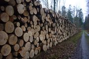
| Fresh cut wood. It smelled marvellous. |
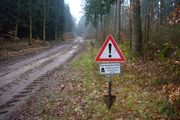
| Geohashing is a risky sport! |
| You can probably not see it, but there is a squirrel in front of those woods. |
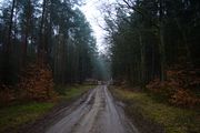
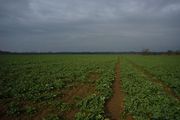
| Approaching the hash field. |
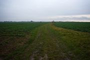
| Looking south against the sudden shining sun. |
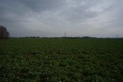
| Looking west. That tree line is the road north of Neu Boltenhagen I took. |
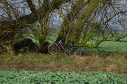
| Where I parked Winterbuche and was waiting for me. |
|
Achievements
Other Geohashing Expeditions and Plans on This Day
Expeditions and Plans
| 2020-02-29
|
| Rochester, New York |
Pedalpusher |
Middle of the I-390 Northbound, right before Exit 13
|
| Barrie, Ontario |
SIGSTKFLT, SIGSTKFLT'S mom |
A field near Highway 404
|
| Augsburg, Germany |
TheOneRing |
on a service road near Türkheim.
|
| München, Germany |
Clearlucid9 |
In a landscape park that used to be an army airfield just south east of Mun...
|
| Pforzheim, Germany |
RecentlyChanged |
located next to a house in Trossingen.
|
| Southampton, United Kingdom |
Someone went |
In the sea!
|
| Frankfurt am Main, Germany |
GeorgDerReisende, Yakamoz, Rincewind |
The hash lies in the forest south of Frankfurt am Main. North of S-train st...
|
| Swindon, United Kingdom |
Macronencer |
Swindon, United Kingdom
|
| Mid Wales, United Kingdom |
KarMann, KarMann's wife |
A short ways off a minor track in a wood near Llanwrtyd Wells in Wales.
|
| Aberystwyth, United Kingdom |
KarMann, KarMann's wife |
In a field near Cardigan/Ceredigion in Wales.
|
| Enschede, Netherlands |
FelixTheCat |
On a bike path along the Groenloseweg, Eibergen, Gelderland province.
|
| Hannover, Germany |
Fippe |
located on a field in Salzhemmendorf-Oldendorf.
|
| Sheffield, United Kingdom |
KarMann, KarMann's wife |
located near the Carsington Water Sheepwash Car Park.
|
| Manchester, United Kingdom |
Someone went |
In a field near Nantwich.
|
| Stralsund, Germany |
SastRe.O |
Field between Neu Boltenhagen and Lodmannshagen, VG, MV, Germany.
|
| Flensburg, Germany |
π π π |
on a very muddy meadow beyond a forest in Jahrsdorf (70 km by bike)
|
| Næstved, Denmark |
Sermoa |
Knudsskovvej, Vordingborg, Sjælland
|
| København, Denmark |
Someone went |
ABORT MISSION! It's right in the middle of the sea!
|
Update this list.
