Difference between revisions of "Newark, New Jersey"
imported>Jevanyn (→Cities in this Graticule) |
imported>Jevanyn (→Daily Locations) |
||
| Line 21: | Line 21: | ||
<!-- For Monday thru Thursday coords, use {{#time}} for the current date --> | <!-- For Monday thru Thursday coords, use {{#time}} for the current date --> | ||
'''For {{#time:Y-m-d}}: <!--{{coordinates graticule|{{#time:Y-m-d}}|lat=40|lon=-74}}'''--> | '''For {{#time:Y-m-d}}: <!--{{coordinates graticule|{{#time:Y-m-d}}|lat=40|lon=-74}}'''--> | ||
| − | + | ''' 40.532169 -74.699548 '''<!-- Correction for 8/18 --> | |
| − | : (8/18) | + | : (8/18) In the trees behind #1 Norz Dr., near River Rd., South Branch, Somerset County. |
| + | |||
| + | :: [2009-08-18 40 -74] I made it! | ||
| Line 30: | Line 32: | ||
'''For 2009-08-21: {{coordinates graticule|2009-08-21|lat=40|lon=-74}}''' | '''For 2009-08-21: {{coordinates graticule|2009-08-21|lat=40|lon=-74}}''' | ||
| − | : | + | : |
'''For 2009-08-22: {{coordinates graticule|2009-08-22|lat=40|lon=-74}}''' | '''For 2009-08-22: {{coordinates graticule|2009-08-22|lat=40|lon=-74}}''' | ||
| − | : | + | : |
'''For 2009-08-23: {{coordinates graticule|2009-08-23|lat=40|lon=-74}}''' | '''For 2009-08-23: {{coordinates graticule|2009-08-23|lat=40|lon=-74}}''' | ||
| − | : | + | : |
--> | --> | ||
'''Daily Location: [[http://irc.peeron.com/xkcd/map/map.html?date={{#time:Y-m-d}}&lat=40&long=-74&zoom=9&abs=-1 Newark, New Jersey]]''' | '''Daily Location: [[http://irc.peeron.com/xkcd/map/map.html?date={{#time:Y-m-d}}&lat=40&long=-74&zoom=9&abs=-1 Newark, New Jersey]]''' | ||
Revision as of 02:13, 19 August 2009
| Scranton, PA | Newburgh, NY | Danbury, CT |
| Allentown, PA | Newark | New York City |
| Philadelphia, PA | Atlantic City | – |
[[Category:Meetup in {{{lat}}} {{{lon}}}| ]]
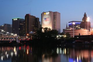
The Newark graticule is at 40 N, -74 W. This may be the most populous graticule in the United States, with a population in the neighborhood of 7 million people. It includes almost the entire northern half of New Jersey, the most densely populated state (Census), as well as Staten Island, western sections of Brooklyn and lower Manhattan in New York, and a part of Pennsylvania northeast of Philadelphia. In addition, other than Raritan Bay, there are no large sections of water.
Thanks to Meteorswarm for setting up a Facebook group for this graticule. Meet-ups can be coordinated there, although so far this wiki has been more active.
Daily Locations
For 2024-11-10: 40.532169 -74.699548
- (8/18) In the trees behind #1 Norz Dr., near River Rd., South Branch, Somerset County.
- [2009-08-18 40 -74] I made it!
Daily Location: [Newark, New Jersey]
Cities in this Graticule
| New Jersey | New York | Pennsylvania |
| Newark | Staten Island | New Hope |
| Jersey City | Lower Manhattan | Levittown |
| New Brunswick | Parts of Brooklyn | Langhorne |
| Trenton |
Local Geohashers
- Madalis
- bjimba
- krip
- trntr

- TorsionalMetric
- Direwulf
- Jevanyn

- LangleyLGLF (When @Rutgers)


- Esteban

- Science Works!

- sve
- Zubenelgenubi


- Mike
- darko
- jimpoz
- RminusQ

- Brandon
 20px and his father
- GISninja

- BlastOButter42, but probably only if it's near the city and New York's isn't closer
- AlexF
- Knitting Duck
- Flashbullzeye
Attempted geohashes
- Main page: Category:Meetup in 40 -74
- Thursday, July 16, 2009:
- Jevanyn has a weird expedition to Shades of Death Road.
- Saturday, July 11, 2009:
- Zubenelgenubi visits the geohash corral.
- Friday, July 3, 2009:
- Zubenelgenubi decides not to trespass where guns are being fired.
- Sunday, June 28, 2009:
- Knitting Duck encounters win (and swarms of
mosquitosraptors) in Lincoln Park, NJ.
- Knitting Duck encounters win (and swarms of
- Friday, June 26, 2009:
- Knitting Duck encounters fail in Denville, NJ.
- Saturday, June 6, 2009:
- Jevanyn reminisces about his hometown.
- Tuesday, June 2, 2009:
- The geohash is only a couple of miles from Jevanyn's house, so he's going to try to bike there, if the weather cooperates.
- Saturday, May 16, 2009:
- Zubenelgenubi stops near a quiet hash in the woods.
- Monday, May 11, 2009:
- Jevanyn planned on a bicycle geohash 7 miles from work, but he didn't plan on getting squished by traffic on the way there.
- Saturday, May 2, 2009:
- Avish said no one was there in the middle of Route 17 in Paramus.
- Sunday, April 26, 2009:
- Jevanyn is on the wrong side of the tracks in White House Station.
- Tuesday, April 14, 2009:
- GISninja planned to be there, but not to jump like Jenny did.
- Saturday, April 11, 2009
- Jevanyn rode to the geohash on his bike, in the rain.
- Wednesday, March 4, 2009
- No GPS! No map! No directions! (bzzzt) No camera?
- Saturday, February 28, 2009
- Jevanyn and his family took a trip to Hightstown to look for buried treasure! Aaaarh!
- Friday, February 20, 2009
- In a parking lot in Paramus. Brandon braved rush hour traffic to make it there.
- Thursday, February 19, 2009
- Jevanyn couldn't resist a geohash this close to home.
- Wednesday, February 18, 2009
- Someone's front yard in White House Station, New Jersey. Brandon dragged his father along despite the freezing rain for their first geohash.
- Saturday, February 14, 2009
- Saturday, January 31, 2009
- A new geohasher, RminusQ, does the Speed Racer thing on a suburban street in Oakland.
- Saturday, January 17, 2009
- A geohashing-inspired location for an annual nature hike.
2008 geohashing expeditions have been archived.
