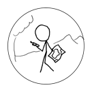
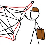
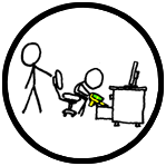
(xkcd-100, Picnic, and Earliest geohasher achievements) |
(Dark Ages and Birthday geohash achievements) |
||
| Line 776: | Line 776: | ||
== Winners == | == Winners == | ||
The following is a list of geohashers who have claimed the Earliest geohasher achievement and added themselves below. For a complete list of pages containing this achievement ribbon, see [[:Category:Earliest geohash achievement]]. | The following is a list of geohashers who have claimed the Earliest geohasher achievement and added themselves below. For a complete list of pages containing this achievement ribbon, see [[:Category:Earliest geohash achievement]]. | ||
| + | |||
| + | (list of winners) | ||
| + | |||
| + | = Dark Ages achievement = | ||
| + | [[:Template:Dark Ages]] | ||
| + | |||
| + | {{Dark Ages}} | ||
| + | |||
| + | [[File:Fiveohthree.png|right|220px]] <!-- Ideally, this line would come first on the page and would be aligned with the ribbon. This currently cannot be done as the Ribbon2 template has not been updated to allow the text to wrap. Working on finding out if this will be changed any time soon, as it appears to have been in progress since March 2020. --> | ||
| + | |||
| + | The Dark Ages achievement can be claimed when you go geohashing during the [[Dark Ages]], that is, at a time when the geohashing wiki is out of action. This previously happened for five months in 2019/2020 due to a breach of the xkcd forums. Whilst it is unlikely that a similar event will take place in the near future, any geohasher who took part in an expedition during this time can claim this achievement. | ||
| + | |||
| + | The exact start and end date/time of the Dark Ages is disputed, but anything between 2019-08-31 07:01 UTC and 2020-01-29 15:02 UTC is uncontroversial. It is possible that the time period extends from 2019-08-30 11:01 UTC until 2020-02-02 07:04 UTC. | ||
| + | |||
| + | == Proof == | ||
| + | You should provide some form of evidence that you took part in an expedition during the Dark Ages. The expedition does not need to have been successful, but it must have been during this period of time. | ||
| + | |||
| + | == Winners == | ||
| + | The following is a list of geohashers who have claimed the Dark Ages achievement and added themselves below. For a complete list of pages containing this achievement ribbon, see [[:Category:Dark Ages achievement]]. | ||
| + | |||
| + | (list of winners) | ||
| + | |||
| + | = Birthday geohash achievement = | ||
| + | [[File:birthday.PNG|right|220px]] | ||
| + | |||
| + | [[:Template:Birthday geohash]] | ||
| + | |||
| + | {{Birthday geohash}} | ||
| + | |||
| + | The Birthday geohash achievement can be claimed when you successfully reach a geohash on your birthday. Although not required, it is recommended to bring some cake to the geohash with you to celebrate your birthday. | ||
| + | |||
| + | There are a number of fun ways to celebrate your birthday while geohashing. You could combine this achievement with others, such as the [[Picnic achievement]], or you could throw a party by issuing invitations to guests to meet at the geohashing coordinates, earning you the [[Drag-along achievement]]. The more daring geohasher may also take the opportunity to claim the [[Geoflashing|Geoflashing achievement]], creating the gratuitous 'Birthday suit achievement'. | ||
| + | |||
| + | == Proof == | ||
| + | As this achievement requires you to reach the coordinates, [[Achievements#Proof|standard proof]] should be provided. You should also provide some kind of proof showing that your date of birth is the same as the geohash date. | ||
| + | |||
| + | == Winners == | ||
| + | The following is a list of geohashers who have claimed the Birthday geohash achievement and added themselves below. For a complete list of pages containing this achievement ribbon, see [[:Category:Birthday geohash achievement]]. | ||
(list of winners) | (list of winners) | ||
Revision as of 00:20, 26 August 2024
This page is not linked to the main content of the wiki and should not be used as the standard page for achievements.
The following is a list of current achievements re-written to match a hypothetical standardised formatting. I am open to comments on the current formats, which can be left on the discussion page. I am not currently expecting any of these versions to be implemented, but if there is enough support for them, then I'd imagine they could be at some point. This page will be updated periodically to add new achievements. You can use the Contents section to navigate to already rewritten achievements, or you can scroll through to view them.
Contents
- 1 Land geohash achievement
- 2 Bicycle geohash achievement
- 3 Public transport geohash achievement
- 4 Graticule unlocked achievement
- 5 Consecutive geohash achievement
- 6 Minesweeper geohash achievement
- 7 Drag-along achievement
- 8 Multihash achievement
- 9 Walk geohash achievement
- 10 Two to the N achievement
- 11 Frozen geohash achievement
- 12 xkcd centurion achievement
- 13 Midnight geohash achievement
- 14 Last man standing achievement
- 15 Speed racer achievement
- 16 Tron achievement
- 17 OpenStreetMap achievement
- 18 No batteries geohash achievement
- 19 Thumbs up geohash achievement
- 20 Meet-up achievement
- 21 Easy geohash achievement
- 22 Geotrash achievement
- 23 Hash collision achievement
- 24 Drowned rat geohash achievement
- 25 Déjà vu geohash achievement
- 26 Border geohash achievement
- 27 Geohashing Day achievement
- 28 Regional geohashing achievement
- 29 xkcd-100 achievement
- 30 Picnic achievement
- 31 Earliest geohasher achievement
- 32 Dark Ages achievement
- 33 Birthday geohash achievement
Land geohash achievement
This user earned the Land geohash achievement
|
The Land geohash achievement can be claimed when you successfully reach a geohash positioned on land. This achievement is the oldest and most basic of the achievements, but is still highly unattainable to those who live on small islands in the middle of the ocean. Whilst it is perhaps the most easily attainable, it is usually a geohasher's first achievement and is something to be proud of earning.
Proof
As this achievement requires you to reach the coordinates, standard proof should be provided. No additional proof is required for this achievement, as most expeditions are assumed to take place on land unless stated otherwise.
Winners
The following is a list of geohashers who have claimed the Land geohash achievement and added themselves below. For a complete list of pages containing this achievement ribbon, see Category:Land geohash achievement.
(list of winners)
Bicycle geohash achievement
This user earned the Bicycle geohash achievement
|
The Bicycle geohash achievement can be claimed when you successfully reach a geohash by bike. The usage of a car, public transport[1], or any other vehicle which is not entirely powered by yourself is not allowed. Unicycles, monocycles, tricycles, and scooters may also earn you this achievement, as may skateboards and longboards. Anything goes, as long as your transport is not electrically powered. You may also wish to consider if the Skate geohash achievement applies to your expedition.
If your expedition begins and ends at the same point and your expedition route never crosses or touches itself, you may have also earned the Tron achievement; your bicycle has become a Light Cycle!
- ↑ The decision to exclude public transport is one that many geohashers disagree with, as some users have travelled long distances via bike, but due to a short journey via train at the start/end, have not been valid for the achievement. Due to this, some users will still claim this achievement when taking public transport, but will exclude this from any measures of total distance travelled, as can be seen in the list of winners below.
Proof
As this achievement requires you to reach the coordinates, standard proof should be provided. Additionally, you should provide a photograph or track log of your route, demonstrating that it took place via bicycle.
Winners
The following is a list of geohashers who have claimed the Bicycle geohash achievement and added themselves below. For a complete list of pages containing this achievement ribbon, see Category:Bicycle geohash achievement.
Only the expedition with the longest total distance should be listed for each user, resulting in each user having only one listing. The list should also be sorted in descending order of total distance cycled. Feel free to add expeditions shorter than your longest total distance to the Bicycle geohashes page.
Entries marked with a * involved public transport, which has not been included in the total claimed distance.
(list of winners)
Public transport geohash achievement
Template:Public transport geohash
This user earned the Public transport geohash achievement
|
The Public transport geohash achievement can be claimed when you successfully reach a geohash by bus, train, subway, or other mass transit. Using any motorised individual transport - such as a car, taxi, or motorbike - invalidates this achievement. You do not have to reach the geohash whilst onboard your choice of public transport, but it must be involved at some point in your expedition. You may also be eligible for the Water geohash achievement if you reach the geohash whilst you are on a ferry or other maritime transport.
Proof
As this achievement requires you to reach the coordinates, standard proof should be provided. Additionally, you should provide a photograph of the mode of public transport you used in your expedition, or a photograph of any tickets you may have purchased.
Winners
The following is a list of geohashers who have claimed the Public transport geohash achievement and added themselves below. For a complete list of pages containing this achievement ribbon, see Category:Public transport geohash achievement.
(list of winners)
Graticule unlocked achievement
This user earned the Graticule Unlocked Achievement
|
The Graticule unlocked achievement can be claimed when you successfully reach a geohash, and are the first to do so in that graticule. Not to be confused with the Earliest geohasher achievement, the Graticule unlocked achievement can only be claimed by the first ever to reach a geohash in each graticule. As such, this achievement is only available once per graticule, and will become more difficult to achieve as time goes on. 'Achievement completionists' coming late to geohashing will potentially have to consider venturing to Antarctic or oceanic graticules.
Until 2024, the Graticule unlocked achievement was called the 'Virgin graticule achievement', and references to this name may still be found in expedition reports across the wiki.
Who's on First?
The achievement can only be claimed by the first person to reach a geohash in a graticule with the knowledge of it being the geohash for that day. If you happened to have been at a past geohash without knowing at the time, you cannot claim this achievement (but if you revisit this place, you may be eligible for the Déjà vu geohash achievement). Every person who is part of the first group to reach the geohash, or who arrives whilst the first group is still present, may claim this achievement. The geohasher(s) should document their success on the wiki, and should add a reference to their expedition to the graticule page itself.
In addition to this, it would benefit the wiki as a whole if the geohasher(s) edited the graticule page to add some information, potentially including a photograph representative of the general area. Even if your attempt at this achievement is unsuccessful, your additions to the graticule page will be greatly appreciated.
Proof
As this achievement requires you to reach the coordinates, standard proof should be provided. No additional proof is required for this achievement, as it is easy to check via the wiki whether the expedition was the first within its graticule or not.
Winners
The following is a list of geohashers who have claimed the Graticule unlocked achievement and added themselves below. For a complete list of pages containing this achievement ribbon, see Category:Graticule unlocked achievement.
(list of winners)
You can also check the below regional pages for an overview of which graticules have had successful expeditions.
(list of regional pages)
Consecutive geohash achievement
Template:Consecutive geohash - Displays the number of consecutive coordinates reached, the original ribbon.
This user earned the Consecutive geohash achievement
|
Template:Consecutive geohash 2 - Displays the number of consecutive days.
This user earned the Consecutive geohash achievement
|
Template:Consecutive geohash 3 - Displays the number of coordinates reached and consecutive days.
This user earned the Consecutive geohash achievement
|
Template:Consecutive geohash 4 - Displays the number of geohashes attempted, coordinates reached and consecutive days.
This user earned the Consecutive geohash achievement
|
The Consecutive geohash achievement can be claimed when you successfully reach at least one geohash for multiple consecutive days. You should only claim this achievement when you improve your personal best for the number of consecutive days. As this achievement requires you to reach geohashes on multiple days, you must have a minimum of two successful expeditions. There are four ribbon variants, all of which can be seen above, and all of which display different measures. Retrohashes do not count towards your consecutive streak.
Proof
As this achievement requires you to reach the coordinates, standard proof should be provided. Since you are also required to achieve multiple consecutive days, you should ensure that all expeditions within this period have the appropriate proof.
Winners
The following is a list of geohashers who have claimed the Consecutive geohash achievement and added themselves below. For a complete list of pages containing this achievement ribbon, see Category:Consecutive geohash achievement. You are awarded one 'hash-mark' (#) for each consecutive day that you reach a geohash. Reaching multiple geohashes in a single day does not give you any extra 'hash-marks', but it will qualify you for the Multihash achievement.
(list of winners)
Minesweeper geohash achievement
This user achieved level {{{ranknumber}}} of the Minesweeper Geohash achievement
|
| Claremont, NH | Concord, NH | Portland, ME |
| Springfield, MA | Example | Lynn, MA |
| Hartford, CT | Providence, RI | Cape Cod, MA |
The Minesweeper geohash achievement can be claimed when you successfully reach a geohash in any one graticule and in any of the eight graticules that surround it. A complete Minesweeper geohash achievement involves successfully reaching a geohash in all eight of the surrounding graticules.
The eight surrounding graticules could also be referred to as the graticules directly north, northeast, east, southeast, south, southwest, west, and northwest of the central graticule, such as they would appear on the map on a graticule's page (the Boston graticule is shown on this page as an example). The central graticule does not have to be your home graticule, but can be any graticule of your choosing. The geohashes that are a part of your Minesweeper do not have to be achieved in any particular order or within any specific time period.
It is important to note that there are no 'free squares' within the 3-by-3 grid, all graticules must have at least one geohash reached in order to complete the achievement. Whilst it is perfectly acceptable to geohash in a graticule consisting primarily or entirely of ocean, it is suggested that you choose a central graticule which will avoid the requirement of an ocean-going vessel to complete your Minesweeper.
You may also be interested in the N-in-a-row achievement, which is earned by successfully reaching a geohash in multiple graticules in a row. A completed Minesweeper geohash achievement will have earned this achievement a minimum of eight times.
Ranks
Due to the nature of certain areas, this can be an incredibly challenging achievement to fully complete. In order to give relief and encouragement to those who have not yet completed the full achievement, there are a series of ranks with corresponding ribbons to allow for the progress towards completing the Minesweeper to be demonstrated.
- Level 1 - Reach a geohash in any graticule, plus any one of its adjacent graticules.
- Level 2 - Reach a geohash in any graticule, plus any two of its adjacent graticules.
- Level 3 - Reach a geohash in any graticule, plus any three of its adjacent graticules.
- Level 4 - Reach a geohash in any graticule, plus any four of its adjacent graticules.
- Level 5 - Reach a geohash in any graticule, plus any five of its adjacent graticules.
- Level 6 - Reach a geohash in any graticule, plus any six of its adjacent graticules.
- Level 7 - Reach a geohash in any graticule, plus any seven of its adjacent graticules.
- Minesweeper - Reach a geohash in any graticule, plus all eight of its adjacent graticules.
After successfully completing the Minesweeper geohash achievement, some users have went on to reach a geohash in every graticule adjacent to the nine needed for their original Minesweeper, effectively creating a 5-by-5 grid of geohashed graticules, or a 'Super-Minesweeper'. This is a very difficult additional ranking for this achievement, and earning this deserves a large amount of respect and recognition.
Proof
As this achievement requires you to reach the coordinates, standard proof should be provided. Since you are also required to achieve a success in the surrounding graticules, you should ensure that all of the expeditions within this region have the appropriate proof.
Winners
The following is a list of geohashers who have claimed the Minesweeper geohash achievement and added themselves below. For a complete list of pages containing this achievement ribbon, see Category:Minesweeper geohash achievement.
(list of winners)
Drag-along achievement
This user earned the Drag-along achievement
|
The Drag-along achievement can be claimed when you successfully reach a geohash with a friend/acquaintance who is not a geohasher themselves. The person you bring to the geohash must attend of their own free will, but they are not required to know what the purpose of your expedition is. If you send someone to a geohash but do not personally attend it, you do not qualify for this achievement, but you may be interested in the Puppet master geohash achievement.
Proof
As this achievement requires you to reach the coordinates, standard proof should be provided. You should also provide a photograph or some other kind of proof showing that you brought someone to the geohash with you.
Winners
The following is a list of geohashers who have claimed the Drag-along achievement and added themselves below. For a complete list of pages containing this achievement ribbon, see Category:Drag-along achievement.
(list of winners)
Multihash achievement
This user earned the Multihash Achievement
|
This user earned the Multihash Achievement
|
The Multihash achievement can be claimed when you successfully reach multiple geohashes in one day. The geohashes may not be retrohashes, as they must all share the same common date.
Earning this achievement could require geohashers to travel more than 150 miles in one day, or it could require next to no travel at all, depending on your location. For those only a few degrees from the equator, this achievement will prove quite difficult, as their graticules are larger in size. Conversely, those very close to the North or South Pole will find the achievement very easy, with the possibility of claiming 360 geohashes in a very short period of time. It is worth noting that both the equator and the Prime Meridian act as 'mirrors' for the geohash points, allowing for the possibility of two sharing an edge, and often resulting in two geohashes being less than a graticule's width/height away from each other.
If you visit multiple different geohashes at the same local time, often accomplished by travelling across timezones, you may qualify for the Time-traveller achievement. If you visit at least one geohash for multiple days in a row, you may qualify for the Consecutive geohash achievement.
Ranks
Template:Multihash2 allows users to input more than two geohashes as part of their Multihash expeditions, and will change the text of the ribbon accordingly. The terminology often used to describe Multihash expeditions, and thus, the rankings of the Multihash achievement, are as follows:
- Double Hash - Visit two geohashes on the same day.
- Triple Hash - Visit three geohashes on the same day.
- Ultra Hash - Visit four geohashes on the same day.
- MONSTER Hash - Visit five or more geohashes on the same day.
Proof
As this achievement requires you to reach the coordinates, standard proof should be provided. Since you are required to successfully reach multiple geohashes, you should ensure that all expeditions within your Multihash have the appropriate proof.
Winners
The following is a list of geohashers who have claimed the Multihash achievement and added themselves below. For a complete list of pages containing this achievement ribbon, see Category:Multihash achievement.
(list of winners)
Walk geohash achievement
This user earned the Walk geohash Achievement
|
The Walk geohash achievement can be claimed when you successfully reach a geohash completely on foot. You must begin your expedition from a place that is significant to you, and you must perform the entirety of your expedition by walking, jogging, or running. The usage of crutches or manual wheelchairs is also allowed. You may use any means of transportation to return from the geohash, so long as the journey there is entirely on foot.
It is considered not valid to stay overnight at a friend's house or to drive to and work at a satellite office with the sole intention of starting closer to the geohash itself, but if this happens to be the situation you find yourself in when attempting this achievement, you are still eligible to claim it. As with most achievements, there is an honour system in place, and it is expected that you will follow the restrictions of the achievement as best as you can. It is also considered to be not valid if you drive to the base of a mountain and then walk to the summit, even if you have to walk a significant distance to do so.
What counts?
Running, climbing, scrambling, crawling, and taking turns giving piggybacks are all considered to be types of walking, and swimming across a body of water does not invalidate your Walk attempt. You cannot cycle, skateboard, kayak, take public transport, or accept a lift from anyone other than as a piggyback from a walking person. Snowshoeing or sliding down a snow-covered slope on an improvised sled does not invalidate your attempt, but you may not take both the Walk geohash achievement and the MacGyver achievement - either it was a vehicle, or it wasn't. Travelling partially or wholly by crutches or manual wheelchair does still qualify you for this achievement, even if someone pushes your wheelchair for part of the journey. If you were to drive to the home of another geohasher and then both walk from there, only the person whose house you started at earns the Walk geohash achievement, even though all participants walked the same distance.
Proof
As this achievement requires you to reach the coordinates, standard proof should be provided. You should also provide a photograph or track log of your route, demonstrating that it took place on foot.
Winners
The following is a list of geohashers who have claimed the Walk geohash achievement and added themselves below. For a complete list of pages containing this achievement ribbon, see Category:Walk geohash achievement.
Only the expedition with the longest total distance should be listed for each user, resulting in each user having only one listing. The list should also be sorted in descending order of total distance walked. Feel free to add expeditions shorter than your longest total distance to the Walk geohashes page.
(list of winners)
Two to the N achievement
Template:Two to the N achievement
This user earned the Two to the N achievement
|
The Two to the N achievement can be claimed when you reach your 2nth expedition or coordinates reached, either in general, in terms of global geohashes, or in terms or retro geohashes. This achievement can also be apllied to individual graticules, with the wording of the ribbon changing when applicable.
There are many different versions of the achievement ribbon, as listed below:
- Expeditions
- Coordinates Reached
- Global Expeditions
- Global Coordinates Reached
- Retro Expeditions
- Retro Coordinates Reached
Levels
The Two to the N achievement naturally has an in-built levelling system which aligns with the counting of N. The counting, and therefore levelling system, works as follows:
- 20 - 1, claim this for the first occurance of whatever you're tracking.
- 21 - 2, claim this for the second occurance.
- 22 - 4.
- 23 - 8.
- 29 - 512, only 4 people have reached this number for their total expedition count! (2024-07-30)
When first tracking this achievement, geohashers will find the gap between unlocks to be rather short and simple. The difficulty of this achievement increases exponentially as N gets higher. If you wish to claim this achievement for when you reach the 100th occurance, you can input N as 6.64385, or you could use a Gratuitous ribbon achievement.
Proof
Where reaching the coordinates is required for your count, standard proof should be provided. As this achievement typically takes place over multiple expeditions, you should ensure that all expeditions within your Two to the N have the appropriate proof, if required.
Winners
Due to the nature of this achievement, displaying all of those who have claimed it on this page would take up an excessive amount of space. Instead, for a rough estimate of total counts (from which the Two to the N value can be inferred), see Most active Geohashers or other similar pages. For a complete list of pages containing this achievement ribbon, see Category:Two to the N achievement.
Frozen geohash achievement
This user earned the Frozen Geohash Achievement
|
The Frozen geohash achievement can be claimed when you successfully reach a geohash at which the ambient temperature is below the freezing point of water (0°C/32°F). The geohash must be within close proximity to water in a frozen state. You may bring your own water and wait for it to freeze to meet this requirement. The temperature does not need to be below freezing for the entirety of your time at the geohash, but it must be below freezing when you measure it.
The recorded temperature must be that of the surroundings themselves. Taking the temperature of a portable cooler, ice pack, liquid nitrogen dewer, or any similar source of cold temperature is not a valid method for gaining this achievement. If the geohash happens to be positioned within a walk-in freezer which you are able to access, you may claim this achievement.
Proof
As this achievement requires you to reach the coordinates, standard proof should be provided. You should provide a photograph of water in a frozen state at the geohash. You should also provide a photograph of a thermometer showing a sub-freezing temperature or other persuasive evidence (such as frozen beards or eyelashes). The presence of snow or ice at the geohash is generally considered not to be sufficient proof for this achievement as these elements can remain in above-freezing temperatures.
Winners
The following is a list of geohashers who have claimed the Frozen geohash achievement and added themselves below. For a complete list of pages containing this achievement ribbon, see Category:Frozen geohash achievement.
(list of winners)
xkcd centurion achievement
This user earned the xkcd Centurion achievement
|
The xkcd centurion achievement can be claimed in its entirety when you attend 100 Saturday meetups. There are several intermediate steps available via the achievement ribbon to allow users to document their progress.
The definition of what counts as a Saturday meetup changes between individual geohashers. As such, the following definitions are all considered valid ways to earn this achievement:
- You successfully reach the Saturday geohash and are present at the designated meetup time. You do not need to meet another geohasher for this to be valid. The standard designated meetup time is 4pm, but some graticules have shifted their meetup times to align with regional conflicts such as daylight hours. This achievement recognises both of these options as valid.
- You meet at least one other person who is attempting to reach the geohash and is travelling independently to you. Neither of you need to actually reach the geohash for this to be valid.
Levels
This achievement is split into 10 steps preceding the final xkcd centurion achievement. These steps allow geohashers to track their progress as well as encourage them to continue to strive for the complete achievement. Each step is named as follows:
- 0-9 - Nullaturion
- 10-19 - Decurion
- 20-29 - Viginturion
- 30-39 - Triginturion
- 40-49 - Quadraginturion
- 50-59 - Quinquaginturion
- 60-69 - Sextaginturion
- 70-79 - Septaginturion
- 80-89 - Octaginturion
- 90-99 - Nonaginturion
Proof
Where reaching the coordinates is required for your count, standard proof should be provided. In all cases, you must provide some kind of evidence to prove that you met the requirements for the achievement. Whether that proof is a photograph with another geohasher or a screenshot of you at the geohash at the designated meetup time depends on the nature of your claim.
Winners
The following is a list of geohashers who have claimed the xkcd centurion achievement and added themselves below. For a complete list of pages containing this achievement ribbon, see Category:xkcd centurion achievement. The below list is separated into each different level of the achievement from most to least Saturday meetups attended.
(list of winners)
Midnight geohash achievement
This user earned the Midnight Geohash achievement
|
The Midnight geohash achievement can be claimed when you successfully reach a geohash at exactly midnight. Due to when the coordinates are announced in certain areas of the world, this can be either 00:00 (the beginning of the day) or 24:00 (the end of the day). If possible, the former of the two is preferred, as 24:00 is actually just 00:00 the following day. You will be met with extra respect should your expedition be completed without the use of a light source.
Proof
As this achievement requires you to reach the coordinates, standard proof should be provided. You should also provide a screenshot or photograph demonstrating that the time is midnight while you are at the geohash.
Winners
The following is a list of geohashers who have claimed the Midnight geohash achievement and added themselves below. For a complete list of pages containing this achievement ribbon, see Category:Midnight geohash achievement.
(list of winners)
Last man standing achievement
This user earned the Last man/woman/person standing achievement
|
The Last man standing achievement can be claimed when you successfully reach a geohash, and are the only person to report attempting to do so on that date. This achievement is not for being the only person to attempt a specific geohash, but is rather for being the only person in the entire world to attempt a geohash that day. If others attempt but fail to reach a geohash on the same day as you, you are not the only person to attempt a geohash, and are therefore not eligible for this achievement. You must both successfully reach a geohash and be the only person in the world to attempt any geohash on that day.
Multihashes are valid for this achievement, assuming you are the only person to take part in all of the expeditions. If others reach the same geohash as you, with or without you present, you are not eligible for this achievement. This includes drag-alongs, as you would not have been the only person to attempt a geohash on that day if you brought someone with you.
Checking validity
To find out how many people attempted a geohash on a given day, you can head to the appropriate Category:Meetup on YYYY-MM-DD page. If you use Template:Graticule on your expedition report, a link to this page will be displayed at the bottom of your report. An example of this would be Category:Meetup on 2024-02-21, in which only one expedition took place, earning that geohasher the Last man standing achievement. Conversely, Category:Meetup on 2024-03-30 lists five expedition reports, meaning nobody earned this achievement on that day. It is considered standard practice to wait a week or so before claiming this achievement due to some expedition reports not being published on the day they took place. It is also possible that a report can be created after you have already claimed this achievement, which would then invalidate your prior claim.
Proof
As this achievement requires you to reach the coordinates, standard proof should be provided. No additional proof is required for this achievement, as it is easy to check via the wiki if the expedition was the only one to take place on that day.
Winners
The following is a list of geohashers who have claimed the Last man standing achievement and added themselves below. For a complete list of pages containing this achievement ribbon, see Category:Last man standing achievement.
(list of winners)
Speed racer achievement
This user earned the Speed racer achievement
|
The Speed racer achievement can be claimed when you successfully reach a geohash by driving through it at the maximum legal speed. Typically, this requires the geohash to be located on a drivable road. You should ensure that you only attempt this achievement when it is safe to do so. You may be eligible for this achievement in any type of vehicle, so long as it is able to reach the maximum legal speed limit.
Proof
As this achievement requires you to reach the coordinates, standard proof should be provided. Additionally, a photograph of yourself alongside your vehicle near to the location paired with a convincing story is usually enough to be eligible for this achievement. You may be able to provide more concrete proof if one of your passengers takes a photograph of your speedometer, but it is strongly advised for a geohasher not to take such a photo while they are driving the vehicle.
Winners
The following is a list of geohashers who have claimed the Speed racer achievement and added themselves below. For a complete list of pages containing this achievement ribbon, see Category:Speed racer achievement.
(list of winners)
Tron achievement
This user earned the Tron achievement
|
The Tron achievement can be claimed when you successfully reach a geohash and return to your original starting point without crossing your own track. The name is a reference to the film franchise 'Tron', which features Light Cycles, a type of vehicle resembling motorcycles. These Light Cycles leave a constant trail behind them, represented by a glowing wall of light. The aim of the game in which these vehicles feature is to avoid crashing into these walls for as long as possible, resulting in players being unable to cross over their own trail, similar to that of Snake.
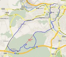
In terms of the Tron achievement, your GPS track log acts as your wall trail and your vehicle of choice acts as your Light Cycle. To be eligible for this achievement, you must travel from your starting point to the geohash and back again without crossing any previous part of your path or using the same segment of road twice. If you are able to travel along opposite lanes of the same road that are distinct enough on the GPS track, you are allowed to do so Small errors such as that of GPS jitter or small overlaps entering and leaving your starting point are acceptable, but you should not pass over your own trail in any significant way. You must begin and end your expedition at the same place, resulting in a track log resembling an almost completely closed curve.
The restrictions imposed by the Tron achievement will have a number of effects on how you carry out your expedition. Some of these include the following:
- Being unable to go over the same footbridge both on the way to the geohash and back.
- Being unable to go into any dead-end streets and back out again, even accidentally.
- Being unable to use a bridge to cross over a road you have previously travelled along, as this will create a loop in the route as viewed from above.
- Having to pass through the geohash instead of reaching it and turning back around.
- Having to approach your starting point from the other end of the road.
Unlike the game Light Cycles feature in, you may pause your route to take minimal linear side trips (such as walking into a store or restaurant on a longer expedition, or changing your positioning to get better pictures) as long as these are explained within the report. However, it is strongly preferred that your track log contains no overlapping sections whatsoever.
Proof
As this achievement requires you to reach the coordinates, standard proof should be provided. Additionally, you should provide a photograph or track log of your route, demonstrating that it did not intersect at any point. For privacy, it is recommended to cut off the route within the immediate vicinity of your home, but requested to leave the beginning and end of your street on the track log. If you do not have access to a GPS device, it is acceptable to use a detailed and plausible representation of your route, which can be hand-drawn or plotted on a mapping tool.
Winners
The following is a list of geohashers who have claimed the Tron achievement and added themselves below. For a complete list of pages containing this achievement ribbon, see Category:Tron achievement.
(list of winners)
OpenStreetMap achievement
Template:OpenStreetMap achievement
This user earned the OpenStreetMap achievement
|
The OpenStreetMap achievement can be claimed when you contribute one or more new geographical features to OpenStreetMap. You do not need to reach the geohash to be eligible for this achievement, and in some cases the reason you were prevented from reaching the geohash may be due to missing features on OSM (such as a cliff face, which may earn you the Done with Nature consolation prize). Previously, this achievement required the feature(s) to be - at least partially - within view of the geohash. This requirement has since been opposed by several people, and is now often not considered to be a strict requirement. Instead, geohashers are now required to have been at the feature(s) they are contributing to ensure that there is still a link with the expedition itself.
Proof
As you are required to have been at the feature(s) you contribute to OpenStreetMap, you must provide either a track log or photograph demonstrating this. Your report should include a description of the feature(s) as well as a link to the OpenStreetMap contribution.
Winners
The following is a list of geohashers who have claimed the OpenStreetMap achievement and added themselves below. For a complete list of pages containing this achievement ribbon, see Category:OpenStreetMap achievement.
(list of winners)
No batteries geohash achievement
This user earned the No Batteries Geohash Achievement
|
The No batteries geohash achievement can be claimed when you successfully reach a geohash using only non-electronic means. You may use an electronic device to research the geohash and the surrounding location, and the usage of a phone or digital camera is allowed for documentation of the expedition, but the expedition itself must not use any equipment such as GPS devices. The usage of car batteries is permitted, as is the case for those in watches, media players, and other non-GPS related devices, but you may not use an in-car satnav during your expedition to the geohash. The restrictions of this achievement are no longer in place during your return from the geohash.
Recording a track log of your position is considered valid within the criteria of the achievement, but you must not view your location on your tracking device during your expedition. Verifying your success at the geohash using a GPS device is allowed, but if you are not in the correct position when you check this, you have not earned this achievement. Once you check a GPS device or other similar device, you have finished your attempt, and any further repositioning to reach the geohash invalidates your No batteries geohash achievement.
When the geohash is located in an urban area or other distinctive place, it is often enough to print off an aerial view of the area and match this to your location. In more rural areas, it may be necessary to use more traditional methods of finding the exact location (such as a tape measure, compass, or sextant). It may also be possible to reach the geohash by memorising the location, depending on how much your trust yourself to do so accurately.
Proof
As this achievement requires you to reach the coordinates, standard proof should be provided. It is hard to prove the non-existance of something, but a photograph of your alternative means of finding the geohash (or a meaningful story) should be enough to meet the requirements. As with most achievements, there is an honour system in place, and it is expected that you will follow the restrictions of the achievement as best as you can.
Winners
The following is a list of geohashers who have claimed the No batteries geohash achievement and added themselves below. For a complete list of pages containing this achievement ribbon, see Category:No batteries geohash achievement.
(list of winners)
Thumbs up geohash achievement
This user earned the Thumbs Up Geohash Achievement
|
The Thumbs up geohash achievement can be claimed when you successfully reach a geohash by hitchhiking for 50% or more of the journey there. You are not eligible for this achievement if the person driving you is someone you already know. It is also required for this achievement that the hitchhiking takes place on the journey to the geohash, not on the way back.
If the driver decides to accompany you to the geohash, you may be eligible for the Drag-along achievement. Always check if hitchhiking is legal in your local area as laws can vary even within the same country. If you are new to hitchhiking, this helpful guide can be used for tips and suggestions on how to get a ride and how to stay safe when doing so.
If you hitchhike during your expedition, but it does not meet the requirements of this achievement (less than 50% of the journey, only on the return journey), you may be eligible for the honorable mention ribbon instead. This can be claimed via the ribbon template linked above.
Proof
As this achievement requires you to reach the coordinates, standard proof should be provided. You may also provide a photograph of you with the hitchhiker or of you in their vehicle if they allow these, but a meaningful story is often enough proof for this achievement. As with most achievements, there is an honour system in place, and it is expected that you will follow the restrictions of the achievement as best as you can.
Winners
The following is a list of geohashers who have claimed the Thumbs up geohash achievement and added themselves below. The list contains honorable mentions for expeditions where the requirements were not fully met. For a complete list of pages containing this achievement ribbon, see Category:Thumbs up geohash achievement.
(list of winners)
Meet-up achievement
This user earned the Meet-up achievement
|
The Meet-up achievement can be claimed when you successfully reach a geohash and meet someone who you have never met before. It is typically considered valid to have spoken to this person online or via the wiki before your meet-up, as long as you have never met in person. This achievement was initially created to celebrate the social aspect of geohashing and the original intentions of the geohashing algorithm.
It is up to you to determine what amount of interaction results in "meeting" someone, but you should at least learn their name and engage in some kind of conversation. If the person you meet at the geohash is not a geohasher, you may still be eligible for this achievement, as long as your meeting goes beyond simple pleasantries and the "what are you doing here?" conversation.
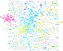
If you go on to invite the stranger into your home, you may also be eligible for the Abduction achievement. If the person you meet happens to have a user page on the wiki, you should also add your encounter to the Meetup Graph page, which will add your new connection to the graph (see right). Once you have met 5 or more geohashers, you may also be eligible for the Handshake achievement.
Proof
As this achievement requires you to reach the coordinates, standard proof should be provided. Additionally, you should provide a photograph containing everyone involved in the meet-up. If the group is too large for one photograph, you may use several, but you must feature in all of them to be able to claim all of the meet-ups.
Winners
The following is a list of geohashers who have claimed the Meet-up achievement and added themselves below. For a complete list of pages containing this achievement ribbon, see Category:Meet-up achievement.
(list of winners)
Easy geohash achievement
This user has visited an Easy Geohash
|
The Easy geohash achievement can be claimed when you successfully reach a geohash that required little or no effort. There is no objective measurement of how easy one geohash is compared to another, so you should claim this achievement whenever you judge your expedition to have been easy by your standards. The ribbon icon is a reference to the idiom "as easy as pie".
Some examples of 'easy' geohashes may include:
- Close to your home or office
- On public transport routes
- Where you were going that day anyway
Proof
As this achievement requires you to reach the coordinates, standard proof should be provided. Due to its subjective nature, a meaningful story explaining how the geohash was easy by your standards is enough proof for this achievement.
Winners
The following is a list of geohashers who have claimed the Easy geohash achievement and added themselves below. For a complete list of pages containing this achievement ribbon, see Category:Easy geohash achievement.
(list of winners)
Geotrash achievement
This user earned the GeoTrash Geohash Achievement
|
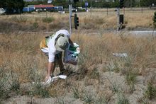
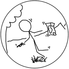
The Geotrash achievement can be claimed when you pick up trash (or litter/rubbish/garbage) during your expedition. You do not need to reach the geohash to be eligible for this achievement. It is recommended to bring your own bag with you if you plan to attempt this achievement, but you will often be able to find one discarded somewhere for you to use.
Proof
As this achievement requires you to pick up and throw away some trash, you should provide photographs of you doing so.
Winners
The following is a list of geohashers who have claimed the Geotrash achievement and added themselves below. For a complete list of pages containing this achievement ribbon, see Category:Geotrash achievement.
(list of winners)
Hash collision achievement
This user earned the Hash collision achievement
|
The Hash collision achievement can be claimed when you successfully reach a geohash and find a geocache on or around the site of the geohash. To be considered as 'on or around the site of the geohash', the geocache must be visible while you are at the geohash. Placing your own geocache at the site does not count (unless this was done before the geohash had been announced), but doing this may help other geohashers to earn this award later in the day. An honorable mention ribbon is available for those who find a geocache nearby to the geohash, but outside of the line of sight.
Proof
As this achievement requires you to reach the coordinates, standard proof should be provided. You should also photograph the contents of the geocache to prove that you found it. Your report may contain a link to the geocache listing, but this can also be done through the ribbon template.
Winners
The following is a list of geohashers who have claimed the Hash collision achievement and added themselves below. The list contains honorable mentions for nearby geocaches, and these are sorted by distance from the geohash. For a complete list of pages containing this achievement ribbon, see Category:Hash collision achievement.
(list of winners)
Drowned rat geohash achievement
This user earned the Drowned Rat Geohash Achievement
|
The Drowned rat geohash achievement can be claimed when you successfully reach a geohash despite being thoroughly wet. Walking or cycling through heavy rain may earn you this achievement, as may traversing a deep swamp or bushwhacking through water-saturated vegetation. If an exclamation of "you look like a drowned rat" would be applicable to you, you are likely eligible for this achievement. An honorable mention ribbon is also available to those who only reach the state of being partially wet and cannot quite claim to be a Drowned Rat.
It is not considered to be valid if you became drenched after a water pistol fight or after jumping into a lake to cool off as you would have opted in to these activities. Driving through torrential rain in a closed-off vehicle is also unlikely to make you eligible for this achievement, but you may earn it if you have to kneel in mud to change a tire or are swept off of the road by floodwater.
Proof
As this achievement requires you to reach the coordinates, standard proof should be provided. Additionally, you should provide a photograph of yourself looking completely soaked. If earning this achievement caused your camera equipment to become damaged or destroyed, as may be the case with an overturned canoe, a meaningful story should suffice.
Winners
The following is a list of geohashers who have claimed the Drowned rat geohash achievement and added themselves below. The list contains honorable mentions for those who only got partially wet. For a complete list of pages containing this achievement ribbon, see Category:Drowned rat geohash achievement.
(list of winners)
Déjà vu geohash achievement
This user earned the Déjà Vu Geohash Achievement
|
The Déjà vu geohash achievement can be claimed when you successfully reach a geohash on a site which you have been to in the past. Your previous visit to the site must have happened before the location of the geohash had been announced. You must revisit the site while it is a geohash in order to claim this achievement.
Proof
As this achievement requires you to reach the coordinates, standard proof should be provided. You should also provide some kind of proof that you were at the site of the geohash in the past, usually in the form of a photograph if one exists. It should be obvious that the photograph was taken on a different date to that of the expedition, usually from development of the site, a difference in season, or the metadata of the photograph.
Winners
The following is a list of geohashers who have claimed the Déjà vu geohash achievement and added themselves below. For a complete list of pages containing this achievement ribbon, see Category:Déjà vu geohash achievement.
(list of winners)
Border geohash achievement
This user earned the Border geohash achievement
|
The Border geohash achievement can be claimed when you successfully reach a geohash after crossing an international border. A border is the dividing line between any two areas that are generally recognised as distinct countries, but this recognition does not need to be universal, nor does the border have to have passport control or any other official presence.
Proof
As this achievement requires you to reach the coordinates, standard proof should be provided. Ideally, you should also provide a photograph of the border crossing. Where this is not permitted by law, photographs of road signs or other distinctive features on either side of the border would be acceptable.
Winners
The following is a list of geohashers who have claimed the Border geohash achievement and added themselves below. For a complete list of pages containing this achievement ribbon, see Category:Border geohash achievement.
(list of winners)
Geohashing Day achievement
This user earned the {{{year}}} Geohashing Day achievement
|
This user earned the {{{year}}} Mouse Over Day achievement
|
The Geohashing Day achievement can be claimed when you go on an expedition on either the 21st of May (Geohashing Day) or the following Saturday (Mouse Over Day). You do not need to reach the geohash to be eligible for this achievement. Anybody who embarks on an expedition on either of these dates is eligible for this achievement.
The Algorithm used in geohashing, as shown in xkcd 426, was first published on the 21st of May, 2008. This has resulted in this date being referred to as 'Geohashing Day', and is a cause for celebration. For those who cannot geohash on weekdays, an expedition on the following Saturday - Mouse Over Day - is worth just as much recognition.
How to celebrate
| Year | Geohashing | Mouse Over |
|---|---|---|
| 2024 | Tuesday | May 25 |
| 2025 | Wednesday | May 24 |
| 2026 | Thursday | May 23 |
| 2027 | Friday | May 22 |
| 2028 | Sunday | May 27 |
| 2029 | Monday | May 26 |
| 2030 | Tuesday | May 25 |
| 2031 | Wednesday | May 24 |
| 2032 | Friday | May 22 |
| 2033 | Saturday | - |
The best way to celebrate Geohashing Day is to go geohashing, even if you don't reach the geohash itself. Often, the restriction of going on a specific day results in geohashers going on expeditions they wouldn't usually attempt, thus having a unique adventure. It is strongly preferred that you attempt the geohash for that year, but with the acknowledgement that many graticules will have inaccessible geohashes, you may also earn this achievement by performing a retrohash expedition to a previous 21st of May geohash. If you choose to do this and you are east of longitude -30, bear in mind that the 30W Time Zone Rule was not in place for the 21st of May 2008 and earlier.
It is also recommended to bring cake with you to the geohash, especially if you are able to transport it fully intact. Sharing cake at the geohash is a good way to meet new people, and it may allow you to introduce geohashing to others who just happened to be nearby; the sort of people who will blindly accept cake from strangers tend to align strongly with the sort of people who enjoy geohashing. Occasionally, Mouse Over Day will fall on the 25th of May, which is also Towel Day. This happens when Geohashing Day takes place on a Tuesday, and will take place at an average of every seven years. The next occurrance of 'Towel Mouse Over Day' will be in 2030.
Proof
Not much is needed in terms of proof for this achievement, just make sure that your expedition takes place on either Geohashing Day or Mouse Over Day.
Winners
The following is a list of geohashers who have claimed the Geohashing Day achievement and added themselves below. For a complete list of pages containing this achievement ribbon, see Category:Geohashing Day achievement.
(list of winners)
You can also refer to the following categories to see Geohashing Day expeditions by year, including those which may not have added the achievement ribbon to the page:
- 2008: Geohashing Day, Mouseover Day
- 2009: Geohashing Day, Mouseover Day
- 2010: Geohashing Day, Mouseover Day
- 2011: Geohashing Day fell on a Saturday, and a large international meetup was held.
- 2012: Geohashing Day, Mouseover Day
- 2013: Geohashing Day, Mouseover Day fell on Towel Day.
- 2014: Geohashing Day, Mouseover Day
- 2015: Geohashing Day, Mouseover Day
- 2016: Geohashing Day fell on a Saturday.
- 2017: Geohashing Day, Mouseover Day
- 2018: Geohashing Day, Mouseover Day - This year was the tenth anniversary.
- 2019: Geohashing Day, Mouseover Day fell on Towel Day.
- 2020: Geohashing Day, Mouseover Day
- 2021: Geohashing Day, Mouseover Day
- 2022: Geohashing Day fell on a Saturday.
- 2023: Geohashing Day, Mouseover Day
- 2024: Geohashing Day, Mouseover Day fell on Towel Day.
Regional geohashing achievement
This user earned the Regional geohashing achievement
|
The Regional geohashing achievement can be claimed when you successfully reach a geohash in each segment of a political/statistical/administrative boundary as split by graticule lines. This means that for for every graticule containing a segment of a certain boundary, you must reach a geohash in all of the individual segments. Rhode Island, for example, has segments in both the Boston, Massachusetts and Providence, Rhode Island graticules. If a user were to successfully reach a geohash in Rhode Island in both of these graticules, they would be eligible for this achievement.
The geohash does not have to be located on land if the boundary extends beyond the coast. The region should ideally cover multiple graticules, but you may claim this achievement for regions fully contained within one graticule. The more graticules there are that contain the boundary, the more impressive the completed achievement will be. In order to keep track of in-progress regions, users have created many different regional geohash maps. It may also prove useful to use an online tool, such as Kripakko's Graticule Partitioner. For the inverse of this achievement, in which users must visit every boundary within a certain graticule, see Reverse regional achievement.
Proof
As this achievement requires you to reach the coordinates, standard proof should be provided. Since you are often required to achieve a success in multiple graticules, you should ensure that all of the expeditions within the chosen boundary have the appropriate proof. Ideally, you should also mention the boundary somewhere on the expedition page(s) to make it clear that they were a part of this achievement.
Winners
The following is a list of geohashers who have claimed the Regional geohashing achievement and added themselves below. Entries are separated by the number of graticules they consisted of. For a complete list of pages containing this achievement ribbon, see Category:Regional geohashing achievement.
(list of winners)
xkcd-100 achievement
This user earned the XKCD-100 Achievement
|
Template:xkcd-100-Honorable-Mention
This user earned the XKCD-100 Honorable Mention Achievement
|
The xkcd-100 achievement can be claimed when you travel 100 miles (160 km) or more with the intention of attending a Saturday meetup. Typically, this means on a Saturday at 4pm, but the definition may vary for certain communities or graticules. An honorable mention ribbon is also available to those who successfully reach a geohash after travelling 100 miles or more, but do not meet the requirement for a Saturday meetup.
Proof
As this achievement (usually) requires you to reach the coordinates, standard proof should be provided. Additionally, you should provide some kind of description or track log as to how you travelled for 100 miles or more. You should also provide proof showing that the requirements of the Saturday meetup have been met when claiming the standard version of this achievement.
Winners
The following is a list of geohashers who have claimed the xkcd-100 achievement and added themselves below. The list contains honorable mentions. For a complete list of pages containing this achievement ribbon, see Category:xkcd-100 geohash achievement.
(list of winners)
Picnic achievement
This user earned the Picnic achievement
|
The Picnic achievement can be claimed when you successfully reach a geohash and enjoy a picnic at the site. The picnic does not need to take place at the exact location of the geohash, it can be at a safe and accessible nearby area. A picnic is defined as sitting down and enjoying food alongside at least one of the following accessories: a picnic basket, a tablecloth/picnic blanket, napkins, plastic or paper tableware. Traditional accompaniments associated in other cultures with a celebratory outdoor meal are also acceptable.
Proof
As this achievement requires you to reach the coordinates, standard proof should be provided. Additionally, a photograph of the picnic with the geohashers involved should be provided, including at least one of the required picnic items.
Winners
The following is a list of geohashers who have claimed the Picnic achievement and added themselves below. For a complete list of pages containing this achievement ribbon, see Category:Picnic achievement.
(list of winners)
Earliest geohasher achievement
This user earned the Earliest geohasher achievement
|
The Earliest geohasher achievement can be claimed when you successfully reach a geohash and are the first person to do so at that specific geohash. This achievement can only be claimed for expeditions in which more than one person reaches the geohash. It is also required that at least one of the geohashers involved travels independently from another, rather than everyone arriving as a group. You must both arrive first and meet at least one other geohasher at the geohash; leaving before meeting another geohasher does not make you eligible for this achievement. This meet-up does not have to take place on a Saturday and you may claim this achievement any day of the week.
This achievement should not be confused for the Graticule unlocked achievement, which can be claimed when you are the first person every to successfully reach any geohash in a graticule, nor should it be confused for the Last man standing achievement, which can be claimed when you are the only person to attempt to reach a geohash on a specific date.
Proof
As this achievement requires you to reach the coordinates, standard proof should be provided. You should also provide a photograph showing you arriving at the geohash before any other geohasher, ideally with some kind of indication of the time. Other people who arrive at the geohash after you may be able to back up your claim, which would be sufficient proof.
Winners
The following is a list of geohashers who have claimed the Earliest geohasher achievement and added themselves below. For a complete list of pages containing this achievement ribbon, see Category:Earliest geohash achievement.
(list of winners)
Dark Ages achievement
This user earned the Dark Ages achievement
|
The Dark Ages achievement can be claimed when you go geohashing during the Dark Ages, that is, at a time when the geohashing wiki is out of action. This previously happened for five months in 2019/2020 due to a breach of the xkcd forums. Whilst it is unlikely that a similar event will take place in the near future, any geohasher who took part in an expedition during this time can claim this achievement.
The exact start and end date/time of the Dark Ages is disputed, but anything between 2019-08-31 07:01 UTC and 2020-01-29 15:02 UTC is uncontroversial. It is possible that the time period extends from 2019-08-30 11:01 UTC until 2020-02-02 07:04 UTC.
Proof
You should provide some form of evidence that you took part in an expedition during the Dark Ages. The expedition does not need to have been successful, but it must have been during this period of time.
Winners
The following is a list of geohashers who have claimed the Dark Ages achievement and added themselves below. For a complete list of pages containing this achievement ribbon, see Category:Dark Ages achievement.
(list of winners)
Birthday geohash achievement
This user earned the Birthday Geohash Achievement
|
The Birthday geohash achievement can be claimed when you successfully reach a geohash on your birthday. Although not required, it is recommended to bring some cake to the geohash with you to celebrate your birthday.
There are a number of fun ways to celebrate your birthday while geohashing. You could combine this achievement with others, such as the Picnic achievement, or you could throw a party by issuing invitations to guests to meet at the geohashing coordinates, earning you the Drag-along achievement. The more daring geohasher may also take the opportunity to claim the Geoflashing achievement, creating the gratuitous 'Birthday suit achievement'.
Proof
As this achievement requires you to reach the coordinates, standard proof should be provided. You should also provide some kind of proof showing that your date of birth is the same as the geohash date.
Winners
The following is a list of geohashers who have claimed the Birthday geohash achievement and added themselves below. For a complete list of pages containing this achievement ribbon, see Category:Birthday geohash achievement.
(list of winners)
- Land geohash achievement
- Bicycle geohash achievement
- Public transport geohash achievement
- Graticule unlocked achievement
- Consecutive geohash achievement
- Minesweeper geohash achievement
- Drag-along achievement
- Multihash achievement
- Walk geohash achievement
- Two to the N achievement
- Frozen geohash achievement
- Xkcd centurion achievement
- Midnight geohash achievement
- Last man standing achievement
- Speed racer achievement
- Tron achievement
- OpenStreetMap achievement
- No batteries geohash achievement
- Thumbs up geohash achievement
- Meet-up achievement
- Easy geohash
- Geotrash achievement
- Hash collision achievement
- Drowned rat geohash achievement
- Déjà vu geohash achievement
- Border geohash achievement
- Geohashing Day achievement
- Regional geohashing achievement
- Xkcd-100 geohash achievement
- Picnic achievement
- Earliest geohash achievement
- Dark Ages achievement
- Birthday geohash achievement
