Difference between revisions of "User:Danatar"
imported>Danatar |
imported>Danatar |
||
| Line 2: | Line 2: | ||
{| border = "0" width="100%" | {| border = "0" width="100%" | ||
|- | |- | ||
| − | | colspan="3" |<div style="border:2px solid #88d;background-color:#eef;padding:6px">{{ASG|width=210px|age= | + | | colspan="3" |<div style="border:2px solid #88d;background-color:#eef;padding:6px">{{ASG|width=210px|age=29|gender=m|lat=49|lon=9}} |
==About== | ==About== | ||
| Line 20: | Line 20: | ||
{|border=0| style="background-color:#ffb" | {|border=0| style="background-color:#ffb" | ||
|width="250"|Total expeditions: | |width="250"|Total expeditions: | ||
| − | |width="250"| | + | |width="250"| 124 in 28 different graticules <!--"xx+yy" means: xx times coordinates reached or failure very near to the hashpoint (e.g. no trespassing 10 m from the hashpoint); yy times failure far from the hashpoint--> |
|- | |- | ||
| | | | ||
:- By bike: [[Image:Bikegeohash.png|24px]] | :- By bike: [[Image:Bikegeohash.png|24px]] | ||
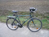
| − | | | + | | 41+2 ([[User:Danatar/Distances|total distance cycled]]: 1476 km) |
|- | |- | ||
| | | | ||
| Line 40: | Line 40: | ||
| | | | ||
:- By car: <!--alone or with other geohashers--> | :- By car: <!--alone or with other geohashers--> | ||
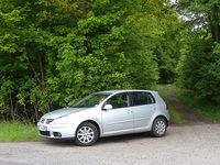
| − | | | + | | 52 ([[User:Danatar/Distances|see list]]) |
|- | |- | ||
| | | | ||
| Line 51: | Line 51: | ||
|- | |- | ||
|Hashpoints reached: | |Hashpoints reached: | ||
| − | | | + | | 115 in 25 different graticules |
|- | |- | ||
| | | | ||
| Line 58: | Line 58: | ||
|- | |- | ||
|Hashpoints not reached: | |Hashpoints not reached: | ||
| − | | | + | | 9 in 6 different graticules<!--47 11; 49 9; 49 10; 50 8; 50 10; 35 136--> |
|- | |- | ||
| | | | ||
:- For not trespassing: [[Image:Notrespassing.gif|24px]] | :- For not trespassing: [[Image:Notrespassing.gif|24px]] | ||
| − | | | + | | 5 ([[User:Danatar/Lists|see list]]) |
|- | |- | ||
| | | | ||
| Line 285: | Line 285: | ||
''most recent first, Saturday Meetups in '''bold''''' | ''most recent first, Saturday Meetups in '''bold''''' | ||
| + | *[[2010-09-07 49 9]] ([[Würzburg, Germany]]), at the edge of a forest near Külsheim: | ||
| + | :Success #115; Hashiversary achievement (2 years) | ||
| + | *[[2010-09-04 50 10]] ([[Schweinfurt, Germany]]), in a stubble field near Burghausen: | ||
| + | :Success #114; Birthday Geohash | ||
| + | *[[2010-08-27 49 10]] ([[Bamberg, Germany]]), in an orchard near Sommerhausen: | ||
| + | :Not reached #9 (No trespassing #5); Bicycle Geohash #41 | ||
*[[2010-08-10 57 11]] ([[Göteborg, Sweden]]), a hill on the island of Styrsö, Göteborg, Sweden: | *[[2010-08-10 57 11]] ([[Göteborg, Sweden]]), a hill on the island of Styrsö, Göteborg, Sweden: | ||
:Success #113; Public Transport #20 | :Success #113; Public Transport #20 | ||
| Line 625: | Line 631: | ||
Geohashing Day | latitude = 49 | longitude = 9| year = 2010 | coorddate = 2010-05-22 | name = Danatar | mouseover = true | image = 2010-05-22 49 9 hp.jpg}}{{ | Geohashing Day | latitude = 49 | longitude = 9| year = 2010 | coorddate = 2010-05-22 | name = Danatar | mouseover = true | image = 2010-05-22 49 9 hp.jpg}}{{ | ||
Tron | latitude = 49 | longitude = 9 | date = 2010-05-25 | name = Danatar | tracklog = http://www.everytrail.com/view_trip.php?trip_id=634678&code=fad2931ec2e71fd35c150a193e481ac0 | possessive = his | image = 2010-05-25_49_9_tron.jpg }}{{ | Tron | latitude = 49 | longitude = 9 | date = 2010-05-25 | name = Danatar | tracklog = http://www.everytrail.com/view_trip.php?trip_id=634678&code=fad2931ec2e71fd35c150a193e481ac0 | possessive = his | image = 2010-05-25_49_9_tron.jpg }}{{ | ||
| − | Virgin graticule | latitude = 46 | longitude = 11 | date = 2010-06-25 | name = [[User:Danatar|Danatar]] }} | + | Virgin graticule | latitude = 46 | longitude = 11 | date = 2010-06-25 | name = [[User:Danatar|Danatar]] }}{{ |
| + | Birthday geohash | latitude = 50 | longitude = 10 | date = 2010-09-04 | pronoun = his | number = 29th | name = [[User:Danatar|Danatar]] | image = 2010-09-04_50_10_hp.jpg }}{{ | ||
| + | hashiversary|ordinal = Second|name=Danatar|new=2010-09-07 49 9|original=2008-09-07 51 15|gender=his|image=2010-09-07_49_9_hp.jpg}} | ||
==Upgradable achievements (in progress)== | ==Upgradable achievements (in progress)== | ||
Revision as of 19:21, 8 September 2010
AboutI live in Würzburg, Germany (near 49.8, 9.94) and work in Schweinfurt (near 50.05, 10.25). On my way to work I am able to visit hashpoints in a large area, depending on which route I use. I might also visit hashpoints near Heidelberg in my origin graticule Mannheim, Germany (49, 8). My GPS receivers are a Magellan Triton 500 (has a map, coordinates in DD.DDDDD° format, also shows distance/accuracy/..., but eats lots of batteries) and a Holux M-241 (no map, coordinates in DD°mm'ss.ss" format, logs the position faithfully every 5/10/... seconds, eats only small amount of batteries).
Statistics
| |||||||||||||||||||||||||||||||||||||||||||||||||||||||||||||||||||||||||||||||||||||||||||||||||||||||||||||||||||||||||||||||||||||||||||||||||||||||||||||||||||||||||||||||||||||
Expeditionsmost recent first, Saturday Meetups in bold
|
|
Achievementsin order of appearance Template:Virgin graticule
 
Upgradable achievements (in progress)
Regional Geohash Achievement progress:
Other achievementsSince all the expeditions have been done by myself, this ribbon is mine as well:
Gratuitous ribbons
| |||||||||||||||||||||||||||||||||||||||||||||||||||||||||||||||||||||||||||||||||||||||||||||||||||||||||||||||||||||||||||||||||||||||||||||||||||||||||||||||||||||||||||||||||||
More AboutEarlier, when I didn't have a GPS, I relied on Google Maps, the Bavarian Land Survey Office's maps (with topographical information) and OpenStreetMap.org to find the hashpoints. This meant that whenever there was no special landmark (intersection, house...) at the hashpoint, I could only guess where the hashpoint was. If the hashpoint was e.g. in a forest 200 m from a track, I considered the coordinates reached after 200 large steps into the underbrush. Although I always try to get to the exact spot, if the hashpoint is in a field with crops or in a very dirty/wet place without any obstacle between me and the hashpoint, I am satisfied at the edge of that area.
For those of you who use Firefox: Have a look at the minimap sidebar add-on. It supports Google Maps and OpenStreetMap and it tells you the exact coordinates the cursor is on. Disclaimer and thanks: Ideas for this page were Many thanks to Hessophanes for his great Regional-Geohash-Map-Tool. Also to ekorren for his Hash Inquiry Tool which even works via foreign mobile phone networks (so far tested for Austria, Italy, Sweden and Japan). This page is maintained by myself. Automatic or manual updates will have no effect, because I'll just overwrite them with a copy on my hard drive, probably without noticing your changes. Use my talk page instead. Also, "Warning: This page is 43 kilobytes long; some browsers may have problems editing pages approaching or longer than 32kb. Please consider breaking the page into smaller sections." is ignored for the same reason, my browser didn't have any problems so far. | |||||||||||||||||||||||||||||||||||||||||||||||||||||||||||||||||||||||||||||||||||||||||||||||||||||||||||||||||||||||||||||||||||||||||||||||||||||||||||||||||||||||||||||||||||||
- Geohashers
- Geohashers in their 20s
- Geohashers in 49,9
- Border geohash achievement
- Bicycle geohash achievement
- No batteries geohash achievement
- Déjà vu geohash achievement
- Midnight geohash achievement
- Walk geohash achievement
- Land geohash achievement
- Public transport geohash achievement
- Drowned rat geohash achievement
- Meet-up achievement
- Earliest geohash achievement
- Holy hash achievement
- Snowman geohash achievement
- Hash collision achievement
- Last man standing achievement
- Train wreck consolation prize
- No trespassing consolation prize
- Cold geohash achievement
- Frozen geohash achievement
- Sunrise geohash achievement
- Hashcard achievement
- Couch potato geohash honorable mention
- Pie geohash achievement
- Picnic achievement
- Geoflashing achievement
- Calendar girl achievement
- Police geohash achievement
- Water geohash achievement
- Pirates
- Underwater geohash achievement
- Pub geohash achievement
- Phonebooth stuffing achievement
- Displaced origin geohash achievement
- Formal attire achievement
- Xkcd-100 geohash achievement
- Reverse regional achievement
- Geotrash achievement
- Ambassador achievement
- Multihash achievement
- Speed racer achievement
- Birthday geohash achievement
- Hashiversary achievement
- Origin geohash achievement
- Consecutive geohash achievement
- Air geohash achievement
- Easy geohash
- Geohashing Day achievement
- Tron achievement
- Minesweeper geohash achievement
- Xkcd centurion achievement
- Most active graticules achievement
- Gratuitous ribbon achievement
- Radio Yerevan
- Geohashers in Germany
- Addicted to geohashing
- Owner of Geohashing Calendar
- Danatar


